Day 36: Niagara Cave and Blue Mounds Campground (Minnesota)

Blasting past traditional expectations, there have been many things that have excelled not because they met up with typical standards, but because they found other ways to excell. When Las Vegas was dragging by catering only to the gamblers, they opened their services up to be family friendly. When Dodge fell behind in the sports car market while Ford had it’s Mustang and Chevy had it’s Corvette, they developed the Dodge Stealth, and later the incredibly prestigious Dodge Viper. Midwest airlines (now Frontier airlines) stood out from the pack by offering more comfortable seats and warm chocolate chip cookies. Every successful business evaluates what they have to offer and promotes that aspect. Today I visited two natural resources, each that have successfully used the resources they have to cater to their consumer.
Niagara Cave is located in the Southeast of Minnesota, near a small town called Harmony. It was discovered when a couple pigs went missing through a small sink hole, and was opened for tours later after some cavers negotiated the land use with the farmer. Niagara Cave isn’t highly decorated with speleothems, but it’s very tall, canyon-like passages actually encompass a full 4 geologic formations. Three of them you experience up close on the tour, and a fourth lays at the bottom of a stream at the end of the tour.

A trilobite in Niagara Cave of Harmony, MN. June 13, 2011

The passages can be enormously tall, at one point we were standing 150′ below ground, the cave being a full 110 feet tall (leaving only 40 feet of rock and soil between the passage and the surface). The limestones are full of fossils, ranging from gastropods to cephalapods to sponges and trilobites. Many of them you can see up close on the tour and I was able to get some decent pictures of them.

The tall, canyon-like passageways of Niagara Cave in Harmony, MN

While I prefer to see dense forests of speleothem development in caves, Niagara Cave was a real treat because of it’s tall, narrow passages. They light the areas smartly, showing off the nature of this cave as the passages follow the natural jointing in the limestones. The cave is privately owned, but it is obvious that the owners pride themselves in keeping the tours educational and as accurate as possible. My tour guide was informative, and everyone at the place seemed to know what formations and ages the cave was within off the top of their heads.

Niagara Cave- My tour guide for scale. Harmony, MN June 13, 2011

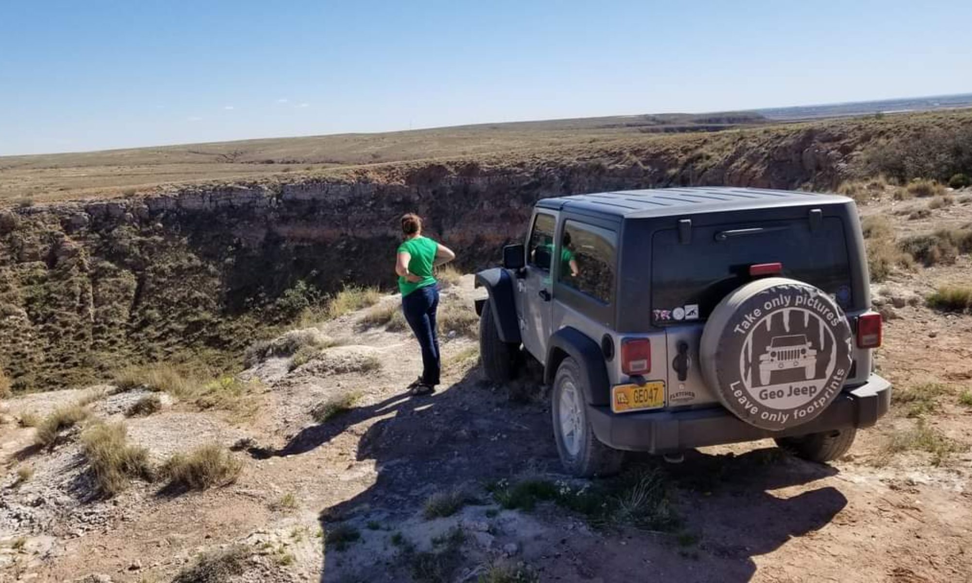
After my tour of Niagara Cave I decided to head as far West as i could to make my drive shorter. I had picked up a state park guide from the Minnesota welcome center and put my target on Blue Mounds State Park in the Western portion of the state. It had a big buffalo neat to the description, so it seemed like a good place to be. I love those fuzzy bovines.
Blue Mounds State Park turned out to be a real gem. The park has a lot to offer, sitting in the high prairie  with ranged of bison, but probably seemed a little lack luster to the campsites nearby that boast sites like the Badlands, the mountains and other wonders. They have done wonderful things to make the park even more attractive. First, it has many handicap-accessible campsites and bathrooms/showers. The fire pits are in great shape, and every campsite is incredibly clean. The best part, I have to say, is probably the shower house.

Check out the shower- It is even handicap accessible, having two shower heads, one at the height for a wheelchair. Blue Mounds S.P. Minnesota.

Every shower is in it’s own, lockable room- Which is wonderful for someone like me who is traveling alone and has some serious security issues. I hate feeling like some punk kid might be trying to grab my stuff from the bench outside my shower curtain. These showers alleviate this stress. They also have sky lights to cut down on lighting costs, the lights are on a sensor, the shower is a water saver as it is a button that you push that gives you a little over a minute of water at a time, and it is clean and nicely decorated with cedar wood.
I was smart enough to pack up camp before I took my shower, because a severe thunderstorm rolled through the area right as I finished showering. I decided to hang out in my shower room for a while, knowing the camp was near empty and I wouldn’t be inconveniencing anyone, and needing to charge my camera battery and phone in the outlet. The storm was mighty outside, and even made the water in the shower turn on all by itself when it struck something nearby, but the shower room was comfortable.

My shower room at Blue Mounds S.P. I had a toilet, a sink, an outlet, and a shower all to myself in one lockable room. Waiting out the storm.

It was actually hard for me to leave Blue Mounds State Park campground, but today I would be heading to the western limits of South Dakota to Custer State Park, when two friends of mine would be meeting up with me tomorrow morning. Ahh, the big open west where you can see miles of uninterruppted wilderness- and some company to make it even better.
-Nicole

One of the few speleothems in Niagara Cave: A bell. Harmony, MN June 13, 2011
A fossil in Niagara Cave. Harmony, Mn. How many of you can identify it?
Speleothems in Niagara Cave. Draperies. Harmony, Mn June 13, 2011

Day 35: Cave of the Mounds and Devil’s Lake State Park, Wisconsin

It wasn’t a long drive into Wisconsin, but I could already detect the change in dialect. When I bought my groceries I was no longer offered a “Bag” I was offered a “Beg”, and the word tomorrow had an unusual accent on the second “o” that I wasn’t used to. Yep, I was in dairy land alright.
My first official stop, after buying my groceries for the night, was at Cave of the Mounds in Blue Mounds, WI. A cave that sat beneath a lead prospector’s feet for more than 100 years before the cave was discovered during a blasting in 1939. After almost a year of the family  guarding the new cave entrance by rifle to curiosity seekers, the cave was open to the public in 1940 and has been ever since.

Cave of the Mounds in Blue Mounds, Wisconsin. June 12, 2011

It, like it’s neighbor to the East in Iowa (see day 34), is located in the Galena carbonate rock formation. It was mostly formed in a typical carbonic acid/water erosion fashion, but some areas were enlarged with sulphuric acid that bubbled up as the water mixed with the sulphur in the galena (PbS). The speleothem development in Cave of the Mounds is pretty sparse, and it has a lot more of the colored varities than Crystal Lake Cave. In fact, the iron oxide staining in some areas is so prnounced that it looks blood red, as if someone had just maimed themselves on the stalagmite.

Iron Oxide staining on a speleothem in Cave of the Mounds. Blue Mounds, Wisconsin.

Everyone I met at Cave of the Mounds, even though it is privately owned, was very helpful. There were several people on staff that were knowledgeable about the geology of the cave and the surrounding area, and they gave me contact information in case I needed any other information for my personal research project. It was hard to leave the cave, but it was time to head a little further North into Wisconsin to my next campsite: Devil’s Lake State park.

Devil’s Lake S.P. Wisconsin. June 12, 2011

Devil’s Lake State Park is focused around a glacial lake that has no stream inlet to speak of. All of it’s water is either remnant from the last ice age, or a result of precipitation. The lake is beautiful and they have been working hard to restore it after levels of a certain chemical were unsafe and caused “swimmers itch” (something I still don’t quite know much about). It has many, many campsites and if you get into the Ice Age campground you have wooded lots that are fairly private.

Devil’s Lake State Park of Wisconsin

I enjoyed some cheese curds, cooked up a stir fry, and drank a local brew called “The Spotted Cow” next to my toasty camp fire. Although I was alone at the campsite, I certainly wasn’t lonely. There was a caterpillar that seemed fixated on crawling on me, as I would throw it into the woods only to have it return half an hour later. Ok,.. who am I kidding, I was a little lonely.

The Caterpillar of Devil’s Lake S.P. June 12, 2011

Honestly, camping alone is pretty tough….I enjoy it from time to time, but after a while it can wear on you. I am very excited that my friends will be joining my in South Dakota, more friends joining me in Yellowstone, and another friend in Glacier. I just hope I haven’t grown so accustomed to being alone that I am a terrible host!
Tomorrow I head on to Minnesota, where I will tour yet another cave and experience another unique camp site. I’m slowly getting closer to the big, openness of the West and I can’t wait. Nothing feels more like home…
-Nicole

The very original gate for Cave of the Mounds in Wisconsin.
Devil’s Lake S.P.:The concession sits on pillars into the lake, giving you a great view as you eat your meal.
Devil’s Lake State Park June 2011

Day 27: Mammoth Cave National Park, The Grand Avenue Tour

The damp, earthy smell. The cool, slow moving air. The lights struggling, and failing, to reach into all corners of this limestone underworld. Caves are familiar territory, it feels like home. The tour guide giving the stereotypical “Do Not Touch” speech, the explanation of the twilight zone, a touch rock to “get it out of your system”, and the story of how the cave was discovered. All of these things are in a cave tour, uniting all the caves into a broad category. One of my favorite parts is when the tour guide shows all the visitors what the “Natural Cave Light” looks like, when people gaspy and children hold on tightly to their parents.
To the untrained eye, all caves are the same. They are all damp, dark environments that descend into the Earth’s depths. Of course they all have similarities, they are all called caves for a reason, but every cave is different. They have different levels of speleothem development, different types of passages, different types of limestone or dolomite, and more. Even within the same cave there can be several different broad categories of passageway, and Mammoth Cave is a great example of this.
Mammoth Cave’s passages can be divided into three main types: The large, oval shaped passages developed in the phreatic zone, the large, more angular passages developed in the vadose zone, and the tall, canyon-like passages developed during times of fast-flowing water, often confined by natural jointing in the limestone. On the Grand Avenue tour of the Mammoth Cave you get to see all three.

Gypsum flowers in Mammoth Cave, in one of the vadose-zone developed passages. June 4, 2011

One thing I had read about, and have studied pictures and specimens of, but never seen in person were gypsum flowers. These crystals “grew” abundantly in the passages that develop in the phreatic zone (The phreatic zone is termed the “unsaturated” zone, the area of the cave that was developed with some airspace still present. These passages tend to have rougher edges, since the water cut downwards as it flowed through these passages). Gypsum crystals, and their more ornate, developed flowers, form best in dry areas of the cave. The passages formed in the phreatic are usually perfect for this, since the water has, over time, found a new passageway deep beneath this one and left it “high and dry”. The crystals grow relatively fast (geologically speaking), as I saw many instances where someone had carved their name into the cave ceiling and the crystals have begun to grow in these cracks, the former graffiti artist’s name forever in the cave as the crystals adorn the scrawl.

Gypsum crystals depositing in the crevices of someone's name. June 4, 2011 in Mammoth Cave.

The snowball dining room in Mammoth Cave actually has a cafeteria, where people are encouraged to buy (overpriced) lunches to fuel them for the rest of the journey. The snowball dining room is so named because it has gypsum growing in “balls” on the ceilings and walls, making it look like someone has thrown snowballs around in the room. The bathrooms in here use artificial walls, but a natural cave ceiling that just happened to be the perfect height tops off the room.

The bathrooms, deep within the cave, in the snowball dining room of Mammoth Cave, Kentucky.

The next area you will travel through on the Grand Avenue tour are narrow, tall, winding passages that make you feel like you are wandering around the bottom of a steep canyon. The area, much like the rest of Mammoth Cave, doesn’t have a whole lot of speleothem development. It does have a few areas where water is flowing, and a deposit called Martha’s Vineyard, and a few stalactities and flowstone. For the most part, this area is dry.

Martha's Vineyard in Mammoth Cave. June 4, 2011

After the canyon-like passages you will entire an area that is very similar to the Mammoth Passages tour: The big, rounded, open passageways that were formed in the phreatic zone (the phreatic zone is that which is completely underwater, and the passageways indicate this by the way they are rounded, oval shaped- showing that the entire passageway was smoothed by water erosion from top to bottom).
At the very end of the 4.5 hour tour, which gives you a very good workout as you climb up and down hundreds of stairs and steep hills, you enter one of the areas that is rare in the Mammoth Cave system: The well-developed speleothems. This area of the cave is located against a valley, where the sandstone cap is no longer present since it was taken away by erosion. This allows more water to percolate through the limestone, saturated with dissolved calcite, and redepositing on the ceilings, walls and floors.

Mammoth Cave Speleothems on the Grand Avenue tour. June 4, 2011

The Mammoth Cave Grand Avenue tour ends by exiting through a revolving door, used to help preserve the high humidity that is present in this last portion of the cave. While you have just spent 4.5 hours underground, it is hard to believe you have only seen a very small percentage of the cave. There are hundreds of miles of passageway closed to the public, and perhaps even more miles that have yet to be discovered.

The revolving humidity lock door at Mammoth Cave, Kentucky. June 4, 2011

Caves are the ultimate “last frontier”, one of the few places on Earth that have yet to be discovered in whole. Each one of these is unique, and you never know what you are going to discover. I intend to collect as much cave experience as possible, which means checking on cave off my list at a time. Everytime I enter a cave I learn something new about them, see something I have never seen specifically before. The subtle differences are beginning to be more stark to my ever-training eye. I can’t wait to see more.
Tomorrow I head back home for a few days, then I will be heading on my Western loop. I can’t wait to see what the caves of the West have to offer me. I have been to 8 caves thus far on this trip…and I have many more planned, and probably many more unplanned, to visit.
Stay tuned!
Nicole

Stylolites in the phreatic-developed passageway. Mammoth Cave, Kentucky June 4, 2011
Carbon-covere gypsum crystals in the snowball dining room of Mammoth Cave. June 4, 2011
My Mammoth Cave National Park campsite. June 4, 2011

Day 26: University of Kentucky and Mammoth Cave National Park’s Mammoth Passages Tour

All over the world children watch their Disney movies and visions of theme parks dance in their heads. Bicyclers dream of the Tour de France, gamblers dream of Las Vegas, and mountain climbers dream of Mount Everest. Mammoth Cave of Kentucky is a lot like the Disney World of the caver. The longest cave in the world, and numerous books and stories of the exploration of the never-ending Mammoth Caverns has kept many cavers dreaming of the underworld.
Today I awoke in Lexington, Kentucky to tour the University of Kentucky, my 3rd stop in my list of potential graduate schools to visit. The University is conveniently located in the midst of Kentucky karst, the library (which holds the record for the largest book endowment of all public universities in the nation) even sits atop two sinkholes which required special foundation design so that it could achieve the feat. The U of K seems to be the perfect size: being both large enough to offer ample facilities (and has a growing geology department), yet small enough that the graduate program still affords a family-like atmosphere. Everyone was friendly, and caving is a serious sport in the area.

The University of Kentucky. June 3, 2011

I ate dinner the night before at Thai Orchid Cafe, where I enjoyed some very yummy peanut chicken. I chose the restaurant because of it’s decoration: orchids galore. It made me feel a little homesick for my own orchids that I have left in the care of my loving sister back home in Missouri. I enjoyed lunch today with some of the geology graduate students where I was able to get a true sense of what the campus was like, and tips on what to look for when seeking a graduate school. I love this opportunity because it gives me the chance to find out what graduate students wish they knew before they entered graduate school and gives me a lot to think about. All in all, I loved the University of Kentucky. Even the quirky robots that make deliveries in the medical building, where the cafeteria is located.

The Univerisity of Kentucky delivery robot. June 3, 2011

After my pleasant visit with the University of Kentucky I headed towards my theme park: The Mammoth Cave National Park. It was a palatable drive from Lexington, and has some great camping facilities (even if you do have to use those silly little tokens to take a shower, each token costs about $2.50 and lasts 10 minutes). The camp store is well stocked, both with products and helpful staff, and located a short walk from the camp. Everything is located within a short walk from the campsite. In fact, once I parked my Jeep at the campsite when I arrived, it didn’t move until two days later when I left the area.

The Mammoth Cave National Park camp store's new sign. June 3, 2011

Arriving later in the afternoon, I had time to take a shorter tour and, planning on taking the long tour the next day that encompassed almost every other tour (exempting the Wild cave tour) I was left with the Mammoth Passages tour. The tour enters through a natural entrance (a short walk from the visitor center, which for me included an encounter with a 2′ copperhead that decided to wander into the trail. The guide expertly kept the snake to the side with his hat after I pointed the snake out, and had everyone walk around before allowing the snake to continue across the walking path).

Looking back out the natural entrance of Mammoth Passages tour at Mammoth Cave National Park in Kentucky. June 3, 2011

The Mammoth Passages tour shows you what a majority of the longest cave in the world looks like: Huge, oval shaped passages with no speleothem development. The caves were named for this feature, having passages of an abnormally large size. While the cave is lacking in speleothem development, it makes up for in size many times over. It was used, as many caves are, by the natives between 4000 and 2000 years ago, when they left moccasins and other indications of human activity. Later the cave was used as a Salt-Petre mine during the war of 1812, over 400,000 lbs of calcium nitrate being extracted from the cave. After the war it had many uses such as a tuberculosis quarantine area, a church, a mushroom farm, and of course tourism, of which it is still used for today.

Moccasins in the Mammoth Passages tour of Mammoth Cave. Kentucky, June 3, 2011

I found the tour guide, as with most of the National Park run caves, to be very informative and fairly accurate in their description of the geology and the history. The kind of tour I appreciate, not only for my own knowledge, but for the education of the general public who are often mislead by private cave tour guides who are encouraged to elaborate upon their stories. My guide today was wonderful, a man who only works during the summer as he is retired.

The black cherry preserves and biscuits at Mammoth Cave Hotel Restaurant. June 3, 2011

Afterward I enjoyed a fried chicken dinner (it seemed appropriate for Kentucky) at the Mammoth Cave Hotel Restaurant, which included biscuits with black cherry preserves. Everything was wonderful, the biscuits with preserves so exceptionally good that I could have made a meal out of them alone. The prices weren’t bad either, comparable to your local Applebees price point. The campsite was large and amenable, and everyone I met on staff was helpful and friendly.

Shower tokens at Mammoth Cave N.P. June 3, 2011

Tomorrow I will be spending more time in my “Disney Land”. While I do prefer to focus on speleothem development and this cave has very little it is certainly a big playground for the caver side of me. Besides, it is important to understand what features cause a cavern to lack speleothem development to further the understanding of what causes speleothem density in other caverns.
Tomorrow I will be hiking for 4.5 hours, underground, on the Grand Avenue tour that takes me through 4 miles of underground bliss, and shows me the three different “faces” that Mammoth Cave has to offer. I’ll let you know how it went tomorrow.
Until then-
Nicole

Mammoth Passages tour entrance. Mammoth Cave N.P. June 3, 2011
Mammoth Cave has been a tourist destination for over a hundred years, this train used to transport guests. June 3, 2011
Thai Orchid Cafe in Lexington, KY. I ate there June 2, 2011.

Day 23: Coral Caverns & Shawnee State Park, Pennsylvania

Tucked away in rural Pennsylvania sits a small cave waiting to be explored, off the beaten path  in the bank of the small mountains of Manns Choice, PA. The cavern is a bit difficult to find and is a fairly small opertion, but what you will find in the cave is a geologist’s candy. It is probably hinted at in the name of the cave, Coral Caverns, but what you will find inside are clear examples of a stromatolite coral reef from the days of the Devonian.

Stromatolite in Coral Caverns, Manns Choice PA, May 31, 2011

Coral Caverns is a privately owned cave. Small and quaint, what it lacks in the generic souvenir and touristy type shop it makes up for with an enthusastic cave owner who shows the cave with pride. Coral Caverns has been in operatiohn since 1932, a small cave discovered by accident when a quarry found the opening in 1928. The limestone is vertically bedded here, and the inside of the cave has some very well preserved stromatoporoid reefs, along with a moderate display of speleothems.

Coral Caverns May 31, 2011

The visitor center has several interpretative displays that can help teach about fossils and other cave life, especially helpful for kids who are thirsting for knowledge. The caverns are open on the weekends for the public to tour, so try to plan accordingly, although if you are organizing a group I am sure a quick call to the owner could arrange a tour time that is conveinent.

Coral Caverns, Manns Choice, PA May 31, 2011

Very near the cave is a wonderful state park that has camping amenities, Shawnee State Park . The campgrounds are large and beautiful, offering access to a large lake where you can canoe, fish or swim. The views are beautiful, as you can gaze across the lake towards the appalachian mountains in the distance.

Shawnee State Park Pennsylvania May 31, 2011

I could go on and on about how beautiful Coral Caverns was, or about the scenery of Shawnee State Park, but I think this is one of those times where the pictures should do the talking. Enjoy!

Coral Caverns in Manns Choice, PA. May 31, 2011
Looking up in a Coral Caverns Chimney in PA. May 31, 2011
Coral caverns May31, 2011
Hey geology buffs, can you determine tops? Pen for scale. Coral Caverns, May 31, 2011
The lanterns lining the entrance of Coral Caverns in Manns Choice, PA. May 31, 2011
Looking up in Coral Caverns. PA, May 31, 2011
The baby robin, newly hatched, in front of Coral Caverns. May 31, 2011
Shawnee State Park, Pennsylvania. You can rent boats for the lake. May 31,2011
Shawnee State Park Pennsylvania. May 31, 2011

Day 22: Niagara Falls, Ontario

Blue. It’s a color that many of us love. To those who know me, it is almost more of an obsession. How many of you have heard me make remarks about that beautiful shade of cerulean blue? Or watch me eat my blue M&Ms last so that I can enjoy looking at them the longest? Are you one of the dozens of people who have remarked to me how often I wear the color?
The color is something that evokes an emotion in me. The emotion produced by looking at the color is what I crave. Blue is a peaceful color, something tranquil and relaxing. It makes you feel as if you are laying in the sahde on a cool, tropical beach. The same feeling of love that many of us are struck with as we gave upon a waterfall, negative ions swirling in the misty air. The color blue and Niagara Falls have something in common: They create a calm, tranquil, loving environment for us to bathe in, truly soaking in all the goodness of life.

Niagara Falls- Horseshow Falls from the top. May 30, 2011

Niagara Falls actually consists of two falls, the American Falls state-side, and Horseshoe falls on the Canadian side. Located on it’s namesake river, more than 4 million cubic feet of water per minute crashing to the bottom of the falls. The area I was closer to, staying on the Canadian side, was the 173 foot tall Horseshoe Falls. It was during high flow season, and the rate had increased to around 6 million cubic feet of water per minute and the mist was thick. I couldn’t get a clear picture of the falls at all.

One of the tourist attractions, Maid of the Mist, where you can get in a boat and get soaking wet as it chugs it's way as close to the falls as it can. May 30, 2011

The geology of the falls is something temporary, and in the terms of geologic time, very short lived. It is currently eroding the top layer of limestone/dolostone at a rate of ONE FOOT per year! It is a remarkable rate that puts the Niagara Falls extinction at only 50,000 years from today. Only 11,000 years ago the falls were located about 7 miles to the North of it’s present location, but the water tapped into a portion of non-resistant soils and rock, causing it to retreat quickly (in days or hours, even!), forming the “Whirlpool” you can visit downstream today.

The Niagara Falls "whirlpool"...I don't think you get the scale, let me post another picture.
So, here it is zoomed in a bit. Do you see the people down there yet? No? Ok...let's zoom in again (Click on photos to see in original size)
Zoomed in as much as I can with my stock lens. Yes, there are people down there. They are just TINY!~

Today Niagara Falls is a HUGE tourist destination, and as such the prices of dining and tourism have risen dramatically. Parking is a full $20 (although they like to note that you can “come and leave all you want…for this day only…ha ha.), the tours are short and cost betwee 15 and 20 dollars, and the food is slightly pricier than normal restaurant prices. I decided that I didn’t feel like getting wet as I was already feeling a little cool because of the mist, so I decided to watch “Niagara’s Fury- A 4D experience”. It only lasted a little over 20 minutes, and although the “4D” effects of a moving floor, snowfall and water spray were interesting, it wasn’t informative enough nor impressive enough  to be deserving of the $17.36 I had to pay.

I would say that you can certainaly make your Niagara Falls trip less expensive if you have more time to see everything. If you bike or hike from a nearby campsite or inexpensive hotel to the Falls you save $20, and there are several inexpensive grocery stores nearby (I went to a local grocery called “No Frills” and I was able to purchase two lunches and two dinners, with drinks, for under $12).

A Niagara Falls rainbow. May 30, 2011

The water wasn’t only at it’s high point while I was there- it was overunning the place. I was the only person crazy enough at my KOA campsite to *attempt* to sleep in a tent. I arrived at my campsite the evening before to a muddy mess, but managed to find a damp spot that my tent would have been ok on- If a severe thunderstorm hadn’t decided to roll through. The entire campsite turned into a wetland, and I had to evacuate my $9.98 tent to my Jeep. I paid for two nights worth of camping to sleep in my Jeep, but hey, this trip isn’t always going to be perfect. It’s an adventure. The storm may have been strong, but I do enjoy a good thunder and lightening show.

The mud of my campsite. At least my Jeep enjoyed it. May 30, 2011 at Niagara Falls, ON, Canada KOA campground.

This wasn’t the first time my tent was in a severe thunderstorm. It has survived many nights and days in such storms, but it was the first time it leaked. I am more than happy with my tent’s performance, considering I bought it for $9.98 from my local Wal-Mart. I don’t think any tent could have survived while pitched in the middle of a mini lake.

The Niagara Falls color-changing night lightshow. May 30, 2011

At night Niagara Falls comes alive with a light show. This time of year (late spring to early summer) the mist is more dense because of the increased water flow so the show isn’t as pretty as it could be (although still enjoyable). If you want the full effect of the Niagara Falls experience I highly recommend coming in late summer or early fall.

The lights of the night at Niagara Falls. May 30, 2011
The Niagara Falls nightly firework show. May 30, 2011

I spent my night at the Falls watching the colored lights pour over the misty water of Niagara Falls, watching the people dancing in the grass to the live band, until the end of the firework show they put on everynight. It was a soothing night, listening to the falling water and feeling that cool mist breeze through the air. A refresher before another long day in my Jeep tomorrow as I drove back into the states to see another cave.

A Blue Niagara Falls. May 30, 2011

In case you were wondering, yes, as the lights changed there were times when the falls were all blue. In some cases, it even qualified as a shade of cerulean.
I’ll see everyone again when I report back state-side. Until then…
-Nicole

"Don't Jump In" is what the sign is telling you.....believe it or not, people actually do go over the Falls in barrels...even with the high fine for the violation. May 30, 2011
Horseshoe Falls- The water is just about to give in to gravity. May 30, 2011 in Niagara Falls, ON.
Yes, there are rainbows at Niagara Falls too! May 30, 2011
Standing in front of Niagara Falls, the American Falls in the background, in Canada. May 30, 2011
The night lights of Niagara Falls. May 30, 2011
Niagara's night lights. May 30, 2011
Live band and dancing audience at Niagara Falls. May 30, 2011

Day 21: Driving thru Canada to Niagara Falls

As I had described on Day 15, what I share with you is only a small portion of what I do in a day. Going to so many places, so far away, involves a lot of driving. Today was another one of those days where driving was the main attraction of the day. This isn’t to say that a day of driving is anything less than exciting- it is more of a series of evens rather than one main event. Little things that add up to one whole experience.

Canadian Gas Prices (in liters) May 29, 2011

Driving through Canada was certainly different. The first noticeable difference on the road in Canada is that everything is in Km instead of Miles. Armed with a Tom Tom GPS unit, this conversion is made with just a couple clicks of the button. Another difference hits you when you stop at the gas station. The sign, at first, looks appealing: Only $1.21 for gas!!!! However, the gas is sold in liters, not gallons, and while right now the Canadian and U.S. dollar are almost par, the Canadian dollar does hold a slightly higher value. I calculate my gas mileage at every gas stop to make sure my Jeep is runnnig smoothly. Try calculating your MPG when you have filled up in liters and driven so many Km. Wouldn’t the world be so much easier if we all used the simple, countable and easily convertible metric system? I think so….

Maple sugar candies. Best enjoyed from Canada, in Canada. May 29, 2011

When I travel I try my hardest to always eat and drink items that are not necessarily available at home. I look for the drinks I have never heard of, the foods that are unique, or sometimes the items that are available back home but are notorious in the area. The following is a collection of a few of the items I have found along my way that are unique to the areas I enjoyed them in.
What have you found on your travels to be unique? Are these certain items that, when you go to a particular state or country, are a must-eat or drink? I look forward to hearing from everyone.
-Nicole

I decided to try a new beer when I arrived at my campsite in Ontario, Canada May 29, 2011
A coconut hershey's chocolate bar in Canada. Notice that the product labeling is required by law to be in both English and French. May 29, 2011
I had never seen this candybar before. Ontario, Canada May 29, 2011
While this is available almost anywhere, it seems to be fitting to drink it while in the country of it's origin. May 29, 2011
Apparently Cadbury makes more than the easter creme eggs. ...Alcohol, huh? It was yummy.

Day 14: Luray Caverns & Shenandoah Valley, Virginia

It is amazing, the things that are created by the Earth’s processes. While we have an understanding of what can be created in a century or less, the Earth creates something over millions of years. A cave is one of those miraculous Earth-created wonders that most of the world’s population has been unable to appreciate. It’s hard to comprehend something like Luray Caverns that has been building and growing for millions of years, it’s speleothems accumulating at one cubic inch every 120 years.

Dream Lake at Luray Caverns. The bottom is just a reflection of the top. May 22, 2011

I will preliminate the tales of Luray Caverns with something that may set you up for expectations, but you won’t be disappointed. Luray Caverns is one of the most beautiful caves I have ever had the pleasure to be in. It is so highly decorated there is scarcely a wall of limestone that doesn’t have some sort of deposit upon it. Every direction you look is picturesque, it is no wonder that the National Park Service designated Luray Caverns as a registered Natural Landmark.

An antique Luray Caverns sign. May 22, 2011

Luray Caverns was discovered in 1878 by Andrew Campbell of Luray, Virginia. He found some cold air blowing out of a sink hole and came back with more men to begin digging for what he knew had to be a cave. It is confined to a 100 foot thick zone in the Beekmantown Dolomite formation. It has no natural entrance to speak of, other than a very small, impassible hole where Mr. Campbell discoverd the blowing air. Perhaps the lack of openings allowed the cavern to develop so well, and so pristine. It has never been a bat hibernaculum, and no animals call the caverns home.

Fried "cave" eggs of Luray Caverns, Virginia. May 22, 2011 (They are actually broken stalagmites that break and are rounded by water erosion & redepostition)

The cave honestly put me into an emptional swirl, much like my first visit to Carlsbad Caverns in December 2009 (For those of you who haven’t followed me until now, click here for that story). This is only the second time I’ve experienced a cave so beautiful that I had to fight back tears. I know it sounds ridiculous, even I thought it was ridiculous….but it simply evokes that sort of emotion from me. The cave was beautiful, each room arguably more beautiful than the last. There were many unique formations, all with appropriate names.

Luray Caverns' Dream Lake. May 22, 2011
Pluto's Ghost, in the lower right, in Luray Caverns of Virginia. May 22, 2011

Pluto’s Ghost sits in Pluto’s Chasm, something you see several timess through the self guided tour. The audio tour is included with general admission, and is very informative. Titania’s Veil is a beautiful, stark white drapery that will amaze you. Saracen’s Tent is a beautiful drapery formed as a perfect tent, and some cave bacon on the side of it looks exactly like a towel. Dream lake is towards the beginning of the self-guided tour, and although the water is under 2 feet deep it reflects amazingly well and creates a perfect illusion.

In Saracen's Tent of Luray Caverns: A drapery that looks just like a bath towel. May 22, 2011
Titiania's Veil in Luray Caverns of Virginia. May 22, 2011

More intriguing to the average visitot, but cringing to the avid caver and geologist, are the Great Stalacpipe Organ. Boasting the title of the world’s largest musical instrument, this organ is electrically wired to specific stalactites throughout the cavern, each that creates it’s own note. It was created in 1954 by Leland Sprinkle, an electronic scientist at the Pentagon. Yes, the organ plays while you are touring the Cathedral room. It is on an automated system that plays every few minutes. While the thought of having instruments wires to the beautiful speleothems is not something I like to think about, the music is rather beautiful.

The Great Stalacpipe Organ of Luray Caverns, Virginia. May 22, 2011
The mechanism in Luray Caverns that strikes the stalactites, sounding the notes for the organ. May 22, 2011

Another tourist spot is the Wishing Well. All commercial caves have had area like this, where in the uneducated past visitors would throw coins into a deep pool to make a wish. Luray Caverns still has one today, the water turning a blueish green from all of the metals. It is with good cause, though… the coins get to be a foot or two thick every year or so, and the Caverns donates this money to various charities, and have donated more than $400,000 to good causes, cleaning out the pool every year before the coins decay.

The Wishing Well of Luray Caverns, Virginia. May 22, 2011

Don’t believe me yet?  Well here’s what the Smithsonian Institution reported in 1880 of Luray Caverns:
“…it is safe to say that there is probably no other cave in the world more completely and profusely decorated with stalactitie and stalagmite ornamentation than that of Luray”.
Alexander Brand, Jr. of the New York Times said:
“It’s a magnificent cave, the most beautiful I’ve ever seen. Trying to compare your cave to others would be like comparing New York City to the town of Luray”
If you still don’t believe me, look at the pictures at the end of this entry. I took hundreds while  visiting Luray and I had a hard time selecting which ones to share…there were simply too many beautiful places within those caverns. I recommend anyone that is ever in the Shenandoah Valley region to make Luray Caverns a priority stop.

Some local Rootbeer sold at Luray Caverns. Virginia. May 22, 2011
The Stalactite Cafe of Luray Caverns. May 22, 2011

Luray Caverns has more than just caves. It has a Car and Carriage Caravan museum, which houses many unique and rare automotbiles and carriages. I was able to see one of the earliest Dodge vehicles (being a Mopar fan, this was fantastic), and of course many of the early Fords including a Model N (to the love of my Father, who is a Ford man of taste).

A 1906 Ford model N at the Car & Carriage Caravan museum of Luray Caverns. May 22, 2011
The 1915 Dodge logo on one of their early cars. The Car & Carriage Caravan Museum at Luray Caverns.

There are also great views of the Shenandoah Valley, a nice cafe to eat at, several museums, camping and hotels within a short distance. I took the scenic route out of the Luray area, headed to Baltimore to visit my cousin. (Now, whether the country road travel was on purpose or an accident I will not divulge, but you can imagine…)
Since words simply can’t describe how beautiful today was in full, here are some pictures to enjoy. I’ll  see all of you here tomorrow, after I spend a day driving from Baltimore, Maryland to Boston, Massachusetts. A drive that promises to be scenic and interesting. Until then….
-Nicole

Luray Caverns. Luray, Virginia Mayy 22, 2011
Luray Caverns. Luray, Virginia. May 22, 2011
Luray Caverns in Luray Virginia, May 22, 2011. See the cave bacon?
Rimstone in Luray Caverns (only an inch tall or less). May 22, 2011
Luray Caverns. Notice Titiania's Veil in the background. May 22, 2011
A close up of the radiator cap on the Ford Model N. The Car & Carriage Caravan Museum of Luray Caverns, Virginia.
A Ford Model T at the Car & Carriage Caravan Museum of Luray Caverns.
One of the earliest Dodge vehciles, 1915. Car & Carriage Caravan Museum of Luray Caverns, Virginia.
An early Ford Radiator cap. The Car & Carriage Caravan Museum of Luray Caverns, Virginia.
Shenandoah Valley, Virginia- Countryside. May 22, 2011

Day 13, Virginia: Shenandoah Valley & Natural Bridge Caverns

A valley that sits between the Blue Ridge and the Ridge & Valley parts of the Appalachian Mountains, Shenandoah is a gorgeous area full of rivers, farms, and most notably in my case, caves. Most of these caverns lie in the Beekmantown Formation of Ordovician age. Today was a chance to visit a cave of a different region to study it’s speleothem development, and to take in what Shenandoah Valley has to offer.
I had made a game plan for today and the next, but I decided to throw it out the window and go with the flow. I had no idea just how many caverns were in the area and I decided I would see at least two to get a better idea of this area’s karst development. The first cave I decided to see boasted the title of being the deepest cavern on the East coast: Natural Bridge Caverns.

The billboard at the entrance to Natural Bridge Caverns. Virginia. May 21, 2011

The cave tour wasn’t all that long, a guided tour through the caverns, and the cave wasn’t too highly decorated. Moss and bacteria covered many areas, including the limited speleothems that were present. It seems that this area is well known for the cave’s namesake, the Natural Bridge, and thus gains most of the company’s attention. Unfortunate because this cave could be a much better tour if they did a little preservation effort. The cave has two natural entrances, which may have explained the lack of speleothem development due to an increase in air flow.(Or perhaps the overlying lithology that is less permeable?)

The largest of the speleothems at Natural Bridge Caverns in Viriginia. May 21, 2011

I gathered my information and photos with scale from the cave, and more information to research later thanks to an incredibly helpful staff member behind the desk who answered my questions as honestly as he could, and admitted what he did not know. I always appreciate it when a cave tour guide admits they don’t know and offers a venue to obtain the information. The worst is when tour guides start making things up, and luckily this particular man (not my actual tour guide) of Natural Bridge Caverns was honest and helpful enough to do just that.

Some of the few soda straws in Natural Bridge Caverns. Virginia. May 21, 2011

After the cave it was time to do some country driving on my way to my KOA campsite. Shenandoah Valley is, after all, well known for it’s fantastic agricultural landscape nestled between the mountains. The view was gorgeous, rolling fields of green with the mountains standing against the sky in the background. I went to a grocery store to get something to cook at camp, having directions gained from my helpful KOA hostess. This was certainly the biggest grocery store I have ever seen. It was the size of a large Wal-Mart supercenter, yet it was all groceries! I had trouble locating my potatoes….until I realized they had their own section. The produce section of this grocery store is almost the size of the entire grocery store back in Missouri.

The KOA I stayed at for the night. I thought the sign was pretty. May 21, 2011. Shenandoah Valley, Virginia.

My campsite was pretty nice considering I am used to camping in State and National parks. KOA’s always have ample amenities thorughout the camp. My site was in a quiet, forested area near a small brook that trickled along. I was able to cook my food (while holding my breath, it turns out the Jalapenos from this monster of a grocery store were extra powerful and I couldn’t breath near my food while cooking..!!!) and settle down in front of my fire (which consisted of the fire starters, the logs never set….ha ha…) in peace and quiet.

My campsite at the Shenandoah Valley KOA (Firestarted burning, not the logs..ha ha!)

Tomorrow I plan to visit another cave of the Shenandoah Valley, and I have a couple ideas. I don’t know which one I’ll stop at for sure. Sometimes it’s best to play it by ear rather than have it planned. What I do know is that I will have fun no matter where I go. Adventurous spirits don’t find adventurous places, they find adventure everywhere, and anywhere, they go. Until tomorrow’s adventure-
Nicole

The grocery store even had a wide variety of different tomatoes. This was called the heritage tomatoe. It was tasty in my beef, potatoe, onion & jalapeno stir fry. May 21, 2011
The view on the way to my KOA campsite in Shenandoah Valley, Virginia. May 21, 2011

Day 11: Hunting Waterfalls in South Carolina

Waterfalls can teach us all something. The water rushes along it’s riverbed powerfully, rounding the edges of boulders and taking with it anything that happens to land within its grasp. Throughout it’s entire path, the water is never as powerful as when it lets go and falls, absent of boundaries, down the edge of a cliff and into a big pool on the bottom. Sometimes to take life by the horns you literally have to let go.
One of the best tips I could give anyone about traveling is to have big gaps in time not planned. I had thought I would sleep in today, but I found out something interesting as I was checking in to my campsite last night: Waterfalls. South Carolina is full of them. The tantalizing thought of going on a waterfall hunt was too much to resist, so I woke up early and began my waterfall hunt armed with a guide from the Devil’s Fork S.P. camp store.

Heading back into South Carolina after a short "detour". May 19, 2011

Luckily the hang tag I was given for my campsite is also good at many State Parks, so I had no additional park use fees to hunt the waterfalls.  The first falls on the agenda was Twin Falls. I misread the directions and spent an extra 40 minutes of driving along a winding mountain road, all the way into North Carolina. It turned out to be a fortous mistake, and I let the road dictate where I went next. I found butterflies galore, picturesque roads winding through emerald mountain forests, some hairpin turns the very image of those car advertisements. I was even able to be in two places at once, as I got out of my Jeep at the state line of North and South Carolina and put on foot on each side.

Standing in two places at once. My left foot in North carolina, my right foot in South Carolina. May 19, 2011
Grafitti on a rock outcrop in South Carolina along my "detour" route. May 19, 2011

I did manage to backtrack my way to Twin Falls. Located at the end of a rural road in Northwestern South Carolina, the finale of a beautiful 1/4 mile walk through the woods on a narrow path along Reedy Cove Creek.  The water rushes over 70 feet of bare granite falling in two seperate curtains of water (hence why it is called Twin Falls, although it is also known as Eastatoe Falls). The water is cool, and as with all falls it sends a vapor of water into the air making the immediate environment feel a bit cooler than the rest.

Twin Falls, AKA Eastatoe Falls. May 19, 2011
Standing in front of Twin Falls (AKA Eastatoe Falls) in South Carolina. May 19, 2011
A boulder of Granite floating in a pool of water in Granite. May 19, 2011 at Twin Falls South Carolina

After I spent some time at Twin Falls I decided it was time to find another waterfall, so I settled on seeing a few things along the route to my next stop in North Carolina. The next waterfall sits right along Highway 11 in South Carolina, known as Wildcat Branch Falls. It isn’t all that large, but it is rather beautiful and easy to find.

South Carolina's Wildcat Branch Falls May 19, 2011
Flowers at Wildcat Branch Falls in South Carolina. May 19, 2011

Next up was one of the most sought after waterfalls anyone wants to see: Raven’s Cliff Falls. It was described as being a 2 mile hike to see the falls, but also well worth it. Raven’s Cliff Falls is a full 420′ tall, cascading down theblue ridge escarpment to a pool below. (It occurs where the Blue Ridge Province drops 2000′ down to the Piedmont Province for you geology folks) I regularly walk a 6 mile loop at home, so I figured 2 miles would be easy enough. I forgot to include the mountain terraine in my calculations of time. Not only that, but the 2 mile trek only led to a distant view of the falls.  If I wanted to see the falls up close, I would have had to hike another 3+ miles along a route that descends 2000 feet, and reascends the 2000 feet in this distance, adding another 4 hours to my hike.

The trail to Raven's Cliff Falls. May 19, 2011
Azaleas on the trail to Raven's Cliff Falls. May 19, 2011

Never the less, the walk was beautiful with all the Azaleas and various plants in bloom. Every twist and turn in the path led to another view of white, pink, red, yellow and blue blossoms. It was truly late Spring here in South Carolina.

A bloom on the ground on the way to Raven's Cliff Falls South Carolina. May 19, 2011

Unfortunately I did not have time to attempt this additional hike, but I would love to return. If you plan on visiting the Raven’s Cliff Falls area I highly recommend spending the entire day there, if not more. There is a nearby South Carolina state park called Cesar’s Head State Park. The drive is yet another beautiful one, Highway 276 curves through the emerald green forests of South Carolina. There are numerous trails to follow in the 40,000 acres of preserve, an area preserved by the Mills and Moore families of South Carolina until 1981 when South Carolina took possession of the land to be protected for years to come.

Raven's Cliff Falls in South Carolina. May 19, 2011

The waterfalls in South Carolina are countless, yet they all  give in to the world around them. There is always a time to carve your own path through the granite, and a time to fall and let the world take us where we should be. We may get to carve the path to the best falls, but all of us fall from time to time. The success lies in how we view that fall. If we view the fall as our ability to show how strong we can be in the most helpless of times, then we all succeed. True happiness doesn’t come from suceeding in easy times, it comes from surviving in the times we can’t control.
Tomorrow I will be visiting a grand home in North Carolina with a good friend of mine who moved to the area a couple years ago. I have already been there once, and so has she, but we both enjoy it so much we had to see it again. Where will we be going? Well I guess you’ll just have to flow with the water and find out where…..
Until the bottom of the waterfall,
-Nicole

Some butterflies I found on my way to Twin Falls in South Carolina. May 19, 2011
The short 1/4 mile walk to Twin Falls in South Carolina. May 19, 2011
South Carolina's Twin Falls (AKA Eastatoe Falls) May 19, 2011
Raven's Cliff Falls from a distance. May 19, 2011. South Carolina.
The sign that made me decide that a distant view of Raven's Cliff Falls was good enough...for today. May 19, 2011
The trails at Mountain Bridge Wilderness Area, near Ceasar's Head State Park May 19, 2011