America was “discovered” during the era of exploration. Western civilization had become fascinated with finding the last frontier. While the Fourth of July is meant to be a holiday to celebrate our independence as a country it seemed fitting to spend my holiday in one of the last frontiers: A cave. There are few places left on Earth that have not been explored yet. The great underground is one of those few. In the spirit of exploration we cavers seek to find places no one else has ever seen. There is nothing like the rush of seeing a place that may have never been seen by a human before. America was already inhabited when we discovered it, but caves often are completely untouched (especially those that are hypogene in nature).
A neat dissolutional stream “chute” in Marble Cave of Sequoia National Park July 4, 2011
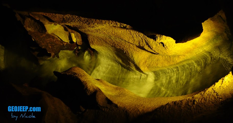
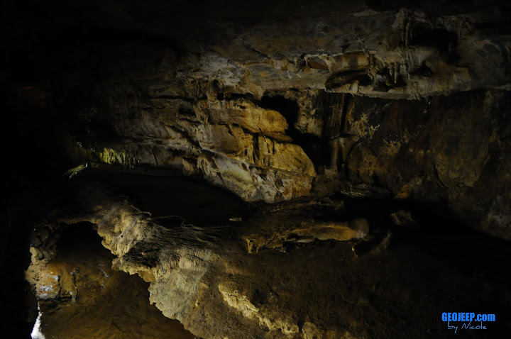
The cave I visited today was a commercial cave and not a new discovery for me, but less than 100 years ago it was a new frontier for someone. Crystal cave was discovered by Alex Medley and Cassius Weber in 1918. Today it is located within the boundaries of Sequoia National Park. Formed in a beautiful gray and white marble it has around 2.5 miles of passage. Since the marble bedding has a high dip angle the cave isn’t extensive laterally.
The marble in a stream bed within Crystal Cave Sequoia National Park July 4, 2011
They have been making a lot of efforts to return Crystal cave to a more natural state. The park has been replacing lighting with new ones that will help prevent the growth of algae and other organisms that are not natural to the cave environment. The tour involves a nice hike down a fair amount of stairs that you will need to climb back up so I don’t recommend it for anyone unable to traverse a significant amount of incline.
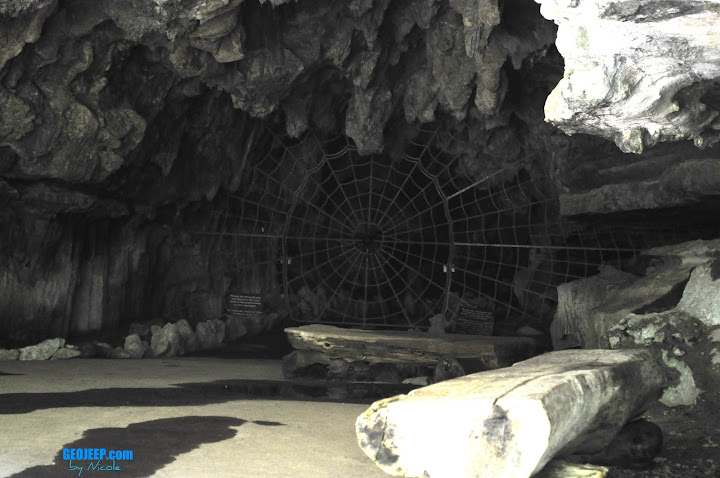
Crystal Cave Entrance July 4, 2011
The cave gate is pretty interesting, designed to look like a spider web. The tour will vary depending on the guide you get, but all are interesting. A member of my grotto back home, Chouteau Grotto, was actually working the day I visited although I wasn’t assigned to his tour. Such a small world when you are a caver!
While I had spent the last couple days visiting caves and natural wonders of inland California it was time for me to make like the explorers of the 15th century and head West. Time to head back to the area of my birth and visit some family. I need the three S’s: Sun, Sand and Sea.
Balance is important in your day to day life. One has to enjoy both the warm sunshine and the starry nights to have a complete day. Life is never about choosing left, right or even straight but rather to chose a mix of the three until you find that perfect place.
Today I headed to the interior of California in anticipation of seeing some of the most spectacular helictities in the country. The caves of the state are known to produce some beautiful, delicate speleothems and helictites are one of my favorites to look at (next to cave pearls, of course!). Black Chasm caverns is one of those such caves that anyone can take the time to visit.
Helictites galore in Black Chasm Caverns. July 3rd, 2011.
The helictites are delicate formations that seem to defy gravity, growing every which way unlike their cousins of the cave (stalactites, stalagmites, draperies, etc). How exactly they form is still debated but it is commonly accepted that capillary forces play a big roll in their whimsical development.
Draperies in Black Chasm Caverns. Volcano, California July 3rd, 2011.
The texture of the draperies here in Black Chasm was quite different than the limestone caves I have been used to. The crystal structure almost looked more like aragonite than calcite. I don’t know why yet, but maybe graduate school will enlighten me. 🙂
A close-up of the crystalline structure of the draperies in Black Chasm. July 3rd, 2011.
Located near Volcano, CA this National Natural Landmark is a pretty inexpensive visit. There are plenty of places to camp near-by, or if you chose to do what I did, is a nice wayside visit on your way to King’s Canyon/Sequoia National Parks. It was time for me to head out to see some of the LARGEST trees in the world.
A sequoia in King’s Canyon N.P. July 3rd, 2011
I was able to see many of the famous Sequoia trees, including the General Grant which is the WIDEST sequoia at 40′ diameter, the 3rd largest tree in the WORLD by volume. and is 1700 years old! A humorous sight to see in this part of King’s Canyon N.P. is the Centennial Stump. It is a tree that was cut in 1875, measuring 24′ in diameter, and shipped to Philadelphia’s Centennial Exhibition. No one believed that it truly was one tree and they proclaimed it to be the “California Hoax”. There is one sequoia that fell many years ago and is now an empty shell that you can actually walk through. That’s how BIG these trees are!
Walking through a fallen giant. A sequoia in King’s Canyon N.P. on July 3rd, 2011.
I stayed the night at the John Muir lodge in Grant Grove, and ate at their wonderful full-service restaurant. It was a bit pricey (think $200+ for the night, although it WAS a holiday weekend) but since the campgrounds were first come first serve and all full I was a bit out of luck. Plus, the lodge ended up being well worth it and the nice dinner was a welcome change to my usual camp food.
It’s a bit ironic that I am a caver because I need sunlight like I need water. In a world full of bright, warm sunlight I love exploring the deepest and darkest depths of the Earth. At the same time I love to spend hours basking in the sun, where I feel happy and content with being at peace. I guess that’s my perfect balance. I need the world as a whole, from the deepest, darkest depths to the greatest, brightest heights. I’m going to spend my life experiencing all that the Earth has to offer.
This Grand Adventure is step one for me, what is your step one?
-Nicole
A beautiful vista of King’s Canyon N.P. July 3rd, 2011.A giant sequoia of King’s Canyon N.P. July 3rd, 2011.
This morning, waking up near Brookings, Oregon in Umpqua Lighthouse State Park I was quite excited. Today I’d be heading South along the famous highway 101 into the state of my birth. The drive itself is so scenic it becomes hard to get more than a few miles without taking pictures.
McCullough Bridge, An Oregon State Historic Landmark. Built in 1936. Driving along the 101 on July 1, 2011
First you cross the famous architectural wonders: The bridges of 101. These bridges have been featured on shows on the travel channel and it’s no mystery why. Each one was uniquely designed by a renowned architect to awe and inspire travelers.
After some amazing bridges, and right before I crossed into California, I cam across some of the most breath-taking views of coastal cliffs, caves and arches. The sedimentary rocks of the pacific coast are eroded by waves and wind, both carrying sediments that slowly carve out caves, and later carve them into bridges, and towers. It’s a beautiful sight to watch the waves crash into these rocks.
Well-knowing that my drive would be slowed due to the gorgeous views of the pacific ocean my plans involved my camping at Golden Bluffs State Park….however I was greeted with a “campground full” sign. Unfortunately many of California’s campsites are first-come first-serve, meaning no reservations. Since my Grand Adventure put me in California the weekend of the 4th of July all of the campgrounds were full. It doesn’t mean I didn’t enjoy the view.
Roosevelt Elk at Golden Bluffs State Park, California July 1, 2011
I’ve now been on the road for over 50 days and I can’t imagine how to decide which view is the most inspirational, but this would definitely be right up in the top. The west coast’s geology is ever changing at such a rapid pace. As compared to the landforms of the east (our passive margin) the west coast is constantly being changed.
A lot of us are scared of change. We see it as a hurdle to overcome or a step backwards in our trek. Truth is the changes are inevitable the most formative parts of our lives. They are the reasons we love, hate, hurt, smile, laugh and inspire. The west coast is a perfect example of how change will mold you into a better, more beautiful person. Perfection isn’t holding a true form. The closest to perfection you will ever be is to accept the challenges that crash into you and make changes to be a better person.
An arch in the Pacific on the South Oregon coast. July 1, 2011
Looking at these scenes along the coasts of Oregon and California you can see two different things: destruction and construction. You could say that the waves are crashing into the rocks and destroying them…or you could say they are creating these landforms that we enjoy. Standing here on the coast, watching those waves crash and catching my breath as I realize I am truly experiencing this, I learn something.
Destruction is a method of creation. You can’t have construction without some sort of destruction. When life starts crashing into you it isn’t trying to destroy you, it is trying to build a more resilient you. Don’t fight the waves….brace yourself and revel in the fact you will be a better person for it.
Experience. Is. Life. All of it.
Nicole
Golden Bluff’s Campground. Cali. July 1, 2011Highway 101 does dive inland a bit into a portion of the Redwood National Forest. July 1, 2011
Today was going to be a detour from the carefully planned itinerary I had developed for this trip. It has been over 50 days since I started this journey and there is one important thing to understand about road trips: The plan is secondary to the journey. If you take a vacation your agenda should be created as a tool in case you fail to find adventure. Something to guide your trip rather than dictate it. I was now armed with the information of local lava tubes and a magnetic pull towards the famous crater lake. Neither were on my itinerary, but both are certainly part of this journey of a lifetime.
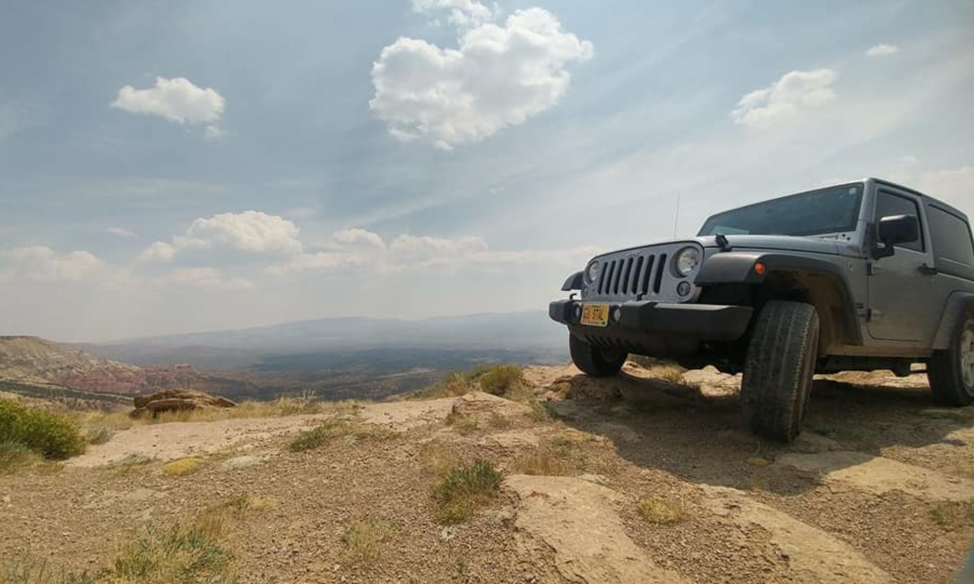
Using the hand drawn map provided to me by the hotel manager I headed along a high desert gravel road towards my first lava tube of the day. Off-roading trails were abundant in this area and I took my fair share of them along the way. In my attempt to avoid people for the day, driving around a truck parked in front of a hill, I managed to put myself on the other side of a makeshift shooting range. The view was beautiful as the wine blew through the dried grass, and the sun was warm and welcoming after spending so many days in the cool northwest. I spent a good amount of time sitting on my Jeep’s hood taking in the sunlight, but the gun fire prompted me to move on. Turns out in avoiding company I had failed to pay attention to the fact they were target shooting and I was on the wrong end of the line of fire. I drove out here to see lava tubes, anyways.
Me in front of Skeleteon Cave June 29, 2011
Boyd cave was the first lava tube I found along the dusty dirt road. The cave, surveyed in 1969, has only 1880 feet worth of passage. The subway tunnel-like passages are pretty typical of a lava tube and Boyd’s was no exception. In contrast to the limestone caves I consider home these were bland and boring. I stopped at Skeleton Cave, another lava tube, but did not go in. It was gated and access is by permit only. I didn’t feel like I was missing out on much.
I mean no offense towards the cavers of the lava tube persuasion, but speleothems are kind of my passion. Not only do the lava tubes I have seen thus far lack any significant decorations (although I hear there are a few lava tubes capped by limestone that do have speleothem development. I have not had the pleasure of visiting these yet) but the passages are too predictable. Caving, for me, is a curious adventure with twists, turns, and a wonderment at the chaotic and complex nature of a cavern’s path. Why water chose to follow one joint instead of another has always been a curiosity of mine. The lava tube is so straight forward that it reminds me of a man made subterranean tunnel, and thus lacks the fantasy of a wild cave.
Entrance to Skeleton Cave, June 29, 2011. Oregon.
The warmth of the high desert plains reminded me it was time to head towards to golden coast. Oregon’s volcanic history sculpted the terrain I was driving through, fields of pumice and lava flows. The northwest is a vulcanologist ideal vacation spot, full of volcanic wonders. There was still another place of interest to visit on today’s impromptu journey: Crater Lake.
I stopped to get gas again and if there is one thing you need to know about journeying through Oregon in your vehicle it is this: You aren’t allowed to pump your own gas. Yesterday I thought the gas station attendant was just being nice, and today I learned it is against the law to pump your own gasoline. Travelers be aware: full service only in Oregon.
The Pumice Desert near Crater Lake in Orgeon. June 29, 2011
On the approach to Crater Lake I drove through the pumice desert. Almost 8000 years ago Mt. Mazama erupted, forming crater lake and this desert of pumice that is nearly 100 feet thick. Vegetation has been slow to return in this area since the lack of nutrients don’t allow for a suitable growing environment. Today the pumice desert was covered lightly in snow, and as I headed up the winding road to the top of Crater lake the snow was even deeper. Throughout this trip I have been reminded that the entire continent received a large amount of winter precipitation, but it never ceased to amaze me how much snow was still here. It is the end of June and as I head up to Crater Lake National Park the RV in front of me is SHORTER than the snow piled along the sides of the plowed road.
Snow pack on road up to Crater Lake June 29, 2011
The weather was misty, and foggy. When I arrived at the top of Crater Lake I could see nothing. The water that everyone claims is so blue and clear, some of the deepest water in the country, was hidden behind the thick blanket of fog. I spent a short period of time there, then retreated back down to a warmer area.
Mt. Thielsen, Lightening Rod of the Cascades June 29, 2011
I drove past the Mt. Thielsen, the lightening rod of the Cascades. This former volcano’s core attracts lighting strikes so often that the rock atop the summit is actually melted. I arrived at my hotel and decided to get some rest. Tomorrow I would be back on the coast, gazing at the beautiful Pacific. While the geologist in me was fascinated with the volcanism of the Cascades nothing could compare with the tranquility brought to me by the crashing waves of the Pacific. Maybe it was because I was born next to this ocean’s breeze, but nothing ever feels more like home.
The foggy view of Crater Lake June 29, 2011.
The tunnel to the bathroom at Crater Lake (meant to keep snow out) June 29, 2011
The big open wilderness of Oregon was masked as I drove southeast from the Portland area. As I climbed the pass on 26 highway I joined Mt. Hood in the blanket of the clouds. Driving through Oregon was a lot like opening a present layer by layer. After my foggy drive through Mt. Hood National Forest the land opened up in front of me as a high desert plain. Brushy vegetation was in bloom with snow-capped mountains in the distance.
Oregon Landscape. June 28, 2011. North of Warm Spings, OR
After I passed Warm Springs, Oregon I ran into some beautiful examples of columnar jointing in basalt. At first it towered straight into the sky, and further down the road the pattern made a swirl like I have never seen. I’m not as familiar with igneous rocks so I don’t know what causes the jointing to swirl in different directions rather it’s preferred vertical pattern. If anyone knows please inform me. I live to learn! (See the cover photo for this entry)
Columnar Jointing in Basalt, Oregon June 28, 2011
Further down the highway I stopped at the Ogden State Scenic Viewpoint. It overlooks a beautiful basaltic canyon carved by the Crooked River. The canyon edges are more than steep- they are completely vertical. The canyon is over 300 feet deep and proved impassable until 1911 when they finally had the technology and resources to build a bridge.
Ogden State Viewpoint. Oregon June 28, 2011
While the view is gorgeous, I think one of the main reasons to visit would be to see the warning signs. There are several different flavors of humorous, albeit justified, warning signs. I think my favorite was the one below that shows a dog jumping off a cliff.
Sign at Ogden State Viewpoint, Oregon Juen 28, 2011
After stopping by a Trader Joes to get ingredients for dinner I headed towards my planned campsite. I was pretty excited to camp in Oregon. I knew the weather would be wonderful and it would be my first experience in Oregon. Unfortunately a less humorous sign than those of Ogden State Scenic Viewpoint were ready to welcome me in the state:
Campgrounds were full in Oregon. June 28, 2011
After spending several hours driving from campsite to campsite only to be greeted by the same message I had to surrender to a hotel. Remember how I mentioned yesterday it was important to plan for extra spending money? This is a perfect example of why anyone should plan to do just that. Hotels are certainly more expensive than a campground.
The hotel stay turned out to be a blessing in disguise. The owner happened be someone who had been caving a few times and had the inside info on some local lava tubes I could explore. He gave me directions to 3 or 4 different places I could go visit to round out my lava tube experience from yesterday’s Ape Cave.
I may have been taken out of the campground for the night, but nothing could take the camp out of me. I had planned on browning the ground turkey I purchased at Trader Joes so I could make turkey tacos and nothing could stop me. I set up my camp stove on the sidewalk and brown the half pound of ground turkey (I usually cooked all the meet then all I had to do is keep it in the cooler and reheat at the next camp). I enjoyed my turkey burgers with a sense of accomplishment and laughter at the looks other hotel guests gave me.
Cooking at a Hotel in Bend, Oregon. Juen 28, 2011
Oregon’s outdoors may have escaped the grasp of my tent tonight, but as a result tomorrow I would be doing something well worth the inconvenience: Caving. I’ll see you all underground tomorrow.
-Nicole
I tried a local beer and it commended me. Oregon June 28, 2011
Day 49: Mount St. Helens National Park & Ape Cave
There are a few different types of travelers out there one can embody. One can be the careful traveler, someone who sticks to the main roads and a strict agenda. Reading all of the signs and going only to those places known for tourism this traveler sees the same sort of things that they can experience with an internet service and a basic knowledge of search engines. The places this kind of traveler goes to have already been seen over and over, and from the exact same perspective. The careful traveler only stops to photograph views that are designated by road signs and very likely stands right next to the sign with a camera icon for every scenic picture. A typical cookie-cutter vacationer who wants to see everything they’ve seen in photos exactly as they have seen them.
Another type of traveler one can be is the reckless traveler. These types jump in head first without reading the signs. They trespass into places they have no knowledge of and destroy delicate ecosystems and ancient rock forms. The reckless travelers are the ones who run out of gas and money before the allotted time for vacation is even near to being up. They don’t plan a vacation at all, and leave home with none of the gear they will need forcing them to use all of their spending money on supplies only to show up to the park and learn they can no longer afford the admission fee. This traveler is also the most likely to be injured not because of their activities, but because of their lack of information, common sense, and planning.
There is a third type of traveler and this is the one that I strive to be. It walks the line between careful and reckless. This traveler plans their vacations well but allows for a good amount of wiggle room in budget and time. This traveler plans a generic agenda but is prepared to change it on the fly when they come across something new. They will leave the well-beaten path, but only because they have educated themselves in how to handle every situation. They aren’t always law abiding, but they are respectful and resourceful. This type of traveler is known by a single adjective.
Adventurous.
Mt. St. Helens June 27, 2011. "29" and I.
Mount St. Helens is a place of adventure. Most people think of Mt. St. Helens and think of the explosive event of 1980 when the nation was glued to the news as they watched a mountain transform in front of their eyes. This is one of the aspects of adventure that many of us seek: a slight sense of danger. You can’t get that when you are on confined trails with a monotone tour guide telling you the kindergarten version of the geologic history. The Mt. St. Helens National Park has many things to see and is surprisingly well catered to the traveler who doesn’t want the cookie-cutter guide to take them around (although they do have this on request).
An angry "29". Mt. St. Helens N.P. 6.27.2011
The drive up Mt. St. Helens started out exactly as I expected it. The long, winding road wound up the side of the slumbering volcano, rocky road cuts slowly being replaced by something that looked more like volcanic ash just as one would expect. Unfortunately this mountain was no different than the rest in the country that had received an excessive amount of winter precipitation. I drove for almost 40 miles to find out the pass was closed. It was still buried under 10 plus FEET of snow. My Jeep doesn’t usually care for “Road Closed” signs too well, and it sought an alternate route…. but I force disappointed “29” back down the winding road for an over 100 mile detour to get to the other side of the park.
Ape Cave. A lava tube in Mt. St. Helens National Park. June 27, 2011
On the other side of the park sat Ape Cave, a lava tube that was discovered about 30 years prior to the famous eruption of Mt. St. Helens. It is 12, 180 feet long, completely dark (as you would expect any cave to be), and a lot like a subway tunnel full of sharp boulders. Inside you get a to take the choice of two routes, Upper Passage or Lower Passage. The Lower Passage only goes about 0.75 miles and is an easy walk. Upper Passage is 1.25 miles and a more difficult traverse, climbing large boulder fields and scaling an 8-foot “lava fall” free style. Best of all: The entire tour is self guided and you must provide your own lighting. Guess which route I took…
A skylight in Ape Cave lava tube. Mt. St. Helens N.P. 6/27/2011
Upper Passage was a lot of fun. I will have to say that I found my first lava tube to be interesting, but rather boring in comparison to the winding limestone caves I am used to in the Midwest. Ape Cave is a pretty typical lava tube, a very straight cylindrical cavern with a few sky lights here and there, and small lava drips that hang from the ceilings. The temperature is cooler than the caves I am used to, averaging only 42 degrees fahrenheit.
Ape Cave lava drips in Mt. St. Helens N.P. June 27, 2011
After my tour of Ape Cave (I must proclaim the tour guide was fantastic…lol!) I headed to another interesting place of interest that wasn’t on the agenda. The Trail of Two Forests is a lava flow with hollows where trees originally stood. You can see the ghost tress almost perfectly preserved in the lava, and you can even play a game of prairie dog if you are so inclined, crawling through the tree hollows and popping up through skylights. The place is pretty interesting, and a lot of fun for kids (or the kid in you). Yet another example of how hands-on Mt. St. Helens N.P. seems to be. It allows you to be the adventurous traveler, leaving the paved path and mundane talks behind while still remaining safe and informed.
A tree cast in Mt. St. Helens N.P.'s "Trail of Two Forests" 6/27/2011Me in a ghost tree! "Trail of Two Forests" in Mt. St. Helens N.P. 6/27/2011
On the way out I ran across some off-roading trails. There were no signs forbidding me to drive on them so I took advantage of the opportunity to jostle around on dirt and rocks in the shadow of a snow-covered Mt. St. Helens. There couldn’t have been a more perfect ending to the day.
If you find yourself preparing for a vacation please keep in mind what I have said. You can’t truly experience other worlds if you don’t leave the path, but you need to do so smartly. Be the adventurous traveler, plan your trip with plenty of spare time to enjoy anything you run into, and be ready to change any existing plans at the drop of a hat. A vacation isn’t an itinerary and a bunch of duplicated post card photos. Travel is for experience, for knowledge and growth, for relaxation and something out of the norm.
The only traveler worth being is the adventurous traveler. Anything else can be spent reading a book or a week in the hospital.
Tomorrow I will be continuing my adventurous journey of the summer. My Grand Summer Adventure. Tomorrow will be my 50th day since I embarked on my journey but I’m not slowing down yet. There’s still so much to see, experience, learn…..and share. I’ll see you all there.
Nicole
A view into a cavern from above. Ape Cave in Mt. St. Helens N.P. June 27, 2011
Did you know that Washington has high desert plains? It has plateaus and mountains, rivers and lakes, snowy peaks and great big canyons? I always thought of Washington as the green state- eternally covered from top to bottom in green plants. There is a lot more to Washington than I thought.
I had planned on visiting Gardner cave so I left Sandpoint, Idaho and headed towards Metaline Falls, WA in the afternoon. It turns out that Gardner Cave, one of the few limestone caves of the state, is closed on Tuesday and Wednesday. Since it was a Wednesday I was unable to see the cave. I decided to pull out the hand atlas, unwilling to give the GPS another go at control quite yet, and found something labeled as the Lenore Lake Caves and I started heading in that direction.
The Grand Coulee of Washington. June 22, 2011
On the way south I ran into the Grand Coulee. This giant steep-walled canyon was carved by massive amounts of melting glacial waters as the Ice Age came to the end. It was once a waterfall even grander in scale than that of Niagara Falls. It was a 3.5 mile long, 350 foot tall water fall that rushed along carving the landscape into what it is today. The water that remains here today helps the desert wildlife thrive, and it is in this large canyon where the Lenore Lake Caves were carved out of the solid flood basalts.
Looking at "29", my Jeep, from a Lenore Lake Cave
Technically these “caves” aren’t large enough to be considered a true cave. They never transition past a twilight zone, but they do hold some historical significance. About 5000 years ago the natives used these “caves” as shelters. The native people resided here during the spring and summer to collect plants and herbs that were used in religious ceremonies.
Don't wear flip flops when hiking up piles of loose basalt breakdown! June 22, 2011. Lenore Lake Caves
I hiked up the cliffs (in flip flops…I’m a bit of a rebel like that….) and visited the inside of the shelters. They would have been fairly comfortable, keeping everyone dry while still allowing for a great view of the canyon in front of them. Looking down to the parking area my Jeep looked dwarfed. The trail up to the shelters was dotted with several different flowering plants.
A Lenore Lake Caves flower. June 22, 2011
So far my visit to Washington had not met a single preconceived notion. I had been in the typical mountain terrain, I had taken in the views of waterfalls both ancient and current, and watched as this terrain turned from a high desert plain, sparsely vegetated, to a fertile land of farm land enriched by the Columbia river. When I arrived in Wenatchee, WA I finally saw the first thing that truely told me I was in Washington State: Cherry orchards.
As I learned back in the winter of 2009-2010, states are only bounded politically, not geologically or by climate. Washington State has a little bit of everything as I have learned today. Soon I would be in Seattle, experiencing the mighty Pacific Ocean. When I visited Northern Arizona in January 2010 I saw that Arizona was more than desert- it had snowy, vegetated mountain terrain. Today I visited Washington and discovered it wasn’t all cool and green- but it also had desert terrain. Arizona and Washington have more in common than I thought!
-Nicole
During my visit to Crystal Lake Caverns on Day 34 I spoke shortly on the effects of sacrificing small parts of nature to promote preservation of itself at large. Yellowstone and Glacier National Parks, both, show exactly what this means by changing the way nature interacts with human activity. My friend from Missoula and I went on two long hikes during our visit to Glacier National Park, and during both we noticed abnormal wildlife patterns, starting with our first drive through the park.
We arrived at the park only to find out that, like the rest of the continent, this winter had an abnormally high amount of precipitation and the snow pack was still blocking the pass. We would only be able to experience the Western portion of the park. We drove as far as we could and camped at the end, in the Avalanche Creek campground. The campsites are simple, a firepit and picnic bench with the wooded campsite, and no showers or hot water available. It was right next to the first trail we would hike that night, so we decided to go check out some of the lakes and rivers before we took hit the trail.
Glacier N.P. Blackbear June 20, 2011
On the drive back towards the western entrance we came across some traffic, which usually indicates some sort of wildlife has captured the attention of tourists. After sitting for a short time waiting for the cars to take their turn at taking pictures, we saw the black bear begin to wander around the cars. He took his time, looking into the cars to see who would, unintelligibly, offer him food.
The lakes here are glacial, and the biggest one that we were able to see was Lake McDonald. As may be obvious, a glacial lake is formed by a glacier, in the case of Lake McDonald, one that was over 2000 feet thick. As the thick river of ice slides down during melts it bulldozes dirt and rock in front of it, forming a wall called a terminal moraine. When the glacier receding as the climate warmed, the moraine was left behind, damming a lake that stretches to depths of 472 feet.
Lake McDonald in Glacier N.P. June 20, 2011
When we returned to our campsite we decided it was time to hike the Avalanche Creek Trail so that we could make it back before dark. We had been joking about the bear mace marketed to the city slickers, selling for a whopping $55 per can at the stores within the park. The black bears aren’t anything to worry about, but grizzlies can get pretty aggressive if they are startled by a humans. As long as you follow some common sense rules about wildlife they don’t normally bother you, but as has been indicated in the past few days these animals aren’t quite like normal wild animals. They are used to humans.
The Snowshoe Hare along Avalanche Creek trail in Glacier N.P. June 20, 2011
As we made our way up the 2 mile, 500 foot elevation gain trail (4 miles round trip), wildflowers in bloom everywhere indicating that spring had indeed sprung, we ran across a snowshoe hare. The rabbit hopped around nonchalant as we admired it. It wasn’t until I got within a few feet to take some pictures that he began to hop away. We made out way to the end of the trail that terminated at Avalanche Lake, which was incredibly muddy and wet. Along the north side of the trail Avalanche Creek followed along, carving out the bright red bedrock into curvy, smooth canyons. We laughed at the bear bells we could hear ringing throughout the woods. Fear does a number on people….
Avalanche Creek in Glacier N.P. June 20, 2011
On the way back down the trail to our campsite my friend stopped me mid-step. A deer, barely 10 feet away, walked across the trail and right next to us. Like the hare, she walked slowly along as if we were passing in a hallway. I had never been so close to a deer before, and it didn’t even have it’s tail up in alarm. With each animal we came across that had zero fear of humans we began to understand the excessive warnings throughout the park. These animals weren’t exactly wild: They were a hybrid of wild and domestic. The most dangerous type of wild animals, the kind that are so used to humans they think nothing of walking within arm’s reach.
The deer on Avalanche Creek Trail, unafraid of us hikers. June 20, 2011
The next day we hiked another trail, a 7 mile hike on the McDonald Lake Trail. It is a mostly flat trail that follows along the western side of the lake, heading in a general NE direction. A large portion of the hike goes along an area that suffered from a wildfire not too many years ago. The skeletons of trees stand tall, and wildflowers were blooming everywhere. We also noticed bear scat fairly often right on the trail, many of them obviously too large to be a black bear. Maybe those bear bells weren’t so goofy after all.
Bear scat with a print along the McDonald Lake Trail in Glacier N.P.
Glacier National Park was beautiful. The mountains were topped with snow, the lakes were clear and cold, and the scenery was green and in bloom. Ironically, although I had come to Glacier National Park in hopes to see a glacier there was too much snow on the trails to get to a glacier.
I often wonder if people who live in big cities think that the wilderness really is like this, if they think wildlife come right up to you like they do in Yellowstone and Glacier. If we sacrifice some of nature to promote funding for preservation of itself at large, are we giving people the wrong idea? How many people feel comfortable preserving a place where the animals are dangerously used to humans, and attacks aren’t as uncommon as they are in the true wild.
Perhaps the West could enlighten me, as it was time to start heading towards the coast. This about as far north as I would be going for the remainder of my trip. Time to start getting warmer.
-Nicole
Someone rowing on Lake McDonald...I'm not sure what this sport is called, but it's the new thing apparently. June 20, 2011
Slick rocks in Glacier N.P., N. McDonald Creek. June 20, 2011Wildflowers in Glacier N.P. June 20, 2011
The lichens in Glacier N.P. reminded me of the moss of the deep south. June 20, 2011
The colors of the sunset in a puddle on Avalanche Creek Trail, Glacier N.P.The Avalanche Creek campsite at Glacier N.P. June 20, 2011
The Avalanche Creek campsite in Glacier N.P. June 20, 2011
Wildflowers in Glacier N.P. June 20, 2011
Rock outcrop in N. McDonald Creek. Check out the preferred jointing!
Those of you that have known me for years know how accident prone I can be. There was the Dec. 2009 El Paso, Texas incident (click here), there was the January 2010 Cattle Blunder of New Mexico (click here), and of course who could forget the Costa Rica Weekend Plastic Disappearance of August 2010 (not yet published, to come soon I promise!!!). There are probably many others that you may remember I have not listed.
It’s no surprise: Somehow I am the luckiest accident-prone person on the planet.
I say I’m the luckiest because even though these things could be potentially life altering events, things that normally ruin your trip to the point of no return, I manage to find a way out of it safe, sound, and sometimes even better than before. Today, my friends, family and other followers, ended up being one of those days. Not bad considering I am 40 days into a trip with no major accidents as of yet.
A hot spring in the Old Faithful hydrothermal field of Yellostone National Park June 17, 2011
This morning we awoke, took a warming shower at the campground facility, and then headed towards Old Faithful where we were to meet up with our two other friends who stayed in the lodge that night. On the way we were able to see many of the things we didn’t see the night before as we wound our way along the roads in the dark: herds of buffalo, hot springs that bubbled up, and great vistas of mountains, prairie, rivers, lakes, and pines.
We arrived at Old Faithful right as it was erupting, spraying it’s heated water and steam up into the air nearly 40 feet high. After catching the eruption from the curb, we found a parking spot and found our way through the crowd to meet up with our two new party members. I saw them walking along the sidewalk away from us, and decided to run up behind them to scare them….only I made one vital mistake.
Old Faithful in Yellowstone National Park. June 17, 2011
The lifeline of my DSLR camera, that nylon strap with the yellow Nikon emblem up and down the sides, the very thing I keep around my neck at all times….was not where it was suppose to be. I had failed to swing it over my head…and the camera was just sitting atop it’s case as I skipped my way towards them. There was a tumbling of the expensive camera equipment across the concrete, and a slight moment of disbelief in what had just happened before I bolted forward to grasp the pieces before someone had a chance to run over them.
My lens had snapped off in the tumble, and at first I thought it might be ok, then lens lacking any cracks or scratches…but alas the lens wouldn’t lock into the camera body. The plastic fins that hold it in place had snapped off. Luckily my friend, who I had been trying to surprised, was observant and picked up the two, small plastic pieces to that I may have had the hope of gluing it back on. We found someone with superglue and glued the pieces on…but even after it sitting for a couple hours, the glue didn’t hold. I could still take pictures…but I had to hold my lens on with pressure to trick the camera into thinking the lens actually was attached. I want you to think about that as you enjoy the photos of this day….these pictures took a lot of work….
A boiling hot spring, a cold river behind it, and another hot spring depositing minerals beyond that. Yellowstone National Park Old Faithful area. June 17, 2011
After I calmed down over lunch, angry at myself for such a ridiculously careless move, we watched Old Faithful erupt once again, this time up close. We decided to fill our day with warm, steaming geyser goodness and took a long walking route that looped through the thermal field.
More of the amazing Yellowstone Geysers, this one about a 2 mile walk from old Faithful. June 17, 2011A colorful hot spring of Yellowstone in the Old Faithful area- note that the yellow/brown colors indicated bacteria growth.
The springs and geysers bubbled up in marvelous colors, bright blue and green in the purest of them, and yellows/browns in those that had cooled down a bit too much, allowing bacteria to grow. There were so many it was hard to believe, and everywhere you looked along the walk you could see steam rising from one place or another. The buffalo were here too, resting in the middle of the thermal field with their young calves. I really would enjoy owning a herd of bison….
The bison sleeping in the hydrothermal field. June 17, 2011 Yellowstone National Park
After we made our rounds, passing a bear warning sign on the way out that said Yellowstone is not responsible for our safety, and a slightly disturbing trail-closed due to bear activity sign on the way back, we came to yet another animal obstacle: The fuzzy cows I like to call my friends, the Bison.
The frist bear warning we saw on our trail at Yellowstone's Old Faithful area. June 17, 2011The bear warning sign on our trail in the Old Faithful area of Yellowstone at the END of our trail. June 17, 2011
They trapped us travelers on the wooden walkway, and even managed to walk up, one on each side of the trail, as if they were the guards of Old Faithful. We could hear wolves/coyotes howling in the distance as the evening was cooling the air down. Eventually the bison decided we could pass and moved on to other green pastures.
The guardians of the pathway-Bison. Yellowstone National Park June 17, 2011
On the drive back to the campsite we encountered more bison on the move, using the road as their pathway. Here at Yellowstone the fuzzy cattle know who is boss: them. They have the right of way no matter where you go, and they seem to know it very well. They are so used to people that they don’t budge from their path when a human is in it: it’s expected you will move. I think what I enjoyed most is watching the buffalo’s eyes. You can honestly see them thinking, watching you as if they know who you are and can speak to you with a gaze.
The bison making their evening trek to their night fields in Yellowstone on June 17, 2011
Yellowstone is obviously the place to be if you want to experience wildlife, and hydrothermal activity. There is a lot to take pictures of, so either pack a large memory card (or a lot of film, if that is your style) because you will need it. And remember…those nylon cords, whether they go around your wrist or your neck….are there for a reason!
Tonight we were moved to another campsite….this one with enough room to set up a tent. Hopefully this means we will get a good nights’ rest… I’ll see you tomorrow when we spend more time exploring the wonders of Yellowstone. I’ll be sure to reserve some energy to hold on my lens while taking pictures of all these places for you.
-Nicole
Bison and their calves in Yellowstone, right behind Old Faithful. June 17, 2011
Bison bones from a recent meal for the wolves. June 17, 2011 in Yellowstone National Park
How many people can identify these tracks, located in the warm hot springs of Yellowstone?
There is more than one way to eat a buffalo in Yellowstone National Park of June 17, 2011
Plants incorporated into hot spings deposits? You analyze and let me know what you think. June 17, 2011 at Yellowstone
Today we had a long drive ahead of us to Yellowstone National Park, but that wouldn’t stop us from sightseeing along the way. There were two main things to see on the trek Westward: Devil’s Tower and the site of Custer’s Last Stand, Little Bighorn Battlefield. I jumped into my Jeep, and my two friends into their truck, and we began our journey into the wild west.
Devil’s Tower is one of the geologic sites of importance that we are required to learn the location of as geology students. Today I would actually get to see this place in person, and among reading the theories of the development of Devil’s Tower, also the native stories (and there are many) that accompany it.
Devil's Tower National Monument in Wyoming. June 16, 2011
There are numerous versions of the story, and I read at least 4 different versions within a couple hours. All of them have this in common: some natives (whether they be children, villagers, sisters, etc) were trying to get away from a bear (that may or may not have been a young girl shortly before attack on the village) and the gods raised them up, the bear scratching the rock as it rose into the sky. They became a constellation in the sky.
The geologic theories are also vary, and come in three main flavors.While all theories include that it is an igneous intrusion, how it came to be as it is today has several different possibilities. Some geologists believe it to be a laccolith, an igneous intrusion that was beneath the surface of sedimentary rocks which were later eroded to expose what we see today. Others believe it was a plug of long-gone volcano that used to be in the area, and others still believe it to be other forms of igneous intrusions, the original surroundings long gone due to erosion. I guess you can take your pick as to which you believe…maybe you’ll even go with the bear story.
The Devil’s Tower was the first National Monument in 1906, and thus made Wyoming the state to host both the first National Monument and Park (Yellowstone). It is surrounded in history, an important landmark for the Plains indians. In more recent history (and to my amusement) George Hopkins decided to parachutes from an airplane in 1941 and land atop the Devil’s Tower just to show it could be done. Nevermind the fact that he was trapped there for 6 days until climbers could make their way up to rescue him.
Who can pass up drinking water from a fountain with claims like these? Devil's Tower, June 16, 2011
After climbing up the boulder field to get the closest view of Devil’s Tower you can get without a permit, and drinking the water that was ostentatiously claiming to be pure and of excellent drinking quality, we headed a little northwards so we could swing by Little Bighorn Battlefield before making our arrival, fashionably late, in Yellowstone.
The site of Custer's Last Stand. Little Bighorn Battlefield National Memorial, June 16, 2011
Little Bighorn Battlefield National Memorial is located in Montana, and it is the site of the famous Custer’s Last Stand, where the U.S. troops were defeated by the natives. It is full of historical information about the battle, and the fields are flagged with white markers indicating where soldiers met their fate. It was a pretty interesting place, and if we didn’t have somewhere to be and the weather wasn’t misting upon us we may have stayed longer to learn a bit more.
Little Bighorn Battlefield Memorial. The marker colored in black is Custer's memorial (Although he isn't actually buried here anymore, his body was moved in 1877 to another graveyard)
The last long haul to get to Yellowstone was a long, scenic drive. Montana is full of open space, where you can literally see as far as the eye can see. The mountains eventually begin to jut out of the ground as you near the western half of the state, breaking the golden sunset with snow-capped mountains. The view was beautiful, and with how honey-golden the sun was shining, I imagine it wasn’t difficult for the pioneers to be dreaming of gold in the western frontier.
A Western Montana Sunset. June 16, 2011
When we arrrived at the campsite deep within Yellowstone, the Canyon Campground, we were more than fashionably late. It was near midnight, and the near 2 feet of snow and lack of open space to set up a tent weren’t exactly encouraging. It was the middle of June and there was still an significant amount of snowpack on the ground- who knew!?
Our Canyon Campground site we "slept in" (our vehicles) on June 16, 2011 Yellowstone National Park
Well, we decided to sleep in our vehicles and see what the next day brought.