America was “discovered” during the era of exploration. Western civilization had become fascinated with finding the last frontier. While the Fourth of July is meant to be a holiday to celebrate our independence as a country it seemed fitting to spend my holiday in one of the last frontiers: A cave. There are few places left on Earth that have not been explored yet. The great underground is one of those few. In the spirit of exploration we cavers seek to find places no one else has ever seen. There is nothing like the rush of seeing a place that may have never been seen by a human before. America was already inhabited when we discovered it, but caves often are completely untouched (especially those that are hypogene in nature).
A neat dissolutional stream “chute” in Marble Cave of Sequoia National Park July 4, 2011
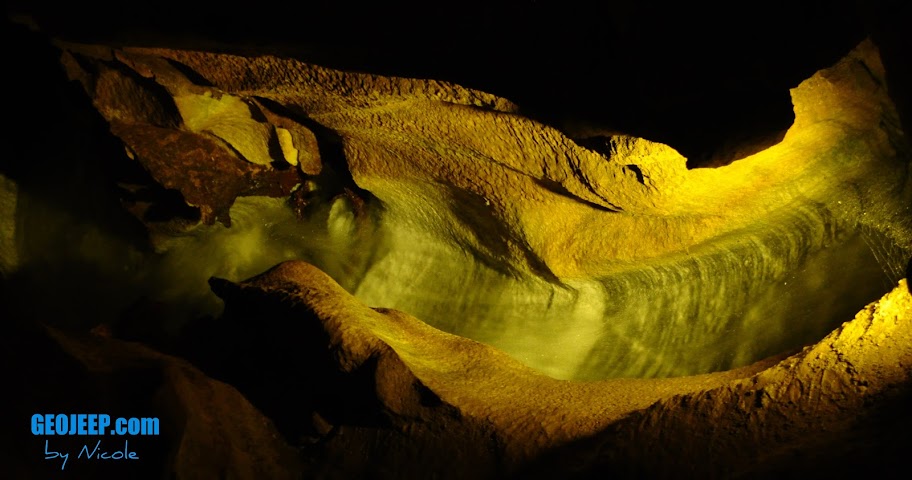
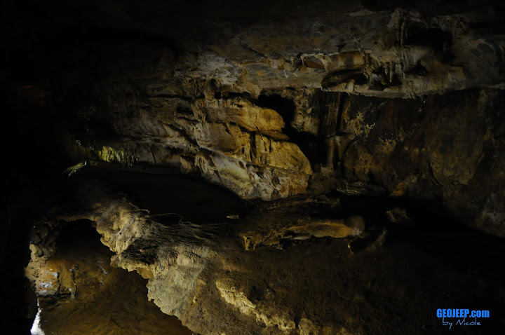
The cave I visited today was a commercial cave and not a new discovery for me, but less than 100 years ago it was a new frontier for someone. Crystal cave was discovered by Alex Medley and Cassius Weber in 1918. Today it is located within the boundaries of Sequoia National Park. Formed in a beautiful gray and white marble it has around 2.5 miles of passage. Since the marble bedding has a high dip angle the cave isn’t extensive laterally.
The marble in a stream bed within Crystal Cave Sequoia National Park July 4, 2011
They have been making a lot of efforts to return Crystal cave to a more natural state. The park has been replacing lighting with new ones that will help prevent the growth of algae and other organisms that are not natural to the cave environment. The tour involves a nice hike down a fair amount of stairs that you will need to climb back up so I don’t recommend it for anyone unable to traverse a significant amount of incline.
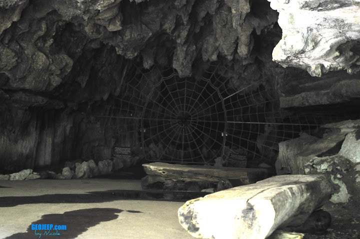
Crystal Cave Entrance July 4, 2011
The cave gate is pretty interesting, designed to look like a spider web. The tour will vary depending on the guide you get, but all are interesting. A member of my grotto back home, Chouteau Grotto, was actually working the day I visited although I wasn’t assigned to his tour. Such a small world when you are a caver!
While I had spent the last couple days visiting caves and natural wonders of inland California it was time for me to make like the explorers of the 15th century and head West. Time to head back to the area of my birth and visit some family. I need the three S’s: Sun, Sand and Sea.
Balance is important in your day to day life. One has to enjoy both the warm sunshine and the starry nights to have a complete day. Life is never about choosing left, right or even straight but rather to chose a mix of the three until you find that perfect place.
Today I headed to the interior of California in anticipation of seeing some of the most spectacular helictities in the country. The caves of the state are known to produce some beautiful, delicate speleothems and helictites are one of my favorites to look at (next to cave pearls, of course!). Black Chasm caverns is one of those such caves that anyone can take the time to visit.
Helictites galore in Black Chasm Caverns. July 3rd, 2011.
The helictites are delicate formations that seem to defy gravity, growing every which way unlike their cousins of the cave (stalactites, stalagmites, draperies, etc). How exactly they form is still debated but it is commonly accepted that capillary forces play a big roll in their whimsical development.
Draperies in Black Chasm Caverns. Volcano, California July 3rd, 2011.
The texture of the draperies here in Black Chasm was quite different than the limestone caves I have been used to. The crystal structure almost looked more like aragonite than calcite. I don’t know why yet, but maybe graduate school will enlighten me. 🙂
A close-up of the crystalline structure of the draperies in Black Chasm. July 3rd, 2011.
Located near Volcano, CA this National Natural Landmark is a pretty inexpensive visit. There are plenty of places to camp near-by, or if you chose to do what I did, is a nice wayside visit on your way to King’s Canyon/Sequoia National Parks. It was time for me to head out to see some of the LARGEST trees in the world.
A sequoia in King’s Canyon N.P. July 3rd, 2011
I was able to see many of the famous Sequoia trees, including the General Grant which is the WIDEST sequoia at 40′ diameter, the 3rd largest tree in the WORLD by volume. and is 1700 years old! A humorous sight to see in this part of King’s Canyon N.P. is the Centennial Stump. It is a tree that was cut in 1875, measuring 24′ in diameter, and shipped to Philadelphia’s Centennial Exhibition. No one believed that it truly was one tree and they proclaimed it to be the “California Hoax”. There is one sequoia that fell many years ago and is now an empty shell that you can actually walk through. That’s how BIG these trees are!
Walking through a fallen giant. A sequoia in King’s Canyon N.P. on July 3rd, 2011.
I stayed the night at the John Muir lodge in Grant Grove, and ate at their wonderful full-service restaurant. It was a bit pricey (think $200+ for the night, although it WAS a holiday weekend) but since the campgrounds were first come first serve and all full I was a bit out of luck. Plus, the lodge ended up being well worth it and the nice dinner was a welcome change to my usual camp food.
It’s a bit ironic that I am a caver because I need sunlight like I need water. In a world full of bright, warm sunlight I love exploring the deepest and darkest depths of the Earth. At the same time I love to spend hours basking in the sun, where I feel happy and content with being at peace. I guess that’s my perfect balance. I need the world as a whole, from the deepest, darkest depths to the greatest, brightest heights. I’m going to spend my life experiencing all that the Earth has to offer.
This Grand Adventure is step one for me, what is your step one?
-Nicole
A beautiful vista of King’s Canyon N.P. July 3rd, 2011.A giant sequoia of King’s Canyon N.P. July 3rd, 2011.
Today was going to be a detour from the carefully planned itinerary I had developed for this trip. It has been over 50 days since I started this journey and there is one important thing to understand about road trips: The plan is secondary to the journey. If you take a vacation your agenda should be created as a tool in case you fail to find adventure. Something to guide your trip rather than dictate it. I was now armed with the information of local lava tubes and a magnetic pull towards the famous crater lake. Neither were on my itinerary, but both are certainly part of this journey of a lifetime.
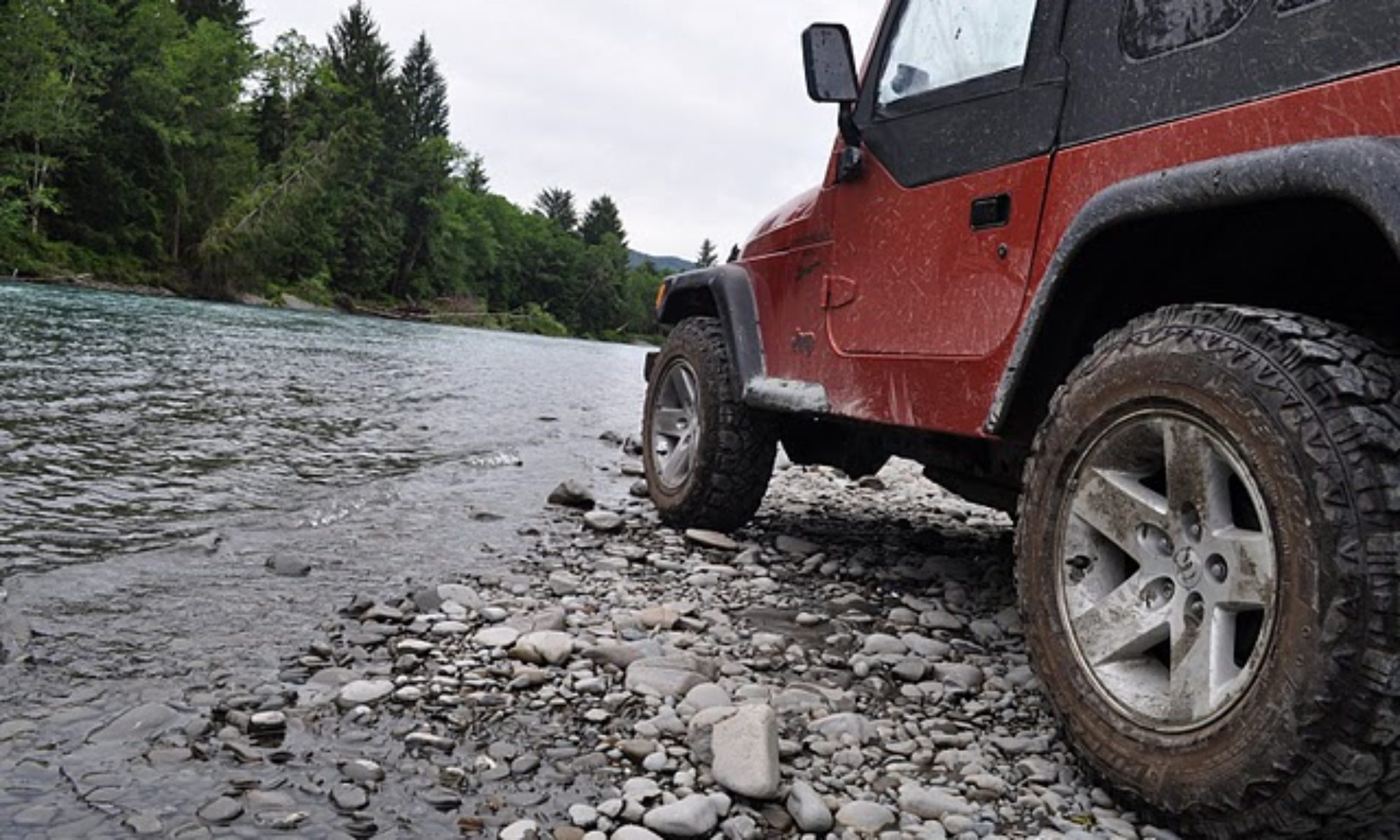
Using the hand drawn map provided to me by the hotel manager I headed along a high desert gravel road towards my first lava tube of the day. Off-roading trails were abundant in this area and I took my fair share of them along the way. In my attempt to avoid people for the day, driving around a truck parked in front of a hill, I managed to put myself on the other side of a makeshift shooting range. The view was beautiful as the wine blew through the dried grass, and the sun was warm and welcoming after spending so many days in the cool northwest. I spent a good amount of time sitting on my Jeep’s hood taking in the sunlight, but the gun fire prompted me to move on. Turns out in avoiding company I had failed to pay attention to the fact they were target shooting and I was on the wrong end of the line of fire. I drove out here to see lava tubes, anyways.
Me in front of Skeleteon Cave June 29, 2011
Boyd cave was the first lava tube I found along the dusty dirt road. The cave, surveyed in 1969, has only 1880 feet worth of passage. The subway tunnel-like passages are pretty typical of a lava tube and Boyd’s was no exception. In contrast to the limestone caves I consider home these were bland and boring. I stopped at Skeleton Cave, another lava tube, but did not go in. It was gated and access is by permit only. I didn’t feel like I was missing out on much.
I mean no offense towards the cavers of the lava tube persuasion, but speleothems are kind of my passion. Not only do the lava tubes I have seen thus far lack any significant decorations (although I hear there are a few lava tubes capped by limestone that do have speleothem development. I have not had the pleasure of visiting these yet) but the passages are too predictable. Caving, for me, is a curious adventure with twists, turns, and a wonderment at the chaotic and complex nature of a cavern’s path. Why water chose to follow one joint instead of another has always been a curiosity of mine. The lava tube is so straight forward that it reminds me of a man made subterranean tunnel, and thus lacks the fantasy of a wild cave.
Entrance to Skeleton Cave, June 29, 2011. Oregon.
The warmth of the high desert plains reminded me it was time to head towards to golden coast. Oregon’s volcanic history sculpted the terrain I was driving through, fields of pumice and lava flows. The northwest is a vulcanologist ideal vacation spot, full of volcanic wonders. There was still another place of interest to visit on today’s impromptu journey: Crater Lake.
I stopped to get gas again and if there is one thing you need to know about journeying through Oregon in your vehicle it is this: You aren’t allowed to pump your own gas. Yesterday I thought the gas station attendant was just being nice, and today I learned it is against the law to pump your own gasoline. Travelers be aware: full service only in Oregon.
The Pumice Desert near Crater Lake in Orgeon. June 29, 2011
On the approach to Crater Lake I drove through the pumice desert. Almost 8000 years ago Mt. Mazama erupted, forming crater lake and this desert of pumice that is nearly 100 feet thick. Vegetation has been slow to return in this area since the lack of nutrients don’t allow for a suitable growing environment. Today the pumice desert was covered lightly in snow, and as I headed up the winding road to the top of Crater lake the snow was even deeper. Throughout this trip I have been reminded that the entire continent received a large amount of winter precipitation, but it never ceased to amaze me how much snow was still here. It is the end of June and as I head up to Crater Lake National Park the RV in front of me is SHORTER than the snow piled along the sides of the plowed road.
Snow pack on road up to Crater Lake June 29, 2011
The weather was misty, and foggy. When I arrived at the top of Crater Lake I could see nothing. The water that everyone claims is so blue and clear, some of the deepest water in the country, was hidden behind the thick blanket of fog. I spent a short period of time there, then retreated back down to a warmer area.
Mt. Thielsen, Lightening Rod of the Cascades June 29, 2011
I drove past the Mt. Thielsen, the lightening rod of the Cascades. This former volcano’s core attracts lighting strikes so often that the rock atop the summit is actually melted. I arrived at my hotel and decided to get some rest. Tomorrow I would be back on the coast, gazing at the beautiful Pacific. While the geologist in me was fascinated with the volcanism of the Cascades nothing could compare with the tranquility brought to me by the crashing waves of the Pacific. Maybe it was because I was born next to this ocean’s breeze, but nothing ever feels more like home.
The foggy view of Crater Lake June 29, 2011.
The tunnel to the bathroom at Crater Lake (meant to keep snow out) June 29, 2011
Day 49: Mount St. Helens National Park & Ape Cave
There are a few different types of travelers out there one can embody. One can be the careful traveler, someone who sticks to the main roads and a strict agenda. Reading all of the signs and going only to those places known for tourism this traveler sees the same sort of things that they can experience with an internet service and a basic knowledge of search engines. The places this kind of traveler goes to have already been seen over and over, and from the exact same perspective. The careful traveler only stops to photograph views that are designated by road signs and very likely stands right next to the sign with a camera icon for every scenic picture. A typical cookie-cutter vacationer who wants to see everything they’ve seen in photos exactly as they have seen them.
Another type of traveler one can be is the reckless traveler. These types jump in head first without reading the signs. They trespass into places they have no knowledge of and destroy delicate ecosystems and ancient rock forms. The reckless travelers are the ones who run out of gas and money before the allotted time for vacation is even near to being up. They don’t plan a vacation at all, and leave home with none of the gear they will need forcing them to use all of their spending money on supplies only to show up to the park and learn they can no longer afford the admission fee. This traveler is also the most likely to be injured not because of their activities, but because of their lack of information, common sense, and planning.
There is a third type of traveler and this is the one that I strive to be. It walks the line between careful and reckless. This traveler plans their vacations well but allows for a good amount of wiggle room in budget and time. This traveler plans a generic agenda but is prepared to change it on the fly when they come across something new. They will leave the well-beaten path, but only because they have educated themselves in how to handle every situation. They aren’t always law abiding, but they are respectful and resourceful. This type of traveler is known by a single adjective.
Adventurous.
Mt. St. Helens June 27, 2011. "29" and I.
Mount St. Helens is a place of adventure. Most people think of Mt. St. Helens and think of the explosive event of 1980 when the nation was glued to the news as they watched a mountain transform in front of their eyes. This is one of the aspects of adventure that many of us seek: a slight sense of danger. You can’t get that when you are on confined trails with a monotone tour guide telling you the kindergarten version of the geologic history. The Mt. St. Helens National Park has many things to see and is surprisingly well catered to the traveler who doesn’t want the cookie-cutter guide to take them around (although they do have this on request).
An angry "29". Mt. St. Helens N.P. 6.27.2011
The drive up Mt. St. Helens started out exactly as I expected it. The long, winding road wound up the side of the slumbering volcano, rocky road cuts slowly being replaced by something that looked more like volcanic ash just as one would expect. Unfortunately this mountain was no different than the rest in the country that had received an excessive amount of winter precipitation. I drove for almost 40 miles to find out the pass was closed. It was still buried under 10 plus FEET of snow. My Jeep doesn’t usually care for “Road Closed” signs too well, and it sought an alternate route…. but I force disappointed “29” back down the winding road for an over 100 mile detour to get to the other side of the park.
Ape Cave. A lava tube in Mt. St. Helens National Park. June 27, 2011
On the other side of the park sat Ape Cave, a lava tube that was discovered about 30 years prior to the famous eruption of Mt. St. Helens. It is 12, 180 feet long, completely dark (as you would expect any cave to be), and a lot like a subway tunnel full of sharp boulders. Inside you get a to take the choice of two routes, Upper Passage or Lower Passage. The Lower Passage only goes about 0.75 miles and is an easy walk. Upper Passage is 1.25 miles and a more difficult traverse, climbing large boulder fields and scaling an 8-foot “lava fall” free style. Best of all: The entire tour is self guided and you must provide your own lighting. Guess which route I took…
A skylight in Ape Cave lava tube. Mt. St. Helens N.P. 6/27/2011
Upper Passage was a lot of fun. I will have to say that I found my first lava tube to be interesting, but rather boring in comparison to the winding limestone caves I am used to in the Midwest. Ape Cave is a pretty typical lava tube, a very straight cylindrical cavern with a few sky lights here and there, and small lava drips that hang from the ceilings. The temperature is cooler than the caves I am used to, averaging only 42 degrees fahrenheit.
Ape Cave lava drips in Mt. St. Helens N.P. June 27, 2011
After my tour of Ape Cave (I must proclaim the tour guide was fantastic…lol!) I headed to another interesting place of interest that wasn’t on the agenda. The Trail of Two Forests is a lava flow with hollows where trees originally stood. You can see the ghost tress almost perfectly preserved in the lava, and you can even play a game of prairie dog if you are so inclined, crawling through the tree hollows and popping up through skylights. The place is pretty interesting, and a lot of fun for kids (or the kid in you). Yet another example of how hands-on Mt. St. Helens N.P. seems to be. It allows you to be the adventurous traveler, leaving the paved path and mundane talks behind while still remaining safe and informed.
A tree cast in Mt. St. Helens N.P.'s "Trail of Two Forests" 6/27/2011Me in a ghost tree! "Trail of Two Forests" in Mt. St. Helens N.P. 6/27/2011
On the way out I ran across some off-roading trails. There were no signs forbidding me to drive on them so I took advantage of the opportunity to jostle around on dirt and rocks in the shadow of a snow-covered Mt. St. Helens. There couldn’t have been a more perfect ending to the day.
If you find yourself preparing for a vacation please keep in mind what I have said. You can’t truly experience other worlds if you don’t leave the path, but you need to do so smartly. Be the adventurous traveler, plan your trip with plenty of spare time to enjoy anything you run into, and be ready to change any existing plans at the drop of a hat. A vacation isn’t an itinerary and a bunch of duplicated post card photos. Travel is for experience, for knowledge and growth, for relaxation and something out of the norm.
The only traveler worth being is the adventurous traveler. Anything else can be spent reading a book or a week in the hospital.
Tomorrow I will be continuing my adventurous journey of the summer. My Grand Summer Adventure. Tomorrow will be my 50th day since I embarked on my journey but I’m not slowing down yet. There’s still so much to see, experience, learn…..and share. I’ll see you all there.
Nicole
A view into a cavern from above. Ape Cave in Mt. St. Helens N.P. June 27, 2011
Did you know that Washington has high desert plains? It has plateaus and mountains, rivers and lakes, snowy peaks and great big canyons? I always thought of Washington as the green state- eternally covered from top to bottom in green plants. There is a lot more to Washington than I thought.
I had planned on visiting Gardner cave so I left Sandpoint, Idaho and headed towards Metaline Falls, WA in the afternoon. It turns out that Gardner Cave, one of the few limestone caves of the state, is closed on Tuesday and Wednesday. Since it was a Wednesday I was unable to see the cave. I decided to pull out the hand atlas, unwilling to give the GPS another go at control quite yet, and found something labeled as the Lenore Lake Caves and I started heading in that direction.
The Grand Coulee of Washington. June 22, 2011
On the way south I ran into the Grand Coulee. This giant steep-walled canyon was carved by massive amounts of melting glacial waters as the Ice Age came to the end. It was once a waterfall even grander in scale than that of Niagara Falls. It was a 3.5 mile long, 350 foot tall water fall that rushed along carving the landscape into what it is today. The water that remains here today helps the desert wildlife thrive, and it is in this large canyon where the Lenore Lake Caves were carved out of the solid flood basalts.
Looking at "29", my Jeep, from a Lenore Lake Cave
Technically these “caves” aren’t large enough to be considered a true cave. They never transition past a twilight zone, but they do hold some historical significance. About 5000 years ago the natives used these “caves” as shelters. The native people resided here during the spring and summer to collect plants and herbs that were used in religious ceremonies.
Don't wear flip flops when hiking up piles of loose basalt breakdown! June 22, 2011. Lenore Lake Caves
I hiked up the cliffs (in flip flops…I’m a bit of a rebel like that….) and visited the inside of the shelters. They would have been fairly comfortable, keeping everyone dry while still allowing for a great view of the canyon in front of them. Looking down to the parking area my Jeep looked dwarfed. The trail up to the shelters was dotted with several different flowering plants.
A Lenore Lake Caves flower. June 22, 2011
So far my visit to Washington had not met a single preconceived notion. I had been in the typical mountain terrain, I had taken in the views of waterfalls both ancient and current, and watched as this terrain turned from a high desert plain, sparsely vegetated, to a fertile land of farm land enriched by the Columbia river. When I arrived in Wenatchee, WA I finally saw the first thing that truely told me I was in Washington State: Cherry orchards.
As I learned back in the winter of 2009-2010, states are only bounded politically, not geologically or by climate. Washington State has a little bit of everything as I have learned today. Soon I would be in Seattle, experiencing the mighty Pacific Ocean. When I visited Northern Arizona in January 2010 I saw that Arizona was more than desert- it had snowy, vegetated mountain terrain. Today I visited Washington and discovered it wasn’t all cool and green- but it also had desert terrain. Arizona and Washington have more in common than I thought!
-Nicole
There are some experiences in your lifetime you can only have once- the first experiences. The moment when you realize those little post cards with the turquoise blue water isn’t computer enchanced- it actually exists. Custer, South Dakota is that first point in your travels West along I-90 where you start to see those beautiful mountains and vistas that stretch out so far it feels as if they are fake. It still takes my breath away, but sometimes the more exciting part is seeing someone else experience that first view. The excitement of your friends as they see something amazing they never thought could be real is about the closest you can get to that first experience again.
Custer State Park. June 15, 2011
My friends met me in the early morning, having driven all night to meet up with me in Custer. They had been detoured from the flooding in Iowa/Missouri and arrived there later than they had anticipated (intending to nap for a few hours), but they were still more than ready to explore what the area had to offer. We drove through Custer State Park first, stopping by the needles area to climb atop the rocks and take in the view. On the way through I saw what I had been searching for my entire trip: a bison. It was just casually grazing in a field to the left of our travels, and we all stopped to watch.
A bison in Custer S.P. June 15, 2011
We arrived at the North end of the park and at lunch at a local cafe that offered bison burgers, having been appetized by the live one in the park. We then headed to Mount Rushmore National Monument so we could see four of the great presidents of the past gaze eternally upon the land. It was an amazing feat, the brain child of Robinson, carried out by Borglum and son, that took 14 years to complete to the point it is today.
Mount Rushmore National Monument
After visiting the monument we went to see Jewel Cave, the second longest cave in the world (next to the cave I visited a couple weeks ago, Mammoth Cave). Jewel Cave is a bit different than the typical limestone caves we experience in the midwest. It is relatiely barren of the typical stalactite/stalagmite dripstone deposits, but is completely covered in calcite crystals. It feels like you are walking in a giant geode- And no wonder because the crystals developed in much the same way.
Calcite crystals in Jewel Cave. Custer, SD June 15, 2011
The cave was full of water, supersaturated in minerals, and they began to deposit on all surfaces of the cavern as a blanket. The deeper in the cave you are the thicker the crystals will be- a blanket of crystals that can be many feet thick. This is because as the water level dropped, the higher areas in the cave ceased to deposit while the lower areas had more time (and a more saturated solution) to continue to deposit onto the surfaces.
The cave tour is incredibly informative, and our tour guide happened to be a member of a local grotto. We were able to chat about caving in the area and the differences in midwestern caving versus caving of this area. Apparently they have much more maganese in their caves, their suits often covered black like soot after a caving trip. Our caves of the midwest tend to be wetter, and muddier, most of us coming out covered in clay and mud at the end of a cave trip.
Soda straw (the longest) in Jewel Cave, amongst the calcite crystals
After our tour of Jewel Cave we headed back to Custer, picked up some groceries, and then headed to our campsite near Stockton lake in Custer State Park. The campsite here was well shaded by the lodgepole pines, and also abundant pine needle litter to help start the fire. It was nice to sit around the fire with friends instead of being alone for once. We chatted and enjoyed the warmth while watching youtube videos on the one phone out of the three of us that had service.
Tomorrow we had a long drive ahead of us, but it would be a scenic one as we had a couple places to stop along the way. Yellostone was a good drive away, but it was something we were all looking forward to seeing- and a place where we would be meeting up with more friends to turn our party of three into a party of five.
I was enjoying this trip even more now that I had friends joining me. Part of the wonders of travel is sharing those experiences with others, and the ultimate way to do that is to have them there with you. I can take as many pictures as I want and share them all with you- but know that you can’t truly appreciate the depth and beauty of these places without going there yourself. If you chose to go to some of the places I have shared with you, please return the favor by sharing with me. Nothing makes me happier than hearing, and seeing, the wonderment of those expereincing such beautiful places for the first time.
-Nicole
A sunny day at Custer State Park June 15, 2011A chipmunk in Custer S.P. June 15, 201129 at an overlook in Custer S.P. June 15, 2011Driving through one of the many tunnels in Custer S.P. June 15, 2011Mt. Rushmore survey marker29 and the bison in Custer S.P. June 15, 2011Washington's face at Mount Rushmore. June 15, 2011Jewel Cave map Part 1Jewel Cave Map Part 2
Blasting past traditional expectations, there have been many things that have excelled not because they met up with typical standards, but because they found other ways to excell. When Las Vegas was dragging by catering only to the gamblers, they opened their services up to be family friendly. When Dodge fell behind in the sports car market while Ford had it’s Mustang and Chevy had it’s Corvette, they developed the Dodge Stealth, and later the incredibly prestigious Dodge Viper. Midwest airlines (now Frontier airlines) stood out from the pack by offering more comfortable seats and warm chocolate chip cookies. Every successful business evaluates what they have to offer and promotes that aspect. Today I visited two natural resources, each that have successfully used the resources they have to cater to their consumer.
Niagara Cave is located in the Southeast of Minnesota, near a small town called Harmony. It was discovered when a couple pigs went missing through a small sink hole, and was opened for tours later after some cavers negotiated the land use with the farmer. Niagara Cave isn’t highly decorated with speleothems, but it’s very tall, canyon-like passages actually encompass a full 4 geologic formations. Three of them you experience up close on the tour, and a fourth lays at the bottom of a stream at the end of the tour.
A trilobite in Niagara Cave of Harmony, MN. June 13, 2011
The passages can be enormously tall, at one point we were standing 150′ below ground, the cave being a full 110 feet tall (leaving only 40 feet of rock and soil between the passage and the surface). The limestones are full of fossils, ranging from gastropods to cephalapods to sponges and trilobites. Many of them you can see up close on the tour and I was able to get some decent pictures of them.
The tall, canyon-like passageways of Niagara Cave in Harmony, MN
While I prefer to see dense forests of speleothem development in caves, Niagara Cave was a real treat because of it’s tall, narrow passages. They light the areas smartly, showing off the nature of this cave as the passages follow the natural jointing in the limestones. The cave is privately owned, but it is obvious that the owners pride themselves in keeping the tours educational and as accurate as possible. My tour guide was informative, and everyone at the place seemed to know what formations and ages the cave was within off the top of their heads.
Niagara Cave- My tour guide for scale. Harmony, MN June 13, 2011
After my tour of Niagara Cave I decided to head as far West as i could to make my drive shorter. I had picked up a state park guide from the Minnesota welcome center and put my target on Blue Mounds State Park in the Western portion of the state. It had a big buffalo neat to the description, so it seemed like a good place to be. I love those fuzzy bovines.
Blue Mounds State Park turned out to be a real gem. The park has a lot to offer, sitting in the high prairie with ranged of bison, but probably seemed a little lack luster to the campsites nearby that boast sites like the Badlands, the mountains and other wonders. They have done wonderful things to make the park even more attractive. First, it has many handicap-accessible campsites and bathrooms/showers. The fire pits are in great shape, and every campsite is incredibly clean. The best part, I have to say, is probably the shower house.
Check out the shower- It is even handicap accessible, having two shower heads, one at the height for a wheelchair. Blue Mounds S.P. Minnesota.
Every shower is in it’s own, lockable room- Which is wonderful for someone like me who is traveling alone and has some serious security issues. I hate feeling like some punk kid might be trying to grab my stuff from the bench outside my shower curtain. These showers alleviate this stress. They also have sky lights to cut down on lighting costs, the lights are on a sensor, the shower is a water saver as it is a button that you push that gives you a little over a minute of water at a time, and it is clean and nicely decorated with cedar wood.
I was smart enough to pack up camp before I took my shower, because a severe thunderstorm rolled through the area right as I finished showering. I decided to hang out in my shower room for a while, knowing the camp was near empty and I wouldn’t be inconveniencing anyone, and needing to charge my camera battery and phone in the outlet. The storm was mighty outside, and even made the water in the shower turn on all by itself when it struck something nearby, but the shower room was comfortable.
My shower room at Blue Mounds S.P. I had a toilet, a sink, an outlet, and a shower all to myself in one lockable room. Waiting out the storm.
It was actually hard for me to leave Blue Mounds State Park campground, but today I would be heading to the western limits of South Dakota to Custer State Park, when two friends of mine would be meeting up with me tomorrow morning. Ahh, the big open west where you can see miles of uninterruppted wilderness- and some company to make it even better.
-Nicole
One of the few speleothems in Niagara Cave: A bell. Harmony, MN June 13, 2011A fossil in Niagara Cave. Harmony, Mn. How many of you can identify it?Speleothems in Niagara Cave. Draperies. Harmony, Mn June 13, 2011
It wasn’t a long drive into Wisconsin, but I could already detect the change in dialect. When I bought my groceries I was no longer offered a “Bag” I was offered a “Beg”, and the word tomorrow had an unusual accent on the second “o” that I wasn’t used to. Yep, I was in dairy land alright.
My first official stop, after buying my groceries for the night, was at Cave of the Mounds in Blue Mounds, WI. A cave that sat beneath a lead prospector’s feet for more than 100 years before the cave was discovered during a blasting in 1939. After almost a year of the family guarding the new cave entrance by rifle to curiosity seekers, the cave was open to the public in 1940 and has been ever since.
Cave of the Mounds in Blue Mounds, Wisconsin. June 12, 2011
It, like it’s neighbor to the East in Iowa (see day 34), is located in the Galena carbonate rock formation. It was mostly formed in a typical carbonic acid/water erosion fashion, but some areas were enlarged with sulphuric acid that bubbled up as the water mixed with the sulphur in the galena (PbS). The speleothem development in Cave of the Mounds is pretty sparse, and it has a lot more of the colored varities than Crystal Lake Cave. In fact, the iron oxide staining in some areas is so prnounced that it looks blood red, as if someone had just maimed themselves on the stalagmite.
Iron Oxide staining on a speleothem in Cave of the Mounds. Blue Mounds, Wisconsin.
Everyone I met at Cave of the Mounds, even though it is privately owned, was very helpful. There were several people on staff that were knowledgeable about the geology of the cave and the surrounding area, and they gave me contact information in case I needed any other information for my personal research project. It was hard to leave the cave, but it was time to head a little further North into Wisconsin to my next campsite: Devil’s Lake State park.
Devil’s Lake S.P. Wisconsin. June 12, 2011
Devil’s Lake State Park is focused around a glacial lake that has no stream inlet to speak of. All of it’s water is either remnant from the last ice age, or a result of precipitation. The lake is beautiful and they have been working hard to restore it after levels of a certain chemical were unsafe and caused “swimmers itch” (something I still don’t quite know much about). It has many, many campsites and if you get into the Ice Age campground you have wooded lots that are fairly private.
Devil’s Lake State Park of Wisconsin
I enjoyed some cheese curds, cooked up a stir fry, and drank a local brew called “The Spotted Cow” next to my toasty camp fire. Although I was alone at the campsite, I certainly wasn’t lonely. There was a caterpillar that seemed fixated on crawling on me, as I would throw it into the woods only to have it return half an hour later. Ok,.. who am I kidding, I was a little lonely.
The Caterpillar of Devil’s Lake S.P. June 12, 2011
Honestly, camping alone is pretty tough….I enjoy it from time to time, but after a while it can wear on you. I am very excited that my friends will be joining my in South Dakota, more friends joining me in Yellowstone, and another friend in Glacier. I just hope I haven’t grown so accustomed to being alone that I am a terrible host!
Tomorrow I head on to Minnesota, where I will tour yet another cave and experience another unique camp site. I’m slowly getting closer to the big, openness of the West and I can’t wait. Nothing feels more like home…
-Nicole
The very original gate for Cave of the Mounds in Wisconsin.Devil’s Lake S.P.:The concession sits on pillars into the lake, giving you a great view as you eat your meal.Devil’s Lake State Park June 2011
I had spent all of Yesterday (the official Day 34) driving so that I could get to Dubuque, IA to see Crystal Lake Cave. By the time I had arrived it was too late to tour the cave, and I was too exhausted to set up camp for the night, so I camped at a Econolodge in Dubuque. It was the last room available, as it turns out I showed up on the weekend of some sort of biking festival. Pure luck that someone had canceled their reservation is what secured my room at the Econolodge, one of the budget options for the Choice hotel chain that claimed to be smoke-free but smelled of stale cigarettes. Not my favorite hotel, but I was too tired to care at the moment.
Crystal Lake Cave map. The red outlines the tour route. June 12, 2011
Dubuque, Iowa is a river town, situated along the Missouri river as a major port for trade. Between the lead mines (you can visit the old spanish mines in the area) and the major river for transport, Dubuque flourished and looks to be a nice city. It has plenty to do in the area and I’m surprised I had never really heard of it until I started planning my trip…perhaps it’s because I struggle in properly pronouncing it’s name.
Crystal Lake Cave Dubuque, IA June 12, 2011
Crystal Lake Cave is just outside of Dubuque, Ia and was discovered by lead miners who had decided they wanted to find their own mine instead of work in someone elses. They found a cave when they began to drill in 1868. It was opened to tourists in the 1930s. It resides in the Galena Limestone layer, with another layer of Limestone above it, the Maquoketa. Underneath is the Decora LS/Shale formation, and below that the St. Peter Sandstone that we are familiar with back in Missouri.
A very pure speleothem (calcite) A Soda straw in Crystal Lake Cave. June 12, 2011
The cave, when it was original before the miners began exploiting it’s resources, was very small- probably only a few feet tall. It would have been a nice, long, (strenuous) belly crawl over flow stone in it’s previous, unaltered state. The miners enlarged the walking paths so that they could stand up and roll carts thorough the tunnels, so the lower half of your tour route was artificially carved out.
Notice the original height of the cave, and the people walking below it through the tunnel created by miners. June 12, 2011
The top half is incredibly rich in speleothem decoration, and most of them are a pure white indicating no traces of iron or manganese have seeped through to discolor them. One of the most amazing things about this cave is that they have anthodites, and quite a few of them. The cave is privately owned, and depending on who gives the tour you might get a different story. Each person has picked up on different bits of information and added their own flare to the tour. If you are the average tourist that just happened to bump into a cave to waste some time, this is fun. If you are a serious caver or geologist, it can be a little funny to listen and censor it in your head.
This isn’t to say it isn’t a good tour- every place has to cater to the audience and do what works for them. These sorts of privately owned caves are businesses, and whatever drives tourism is what needs to be done to keep the cave open. There is a delicate balance that is needed in any sort of natural resource for the public to enjoy and understand. Every National Park and State Park knows this, and they sacrafice small portions of the prized resource so that people can enjoy it while camping, in hopes that they will become educated and inspired to continue to protect it with their tax dollars for years to come.
You know how the saying goes that you have to spend money to make money? Well, you have to let some of these places go to the wayside of conservation to save the rest of it. It’s a fact of business: If people don’t know about it, they won’t want to pay for it.
It’s time for me to head to another cave that has been opened to the public, this time in Wisconsin. I’ll see you there soon.
-Nicole
Soda straws, very white, in Crystal Lake Cave. June 12, 2011
The damp, earthy smell. The cool, slow moving air. The lights struggling, and failing, to reach into all corners of this limestone underworld. Caves are familiar territory, it feels like home. The tour guide giving the stereotypical “Do Not Touch” speech, the explanation of the twilight zone, a touch rock to “get it out of your system”, and the story of how the cave was discovered. All of these things are in a cave tour, uniting all the caves into a broad category. One of my favorite parts is when the tour guide shows all the visitors what the “Natural Cave Light” looks like, when people gaspy and children hold on tightly to their parents.
To the untrained eye, all caves are the same. They are all damp, dark environments that descend into the Earth’s depths. Of course they all have similarities, they are all called caves for a reason, but every cave is different. They have different levels of speleothem development, different types of passages, different types of limestone or dolomite, and more. Even within the same cave there can be several different broad categories of passageway, and Mammoth Cave is a great example of this.
Mammoth Cave’s passages can be divided into three main types: The large, oval shaped passages developed in the phreatic zone, the large, more angular passages developed in the vadose zone, and the tall, canyon-like passages developed during times of fast-flowing water, often confined by natural jointing in the limestone. On the Grand Avenue tour of the Mammoth Cave you get to see all three.
Gypsum flowers in Mammoth Cave, in one of the vadose-zone developed passages. June 4, 2011
One thing I had read about, and have studied pictures and specimens of, but never seen in person were gypsum flowers. These crystals “grew” abundantly in the passages that develop in the phreatic zone (The phreatic zone is termed the “unsaturated” zone, the area of the cave that was developed with some airspace still present. These passages tend to have rougher edges, since the water cut downwards as it flowed through these passages). Gypsum crystals, and their more ornate, developed flowers, form best in dry areas of the cave. The passages formed in the phreatic are usually perfect for this, since the water has, over time, found a new passageway deep beneath this one and left it “high and dry”. The crystals grow relatively fast (geologically speaking), as I saw many instances where someone had carved their name into the cave ceiling and the crystals have begun to grow in these cracks, the former graffiti artist’s name forever in the cave as the crystals adorn the scrawl.
Gypsum crystals depositing in the crevices of someone's name. June 4, 2011 in Mammoth Cave.
The snowball dining room in Mammoth Cave actually has a cafeteria, where people are encouraged to buy (overpriced) lunches to fuel them for the rest of the journey. The snowball dining room is so named because it has gypsum growing in “balls” on the ceilings and walls, making it look like someone has thrown snowballs around in the room. The bathrooms in here use artificial walls, but a natural cave ceiling that just happened to be the perfect height tops off the room.
The bathrooms, deep within the cave, in the snowball dining room of Mammoth Cave, Kentucky.
The next area you will travel through on the Grand Avenue tour are narrow, tall, winding passages that make you feel like you are wandering around the bottom of a steep canyon. The area, much like the rest of Mammoth Cave, doesn’t have a whole lot of speleothem development. It does have a few areas where water is flowing, and a deposit called Martha’s Vineyard, and a few stalactities and flowstone. For the most part, this area is dry.
Martha's Vineyard in Mammoth Cave. June 4, 2011
After the canyon-like passages you will entire an area that is very similar to the Mammoth Passages tour: The big, rounded, open passageways that were formed in the phreatic zone (the phreatic zone is that which is completely underwater, and the passageways indicate this by the way they are rounded, oval shaped- showing that the entire passageway was smoothed by water erosion from top to bottom).
At the very end of the 4.5 hour tour, which gives you a very good workout as you climb up and down hundreds of stairs and steep hills, you enter one of the areas that is rare in the Mammoth Cave system: The well-developed speleothems. This area of the cave is located against a valley, where the sandstone cap is no longer present since it was taken away by erosion. This allows more water to percolate through the limestone, saturated with dissolved calcite, and redepositing on the ceilings, walls and floors.
Mammoth Cave Speleothems on the Grand Avenue tour. June 4, 2011
The Mammoth Cave Grand Avenue tour ends by exiting through a revolving door, used to help preserve the high humidity that is present in this last portion of the cave. While you have just spent 4.5 hours underground, it is hard to believe you have only seen a very small percentage of the cave. There are hundreds of miles of passageway closed to the public, and perhaps even more miles that have yet to be discovered.
The revolving humidity lock door at Mammoth Cave, Kentucky. June 4, 2011
Caves are the ultimate “last frontier”, one of the few places on Earth that have yet to be discovered in whole. Each one of these is unique, and you never know what you are going to discover. I intend to collect as much cave experience as possible, which means checking on cave off my list at a time. Everytime I enter a cave I learn something new about them, see something I have never seen specifically before. The subtle differences are beginning to be more stark to my ever-training eye. I can’t wait to see more.
Tomorrow I head back home for a few days, then I will be heading on my Western loop. I can’t wait to see what the caves of the West have to offer me. I have been to 8 caves thus far on this trip…and I have many more planned, and probably many more unplanned, to visit.
Stay tuned!
Nicole
Stylolites in the phreatic-developed passageway. Mammoth Cave, Kentucky June 4, 2011Carbon-covere gypsum crystals in the snowball dining room of Mammoth Cave. June 4, 2011My Mammoth Cave National Park campsite. June 4, 2011


 in Jewel Cave,")


