Day 43: Glaciers, Deer and Bears, Oh My! Glacier N.P.

During my visit to Crystal Lake Caverns on Day 34 I spoke shortly on the effects of sacrificing small parts of nature to promote preservation of itself at large. Yellowstone and Glacier National Parks, both, show exactly what this means by changing the way nature interacts with human activity. My friend from Missoula and I went on two long hikes during our visit to Glacier National Park, and during both we noticed abnormal wildlife patterns, starting with our first drive through the park.
We arrived at the park only to find out that, like the rest of the continent, this winter had an abnormally high amount of precipitation and the snow pack was still blocking the pass. We would only be able to experience the Western portion of the park. We drove as far as we could and camped at the end, in the Avalanche Creek campground. The campsites are simple, a firepit and picnic bench with the wooded campsite, and no showers or hot water available. It was right next to the first trail we would hike that night, so we decided to go check out some of the lakes and rivers before we took hit the trail.

Glacier N.P. Blackbear June 20, 2011

On the drive back towards the western entrance we came across some traffic, which usually indicates some sort of wildlife has captured the attention of tourists. After sitting for a short time waiting for the cars to take their turn at taking pictures, we saw the black bear begin to wander around the cars. He took his time, looking into the cars to see who would, unintelligibly, offer him food.
The lakes here are glacial, and the biggest one that we were able to see was Lake McDonald. As may be obvious, a glacial lake is formed by a glacier, in the case of Lake McDonald, one that was over 2000 feet thick. As the thick river of ice slides down during melts it bulldozes dirt and rock in front of it, forming a wall called a terminal moraine. When the glacier receding as the climate warmed, the moraine was left behind, damming a lake that stretches to depths of 472 feet.

Lake McDonald in Glacier N.P. June 20, 2011

When we returned to our campsite we decided it was time to hike the Avalanche Creek Trail so that we could make it back before dark. We had been joking about the bear mace marketed to the city slickers, selling for a whopping $55 per can at the stores within the park. The black bears aren’t anything to worry about, but grizzlies can get pretty aggressive if they are startled by a humans. As long as you follow some common sense rules about wildlife they don’t normally bother you, but as has been indicated in the past few days these animals aren’t quite like normal wild animals. They are used to humans.

The Snowshoe Hare along Avalanche Creek trail in Glacier N.P. June 20, 2011

As we made our way up the 2 mile, 500 foot elevation gain trail (4 miles round trip), wildflowers in bloom everywhere indicating that spring had indeed sprung, we ran across a snowshoe hare. The rabbit hopped around nonchalant as we admired it. It wasn’t until I got within a few feet to take some pictures that he began to hop away. We made out way to the end of the trail that terminated at Avalanche Lake, which was incredibly muddy and wet. Along the north side of the trail Avalanche Creek followed along, carving out the bright red bedrock into curvy, smooth canyons. We laughed at the bear bells we could hear ringing throughout the woods. Fear does a number on people….

Avalanche Creek in Glacier N.P. June 20, 2011

On the way back down the trail to our campsite my friend stopped me mid-step. A deer, barely 10 feet away, walked across the trail and right next to us. Like the hare, she walked slowly along as if we were passing in a hallway. I had never been so close to a deer before, and it didn’t even have it’s tail up in alarm. With each animal we came across that had zero fear of humans we began to understand the excessive warnings throughout the park. These animals weren’t exactly wild: They were a hybrid of wild and domestic. The most dangerous type of wild animals, the kind that are so used to humans they think nothing of walking within arm’s reach.

The deer on Avalanche Creek Trail, unafraid of us hikers. June 20, 2011

The next day we hiked another trail, a 7 mile hike on the McDonald Lake Trail. It is a mostly flat trail that follows along the western side of the lake, heading in a general NE direction. A large portion of the hike goes along an area that suffered from a wildfire not too many years ago. The skeletons of trees stand tall, and wildflowers were blooming everywhere. We also noticed bear scat fairly often right on the trail, many of them obviously too large to be a black bear. Maybe those bear bells weren’t so goofy after all.


Bear scat with a print along the McDonald Lake Trail in Glacier N.P.

Glacier National Park was beautiful. The mountains were topped with snow, the lakes were clear and cold,  and the scenery was green and in bloom. Ironically, although I had come to Glacier National Park in hopes to see a glacier there was too much snow on the trails to get to a glacier.
I often wonder if people who live in big cities think that the wilderness really is like this, if they think wildlife come right up to you like they do in Yellowstone and Glacier. If we sacrifice some of nature to promote funding for preservation of itself at large, are we giving people the wrong idea? How many people feel comfortable preserving a place where the animals are dangerously used to humans, and attacks aren’t as uncommon as they are in the true wild.
Perhaps the West could enlighten me, as it was time to start heading towards the coast. This about as far north as I would be going for the remainder of my trip. Time to start getting warmer.
-Nicole
Someone rowing on Lake McDonald...I'm not sure what this sport is called, but it's the new thing apparently. June 20, 2011


Slick rocks in Glacier N.P., N. McDonald Creek. June 20, 2011Wildflowers in Glacier N.P. June 20, 2011


The lichens in Glacier N.P. reminded me of the moss of the deep south. June 20, 2011


The colors of the sunset in a puddle on Avalanche Creek Trail, Glacier N.P.The Avalanche Creek campsite at Glacier N.P. June 20, 2011


The Avalanche Creek campsite in Glacier N.P. June 20, 2011


Wildflowers in Glacier N.P. June 20, 2011


Rock outcrop in N. McDonald Creek. Check out the preferred jointing!

Day 42: A Drive through Montana

Today I left Yellowstone, and although it is considered by many to be the most scenic national park in the country, it didn’t mean I left all of the scenery and wilderness behind. Driving throught the state of Montana is a series of scenic views, one right after the other. The land stretched for miles with few interruptions allowing you to see for miles and miles (and also meaning there are many miles between gas stations, fill up!).
Along the highway heading north from the park that barely stretches into the southwestern corner of the state, Montana natives greeted me on the highway. Some big horn sheep blocked the highway along a mountain pass. They were thin and shaggy from the long winter and watched as I inched my way past them and snapped some pictures with my cell phone.

Big Horn Sheep taking control of the highway in Montana. June 19, 2011

The glacial lakes of the state are just as breathtaking, the water so clear you can see straight to the bottom even when the water is several feet deep. Montana has two sides of a coin: The fiery breaths of a supervolano and the icy glaciers of the far north. Tomorrow I was heading with my friend, who lives in Missoula, to the opposite side of the coin. Glacier National Park has some spectacular hiking trails to hit, and we were ready.
-Nicole

Flathead Lake of Montana. The water is so clear.... about 3 feet deep at this spot where I took the picture.
Big Horn sheep of Montana June 19, 2011


A scenic Montana highway view. June 19, 2011

Day 41: The Emotions of Yellowstone

Your heart beat begins to quicken, causing an involuntary gasp for air. The emotion is one on high. You feel at peace with the world, like you could imagine being no where else, while at the same time being nervous about what it can bring. It is a treat for the eyes, yet it somehow entices you to close them as if it is too much to take in. You take another deep breath. The scent is relaxing, a freshness you can taste. Although it seems impossible, you feel warm and cold at the same time. Something so grand plays out in front of you that you want to immerse yourself deeply in everything it offers.
It is hard to imagine leaving this spot in time, but you know what comes next can be greater than the last. Letting your heart beat calm, and taking a last, deep breath, you push yourself forward so you can see what comes next. That step forwards sends you through the waves of emotion all over again.
This is the experience of travel. Of taking in something so much bigger than yourself.m It is amazing how a landscape can evoke feelings so akin to love. When you first round that corner as you drive up to a new place you can feel overwhelmed. The speedometer slows down as you try to take it in. Maybe you even pull over. All the while you are having these warm feelings of joy- but you also have fear. Steep, dangerous cliffs….aggressive animals that aren’t afraid of people…swift currents ready to take you away… hot steam boiling out of the ground unexpectedly. The very fact that you are standing inside of a super-volcano can be a rush itself- At any moment everything could become nothing.

These are the most rewarding moments in life. When you feel these emotions you open yourself up to what they offer. You expose you vulnerability. Something so beautiful somehow overcomes the fear, making the dangers a palatable cost. No one climbs a mountain, risking their life as they push themselves up steep ravines and cliffs, to see a land fill. We take risks to get to those ultimate feelings, and as uncomfortable as they are, we live to push our limits for a chance at achieving them.  Heart racing, uneven breathing, warmth and cold washing over you in waves.
Yellowstone is one of the ultimate places to visit- it has so many different faces  to evoke those feelings. From the geysers to the waterfalls, from the fields of bison to the tall, snow capped mountains, Yellowstone is a series of emotions waiting to happen.

The Mammoth Hot Springs Terraces.Yellowstone National Park. June 18, 2011.

Today we continued our journey through the park, making our way to the different waterfalls, and eventually ending up at Mammoth Hot Spring where calcite terraces tower into the air like sculpted snow, steam rising. We saw Inspiration Point, a place aptly named for what it surely does for many visitors. We drove over mountain passes with snow piled up along the side of the highway taller than our vehicles, and watched as we transitioned down and that snow created magnificent waterfalls cascading down the stone into deep cutting rivers.

One of the many rivers in Yellowstone, carving down through the richly colored rocks and sediment. June 18, 2011

We soaked it in. Took the deep breaths. Felt our hearts flutter.

If I could stay here for an eternity I would. I didn’t want to imagine being without this. Like so many days during this trip, it was a battle to leave. Whether it was on the account of my friends leaving me, or because I couldn’t get enough of the scenery I can’t tell you.
I can say this: I’m going to take that one last, deep breath. Slow my heart beat, and take that next step. I think we all know that around the corner it will start all over again. It is hard to imagine getting better than this- All that I’ve seen this far has been amazing. I think we all know, from past experience, it only gets better than this. The world awaits to make my heart skip a beat….. join me tomorrow as I continue my way.

…and don’t forget to breathe.
<3 Nicole

A Yellowstone Survey marker. I think I have a whole collections of photos of survey markers...lol
Yellowstone's petrified tree. There used to be a second, but early souvenir collectors took all of it, bit by bit. Now only this one remains. June 18, 2011


Yellowstone's Mammoth Hot Springs June 18, 2011


One of the (slightly comical) warnings about the wildlife. "Don't get gored by the buffalo". (Please click on picture to see undistorted & in full size)

Day 40: Yellowstone- Geysers, Bison and the Return of Nicole the Destroyer

Those of you that have known me for years know how accident prone I can be. There was the Dec. 2009 El Paso, Texas incident (click here), there was the January 2010 Cattle Blunder of New Mexico (click here), and of course who could forget the Costa Rica Weekend Plastic Disappearance of August 2010 (not yet published, to come soon I promise!!!). There are probably many others that you may remember I have not listed.
It’s no surprise: Somehow I am the luckiest accident-prone person on the planet.
I say I’m the luckiest because even though these things could be potentially life altering events, things that normally ruin your trip to the point of no return, I manage to find a way out of it safe, sound, and sometimes even better than before. Today, my friends, family and other followers, ended up being one of those days. Not bad considering I am 40 days into a trip with no major accidents as of yet.

A hot spring in the Old Faithful hydrothermal field of Yellostone National Park June 17, 2011

This morning we awoke, took a warming shower at the campground facility, and then headed towards Old Faithful where we were to meet up with our two other friends who stayed in the lodge that night. On the way we were able to see many of the things we didn’t see the night before as we wound our way along the roads in the dark: herds of buffalo, hot springs that bubbled up, and great vistas of mountains, prairie, rivers, lakes, and pines.
We arrived at Old Faithful right as it was erupting, spraying it’s heated water and steam up into the air nearly 40 feet high. After catching the eruption from the curb, we found a parking spot and found our way through the crowd to meet up with our two new party members. I saw them walking along the sidewalk away from us, and decided to run up behind them to scare them….only I made one vital mistake.

Old Faithful in Yellowstone National Park. June 17, 2011

The lifeline of my DSLR camera, that nylon strap with the yellow Nikon emblem up and down the sides, the very thing I keep around my neck at all times….was not where it was suppose to be. I had failed to swing it over my head…and the camera was just sitting atop it’s case as I skipped my way towards them. There was a tumbling of the expensive camera equipment across the concrete, and a slight moment of disbelief in what had just happened before I bolted forward to grasp the pieces before someone had a chance to run over them.
My lens had snapped off in the tumble, and at first I thought it might be ok, then lens lacking any cracks or scratches…but alas the lens wouldn’t lock into the camera body. The plastic fins that hold it in place had snapped off. Luckily my friend, who I had been trying to surprised, was observant and picked up the two, small plastic pieces to that I may have had the hope of gluing it back on. We found someone with superglue and glued the pieces on…but even after it sitting for a couple hours, the glue didn’t hold. I could still take pictures…but I had to hold my lens on with pressure to trick the camera into thinking the lens actually was attached. I want you to think about that as you enjoy the photos of this day….these pictures took a lot of work….

A boiling hot spring, a cold river behind it, and another hot spring depositing minerals beyond that. Yellowstone National Park Old Faithful area. June 17, 2011

After I calmed down over lunch, angry at myself for such a ridiculously careless move, we watched Old Faithful erupt once again, this time up close. We decided to fill our day with warm, steaming geyser goodness and took a long walking route that looped through the thermal field.

More of the amazing Yellowstone Geysers, this one about a 2 mile walk from old Faithful. June 17, 2011
A colorful hot spring of Yellowstone in the Old Faithful area- note that the yellow/brown colors indicated bacteria growth.

The springs and geysers bubbled up in marvelous colors, bright blue and green in the purest of them, and yellows/browns in those that had cooled down a bit too much, allowing bacteria to grow. There were so many it was hard to believe, and everywhere you looked along the walk you could see steam rising from one place or another. The buffalo were here too, resting in the middle of the thermal field with their young calves. I really would enjoy owning a herd of bison….

The bison sleeping in the hydrothermal field. June 17, 2011 Yellowstone National Park

After we made our rounds, passing a bear warning sign on the way out that said Yellowstone is not responsible for our safety, and a slightly disturbing trail-closed due to bear activity sign on the way back, we came to yet another animal obstacle: The fuzzy cows I like to call my friends, the Bison.

The frist bear warning we saw on our trail at Yellowstone's Old Faithful area. June 17, 2011
The bear warning sign on our trail in the Old Faithful area of Yellowstone at the END of our trail. June 17, 2011

They trapped us travelers on the wooden walkway, and even managed to walk up, one on each side of the trail, as if they were the guards of Old Faithful. We could hear wolves/coyotes howling in the distance as the evening was cooling the air down. Eventually the bison decided we could pass and moved on to other green pastures.

The guardians of the pathway-Bison. Yellowstone National Park June 17, 2011

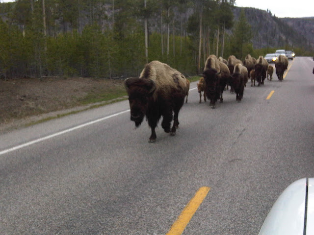
On the drive back to the campsite we encountered more bison on the move, using the road as their pathway. Here at Yellowstone the fuzzy cattle know who is boss: them. They have the right of way no matter where you go, and they seem to know it very well. They are so used to people that they don’t budge from their path when a human is in it: it’s expected you will move. I think what I enjoyed most is watching the buffalo’s eyes. You can honestly see them thinking, watching you as if they know who you are and can speak to you with a gaze.

The bison making their evening trek to their night fields in Yellowstone on June 17, 2011

Yellowstone is obviously the place to be if you want to experience wildlife, and hydrothermal activity. There is a lot to take pictures of, so either pack a large memory card (or a lot of film, if that is your style) because you will need it. And remember…those nylon cords, whether they go around your wrist or your neck….are there for a reason!
Tonight we were moved to another campsite….this one with enough room to set up a tent. Hopefully this means we will get a good nights’ rest… I’ll see you tomorrow when we spend more time exploring the wonders of Yellowstone. I’ll be sure to reserve some energy to hold on my lens while taking pictures of all these places for you.
-Nicole

Bison and their calves in Yellowstone, right behind Old Faithful. June 17, 2011


Bison bones from a recent meal for the wolves. June 17, 2011 in Yellowstone National Park


How many people can identify these tracks, located in the warm hot springs of Yellowstone?


There is more than one way to eat a buffalo in Yellowstone National Park of June 17, 2011


Plants incorporated into hot spings deposits? You analyze and let me know what you think. June 17, 2011 at Yellowstone

Day 39: Devil’s Tower and Little Bighorn Battlefield- The trek towards Yellowstone

Today we had a long drive ahead of us to Yellowstone National Park, but that wouldn’t stop us from sightseeing along the way. There were two main things to see on the trek Westward: Devil’s Tower and the site of Custer’s Last Stand, Little Bighorn Battlefield. I jumped into my Jeep, and my two friends into their truck, and we began our journey into the wild west.

Devil’s Tower is one of the geologic sites of importance that we are required to learn the location of as geology students. Today I would actually get to see this place in person, and among reading the theories of the development of Devil’s Tower, also the native stories (and there are many) that accompany it.

Devil's Tower National Monument in Wyoming. June 16, 2011

There are numerous versions of the story, and I read at least 4 different versions within a couple hours. All of them have this in common: some natives (whether they be children, villagers, sisters, etc) were trying to get away from a bear (that may or may not have been a young girl shortly before attack on the village) and the gods raised them up, the bear scratching the rock as it rose into the sky. They became a constellation in the sky.

The geologic theories are also vary, and come in three main flavors.While all theories include that it is an igneous intrusion, how it came to be as it is today has several different possibilities. Some geologists believe it to be a laccolith, an igneous intrusion that was beneath the surface of sedimentary rocks which were later eroded to expose what we see today. Others believe it was a plug of long-gone volcano that used to be in the area, and others still believe it to be other forms of igneous intrusions, the original surroundings long gone due to erosion. I guess you can take your pick as to which you believe…maybe you’ll even go with the bear story.


The Devil’s Tower was the first National Monument in 1906, and thus made Wyoming the state to host both the first National Monument and Park (Yellowstone). It is surrounded in history, an important landmark for the Plains indians. In more recent history (and to my amusement) George Hopkins decided to parachutes from an airplane in 1941 and land atop the Devil’s Tower just to show it could be done. Nevermind the fact that he was trapped there for 6 days until climbers could make their way up to rescue him.

Who can pass up drinking water from a fountain with claims like these? Devil's Tower, June 16, 2011

After climbing up the boulder field to get the closest view of Devil’s Tower you can get without a permit, and drinking the water that was ostentatiously claiming to be pure and of excellent drinking quality, we headed a little northwards so we could swing by Little Bighorn Battlefield before making our arrival, fashionably late, in Yellowstone.

The site of Custer's Last Stand. Little Bighorn Battlefield National Memorial, June 16, 2011

Little Bighorn Battlefield National Memorial is located in Montana, and it is the site of the famous Custer’s Last Stand, where the U.S. troops were defeated by the natives. It is full of historical information about the battle, and the fields are flagged with white markers indicating where soldiers met their fate. It was a pretty interesting place, and if we didn’t have somewhere to be and the weather wasn’t misting upon us we may have stayed longer to learn a bit more.

Little Bighorn Battlefield Memorial. The marker colored in black is Custer's memorial (Although he isn't actually buried here anymore, his body was moved in 1877 to another graveyard)

The last long haul to get to Yellowstone was a long, scenic drive. Montana is full of open space, where you can literally see as far as the eye can see. The mountains eventually begin to jut out of the ground as you near the western half of the state, breaking the golden sunset with snow-capped mountains. The view was beautiful, and with how honey-golden the sun was shining, I imagine it wasn’t difficult for the pioneers to be dreaming of gold in the western frontier.

A Western Montana Sunset. June 16, 2011

When we arrrived at the campsite deep within Yellowstone, the Canyon Campground, we were more than fashionably late. It was near midnight, and the near 2 feet of snow and lack of open space to set up a tent weren’t exactly encouraging. It was the middle of June and there was still an significant amount of snowpack on the ground- who knew!?

Our Canyon Campground site we "slept in" (our vehicles) on June 16, 2011 Yellowstone National Park

Well, we decided to sleep in our vehicles and see what the next day brought.

-Nicole

Day 38: Custer State Park & Jewel Cave, South Dakota

There are some experiences in your lifetime you can only have once- the first experiences. The moment when you realize those little post cards with the turquoise blue water isn’t computer enchanced- it actually exists. Custer, South Dakota is that first point in your travels West along I-90 where you start to see those beautiful mountains and vistas that stretch out so far it feels as if they are fake. It still takes my breath away, but sometimes the more exciting part is seeing someone else experience that first view. The excitement of your friends as they see something amazing they never thought could be real is about the closest you can get to that first experience again.

Custer State Park. June 15, 2011

My friends met me in the early morning, having driven all night to meet up with me in Custer. They had been detoured from the flooding in Iowa/Missouri and arrived there later than they had anticipated (intending to nap for a few hours), but they were still more than ready to explore what the area had to offer. We drove through Custer State Park first, stopping by the needles area to climb atop the rocks and take in the view. On the way through I saw what I had been searching for my entire trip: a bison. It was just casually grazing in a field to the left of our travels, and we all stopped to watch.

A bison in Custer S.P. June 15, 2011

We arrived at the North end of the park and at lunch at a local cafe that offered bison burgers, having been appetized by the live one in the park. We then headed to Mount Rushmore National Monument so we could see four of the great presidents of the past gaze eternally upon the land. It was an amazing feat, the brain child of Robinson, carried out by Borglum and son, that took 14 years to complete to the point it is today.

Mount Rushmore National Monument

After visiting the monument we went to see Jewel Cave, the second longest cave in the world (next to the cave I visited a couple weeks ago, Mammoth Cave). Jewel Cave is a bit different than the typical limestone caves we experience in the midwest. It is relatiely barren of the typical stalactite/stalagmite dripstone deposits, but is completely covered in calcite crystals. It feels like you are walking in a giant geode- And no wonder because the crystals developed in much the same way.

Calcite crystals in Jewel Cave. Custer, SD June 15, 2011

The cave was full of water, supersaturated in minerals, and they began to deposit on all surfaces of the cavern as a blanket. The deeper in the cave you are the thicker the crystals will be- a blanket of crystals that can be many feet thick. This is because as the water level dropped, the higher areas in the cave ceased to deposit while the lower areas had more time (and a more saturated solution) to continue to deposit onto the surfaces.
The cave tour is incredibly informative, and our tour guide happened to be a member of a local grotto. We were able to chat about caving in the area and the differences in midwestern caving versus caving of this area. Apparently they have much more maganese in their caves, their suits often covered black like soot after a caving trip. Our caves of the midwest tend to be wetter, and muddier, most of us coming out covered in clay and mud at the end of a cave trip.

Soda straw (the longest) in Jewel Cave, amongst the calcite crystals

After our tour of Jewel Cave we headed back to Custer, picked up some groceries, and then headed to our campsite near Stockton lake in Custer State Park. The campsite here was well shaded by the lodgepole pines, and also abundant pine needle litter to help start the fire. It was nice to sit around the fire with friends instead of being alone for once. We chatted and enjoyed the warmth while watching youtube videos on the one phone out of the three of us that had service.
Tomorrow we had a long drive ahead of us, but it would be a scenic one as we had a couple places to stop along the way. Yellostone was a good drive away, but it was something we were all looking forward to seeing- and a place where we would be meeting up with more friends to turn our party of three into a party of five.
I was enjoying this trip even more now that I had friends joining me. Part of the wonders of travel is sharing those experiences with others, and the ultimate way to do that is to have them there with you. I can take as many pictures as I want and share them all with you- but know that you can’t truly appreciate the depth and beauty of these places without going there yourself. If you chose to go to some of the places I have shared with you, please return the favor by sharing with me. Nothing makes me happier than hearing, and seeing, the wonderment of those expereincing such beautiful places for the first time.
-Nicole

A sunny day at Custer State Park June 15, 2011
A chipmunk in Custer S.P. June 15, 2011
29 at an overlook in Custer S.P. June 15, 2011
Driving through one of the many tunnels in Custer S.P. June 15, 2011
Mt. Rushmore survey marker
29 and the bison in Custer S.P. June 15, 2011
Washington's face at Mount Rushmore. June 15, 2011
Jewel Cave map Part 1
Jewel Cave Map Part 2

Day 37: The transition into the West: A Long Drive through South Dakota

My drive across South Dakota was going to be a long one. I had not particular plans for today other than find a campsite that was within cell range so that my two friends that were to meet me there early tomorrow would be able to reach me. (I ended up staying in a hotel because my lovely cell phone company didn’t have service at any of the camps) I was heading west on I-90 and before I even hit the South Dakota state line I saw them: The Wall Drug bill boards.
Anyone who has driven through South Dakota is familiar with the barrage of billboards listing what Wall Drug has to offer. If you have driven through South Dakota and haven’t seen them, I strongly advise you to contact both your eyecare professional and your psychiatrist about some sort of disorder. They are literally everywhere, probably at least one every half mile. There is even one billboard that tells you about a Wall Drug billboard located in Africa….Really?
It’s actually quite a good advertising scheme. They adverstise so many different items that you start thinking it might be a good place to get your supplies. I mean, they have almost everything according to the bill boards that one by one list off the products Wall Drug has in store. It worked for me…I stopped by to get some dinner supplies only to find they didn’t really have groceries. I actually managed to find my way out of the labyrinth that is Wall Drug without spending a penny.

The prarie of South Dakota along I-90. June 14, 2011

Between bill boards you have a beautiful inspiring landscape. As far as the eye can see is nothing but big, open prarie with rolling hills that slowly transition into the bad lands, the black hills and the mountains. It is a gorgeous view and one of those constant reminders how much I love being in the West. The East is great to visit, and they have a lot to offer both culturally and naturally, but the only place you can find this much land untouched is in the West.

South Dakota along I-90.

The West was the last frontier of the United States, and because of this large portions of land were able to be stowed away without settlement. The first National Park and the first National Monument (both I will visit in the next few days) were both in the west. The National and State parks of this area are world-renowned for unique beauty and inspirational vistas that can be seen nowhere else. The landscapes are as gorgeous as they are varied, the west claiming tall, young mountains that are still growing, and older ranges that have begun to erode. A beautiful coastline that ranges from rocky points to sandy sun-bathed beaches lines the Pacific coast. The praries can be vast and flat as can be, and turn into rolling hills and rising plateaus. There are the lush rainforests in the West so filled to the brim with plants and animals it appears as an alien planet, as well as dry deserts home to very few animals or plants.

The mountains here are tall enough in places to have snow and ice year round, and even hosts some of the remaining glaciers of the continental U.S.
The West has always been more of who I am. It is the place where I can take a deep breath and feel….free. For the next month and a half…I was home.
-Nicole

A dragonfly on the prarie in South Dakota. June 14, 2011
A storm rolling in at my hotel in Custer, SD. June 14, 2011

Day 36: Niagara Cave and Blue Mounds Campground (Minnesota)

Blasting past traditional expectations, there have been many things that have excelled not because they met up with typical standards, but because they found other ways to excell. When Las Vegas was dragging by catering only to the gamblers, they opened their services up to be family friendly. When Dodge fell behind in the sports car market while Ford had it’s Mustang and Chevy had it’s Corvette, they developed the Dodge Stealth, and later the incredibly prestigious Dodge Viper. Midwest airlines (now Frontier airlines) stood out from the pack by offering more comfortable seats and warm chocolate chip cookies. Every successful business evaluates what they have to offer and promotes that aspect. Today I visited two natural resources, each that have successfully used the resources they have to cater to their consumer.
Niagara Cave is located in the Southeast of Minnesota, near a small town called Harmony. It was discovered when a couple pigs went missing through a small sink hole, and was opened for tours later after some cavers negotiated the land use with the farmer. Niagara Cave isn’t highly decorated with speleothems, but it’s very tall, canyon-like passages actually encompass a full 4 geologic formations. Three of them you experience up close on the tour, and a fourth lays at the bottom of a stream at the end of the tour.

A trilobite in Niagara Cave of Harmony, MN. June 13, 2011

The passages can be enormously tall, at one point we were standing 150′ below ground, the cave being a full 110 feet tall (leaving only 40 feet of rock and soil between the passage and the surface). The limestones are full of fossils, ranging from gastropods to cephalapods to sponges and trilobites. Many of them you can see up close on the tour and I was able to get some decent pictures of them.

The tall, canyon-like passageways of Niagara Cave in Harmony, MN

While I prefer to see dense forests of speleothem development in caves, Niagara Cave was a real treat because of it’s tall, narrow passages. They light the areas smartly, showing off the nature of this cave as the passages follow the natural jointing in the limestones. The cave is privately owned, but it is obvious that the owners pride themselves in keeping the tours educational and as accurate as possible. My tour guide was informative, and everyone at the place seemed to know what formations and ages the cave was within off the top of their heads.

Niagara Cave- My tour guide for scale. Harmony, MN June 13, 2011

After my tour of Niagara Cave I decided to head as far West as i could to make my drive shorter. I had picked up a state park guide from the Minnesota welcome center and put my target on Blue Mounds State Park in the Western portion of the state. It had a big buffalo neat to the description, so it seemed like a good place to be. I love those fuzzy bovines.
Blue Mounds State Park turned out to be a real gem. The park has a lot to offer, sitting in the high prairie  with ranged of bison, but probably seemed a little lack luster to the campsites nearby that boast sites like the Badlands, the mountains and other wonders. They have done wonderful things to make the park even more attractive. First, it has many handicap-accessible campsites and bathrooms/showers. The fire pits are in great shape, and every campsite is incredibly clean. The best part, I have to say, is probably the shower house.

Check out the shower- It is even handicap accessible, having two shower heads, one at the height for a wheelchair. Blue Mounds S.P. Minnesota.

Every shower is in it’s own, lockable room- Which is wonderful for someone like me who is traveling alone and has some serious security issues. I hate feeling like some punk kid might be trying to grab my stuff from the bench outside my shower curtain. These showers alleviate this stress. They also have sky lights to cut down on lighting costs, the lights are on a sensor, the shower is a water saver as it is a button that you push that gives you a little over a minute of water at a time, and it is clean and nicely decorated with cedar wood.
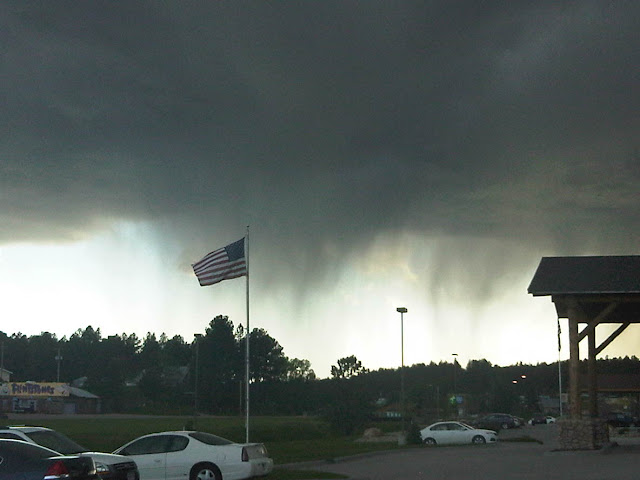
I was smart enough to pack up camp before I took my shower, because a severe thunderstorm rolled through the area right as I finished showering. I decided to hang out in my shower room for a while, knowing the camp was near empty and I wouldn’t be inconveniencing anyone, and needing to charge my camera battery and phone in the outlet. The storm was mighty outside, and even made the water in the shower turn on all by itself when it struck something nearby, but the shower room was comfortable.

My shower room at Blue Mounds S.P. I had a toilet, a sink, an outlet, and a shower all to myself in one lockable room. Waiting out the storm.

It was actually hard for me to leave Blue Mounds State Park campground, but today I would be heading to the western limits of South Dakota to Custer State Park, when two friends of mine would be meeting up with me tomorrow morning. Ahh, the big open west where you can see miles of uninterruppted wilderness- and some company to make it even better.
-Nicole

One of the few speleothems in Niagara Cave: A bell. Harmony, MN June 13, 2011
A fossil in Niagara Cave. Harmony, Mn. How many of you can identify it?
Speleothems in Niagara Cave. Draperies. Harmony, Mn June 13, 2011

Day 35: Cave of the Mounds and Devil’s Lake State Park, Wisconsin

It wasn’t a long drive into Wisconsin, but I could already detect the change in dialect. When I bought my groceries I was no longer offered a “Bag” I was offered a “Beg”, and the word tomorrow had an unusual accent on the second “o” that I wasn’t used to. Yep, I was in dairy land alright.
My first official stop, after buying my groceries for the night, was at Cave of the Mounds in Blue Mounds, WI. A cave that sat beneath a lead prospector’s feet for more than 100 years before the cave was discovered during a blasting in 1939. After almost a year of the family  guarding the new cave entrance by rifle to curiosity seekers, the cave was open to the public in 1940 and has been ever since.

Cave of the Mounds in Blue Mounds, Wisconsin. June 12, 2011

It, like it’s neighbor to the East in Iowa (see day 34), is located in the Galena carbonate rock formation. It was mostly formed in a typical carbonic acid/water erosion fashion, but some areas were enlarged with sulphuric acid that bubbled up as the water mixed with the sulphur in the galena (PbS). The speleothem development in Cave of the Mounds is pretty sparse, and it has a lot more of the colored varities than Crystal Lake Cave. In fact, the iron oxide staining in some areas is so prnounced that it looks blood red, as if someone had just maimed themselves on the stalagmite.

Iron Oxide staining on a speleothem in Cave of the Mounds. Blue Mounds, Wisconsin.

Everyone I met at Cave of the Mounds, even though it is privately owned, was very helpful. There were several people on staff that were knowledgeable about the geology of the cave and the surrounding area, and they gave me contact information in case I needed any other information for my personal research project. It was hard to leave the cave, but it was time to head a little further North into Wisconsin to my next campsite: Devil’s Lake State park.

Devil’s Lake S.P. Wisconsin. June 12, 2011

Devil’s Lake State Park is focused around a glacial lake that has no stream inlet to speak of. All of it’s water is either remnant from the last ice age, or a result of precipitation. The lake is beautiful and they have been working hard to restore it after levels of a certain chemical were unsafe and caused “swimmers itch” (something I still don’t quite know much about). It has many, many campsites and if you get into the Ice Age campground you have wooded lots that are fairly private.

Devil’s Lake State Park of Wisconsin

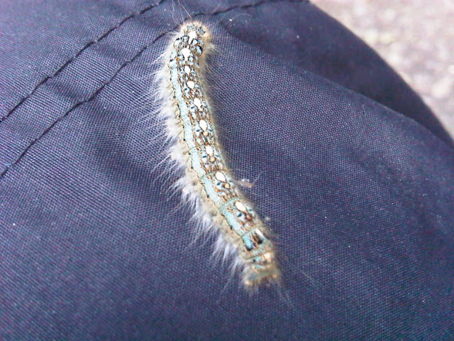
I enjoyed some cheese curds, cooked up a stir fry, and drank a local brew called “The Spotted Cow” next to my toasty camp fire. Although I was alone at the campsite, I certainly wasn’t lonely. There was a caterpillar that seemed fixated on crawling on me, as I would throw it into the woods only to have it return half an hour later. Ok,.. who am I kidding, I was a little lonely.

The Caterpillar of Devil’s Lake S.P. June 12, 2011

Honestly, camping alone is pretty tough….I enjoy it from time to time, but after a while it can wear on you. I am very excited that my friends will be joining my in South Dakota, more friends joining me in Yellowstone, and another friend in Glacier. I just hope I haven’t grown so accustomed to being alone that I am a terrible host!
Tomorrow I head on to Minnesota, where I will tour yet another cave and experience another unique camp site. I’m slowly getting closer to the big, openness of the West and I can’t wait. Nothing feels more like home…
-Nicole

The very original gate for Cave of the Mounds in Wisconsin.
Devil’s Lake S.P.:The concession sits on pillars into the lake, giving you a great view as you eat your meal.
Devil’s Lake State Park June 2011

Day 34: Crystal Lake Cave in Dubuque, IA

I had spent all of Yesterday (the official Day 34) driving so that I could get to Dubuque, IA to see Crystal Lake Cave. By the time I had arrived it was too late to tour the cave, and I was too exhausted to set up camp for the night, so I camped at a Econolodge in Dubuque. It was the last room available, as it turns out I showed up on the weekend of some sort of biking festival. Pure luck that someone had canceled their reservation is what secured my room at the Econolodge, one of the budget options for the Choice hotel chain that claimed to be smoke-free but smelled of stale cigarettes. Not my favorite hotel, but I was too tired to care at the moment.

Crystal Lake Cave map. The red outlines the tour route. June 12, 2011

Dubuque, Iowa is a river town, situated along the Missouri river as a major port for trade. Between the lead mines (you can visit the old spanish mines in the area) and the major river for transport, Dubuque flourished and looks to be a nice city. It has plenty to do in the area and I’m surprised I had never really heard of it until I started planning my trip…perhaps it’s because I struggle in properly pronouncing it’s name.

Crystal Lake Cave Dubuque, IA June 12, 2011

Crystal Lake Cave is just outside of Dubuque, Ia and was discovered by lead miners who had decided they wanted to find their own mine instead of work in someone elses. They found a cave when they began to drill in 1868. It was opened to tourists in the 1930s. It resides in the Galena Limestone layer, with another layer of Limestone above it, the Maquoketa. Underneath is the Decora LS/Shale formation, and below that the St. Peter Sandstone that we are familiar with back in Missouri.

A very pure speleothem (calcite) A Soda straw in Crystal Lake Cave. June 12, 2011

The cave, when it was original before the miners began exploiting it’s resources, was very small- probably only a few feet tall. It would have been a nice, long, (strenuous) belly crawl over flow stone in it’s previous, unaltered state. The miners enlarged the walking paths so that they could stand up and roll carts thorough the tunnels, so the lower half of your tour route was artificially carved out.

Notice the original height of the cave, and the people walking below it through the tunnel created by miners. June 12, 2011

The top half is incredibly rich in speleothem decoration, and most of them are a pure white indicating no traces of iron or manganese have seeped through to discolor them. One of the most amazing things about this cave is that they have anthodites, and quite a few of them. The cave is privately owned, and depending on who gives the tour you might get a different story. Each person has picked up on different bits of information and added their own flare to the tour. If you are the average tourist that just happened to bump into a cave to waste some time, this is fun. If you are a serious caver or geologist, it can be a little funny to listen and censor it in your head.

This isn’t to say it isn’t a good tour- every place has to cater to the audience and do what works for them. These sorts of privately owned caves are businesses, and whatever drives tourism is what needs to be done to keep the cave open. There is a delicate balance that is needed in any sort of natural resource for the public to enjoy and understand. Every National Park and State Park knows this, and they sacrafice small portions of the prized resource so that people can enjoy it while camping, in hopes that they will become educated and inspired to continue to protect it with their tax dollars for years to come.

You know how the saying goes that you have to spend money to make money? Well, you have to let some of these places go to the wayside of conservation to save the rest of it. It’s a fact of business: If people don’t know about it, they won’t want to pay for it.

It’s time for me to head to another cave that has been opened to the public, this time in Wisconsin. I’ll see you there soon.

-Nicole

Soda straws, very white, in Crystal Lake Cave. June 12, 2011