Day 47: Ferry Boats and Fairy Tales

Escape from reality is something sought by a majority of society. Whether we read a book, watch a movie or tv show, or play video games we are all looking for a break. Many people even spend a large percentage of their time achieving this goal. Life is so mundane in reality that we have to live other lives within our mind. It is a recent addition to the needs of being human- we used to be too busy working to live to delve into creative arts. Now we don’t only create alternative worlds, we live in other’s creations.
Today was a day where I would mesh both worlds together. A few of the fantasy worlds that I enjoyed as a guilty pleasure when I needed a break from the daily grind, and the real world, were about to come together. As I left Seattle I decided to leave in the only way a Grey’s Anatomy character would: On a ferry boat.

My Jeep, "29" on the ferry boat from Fauntleroy to Southworth. June 25, 2011

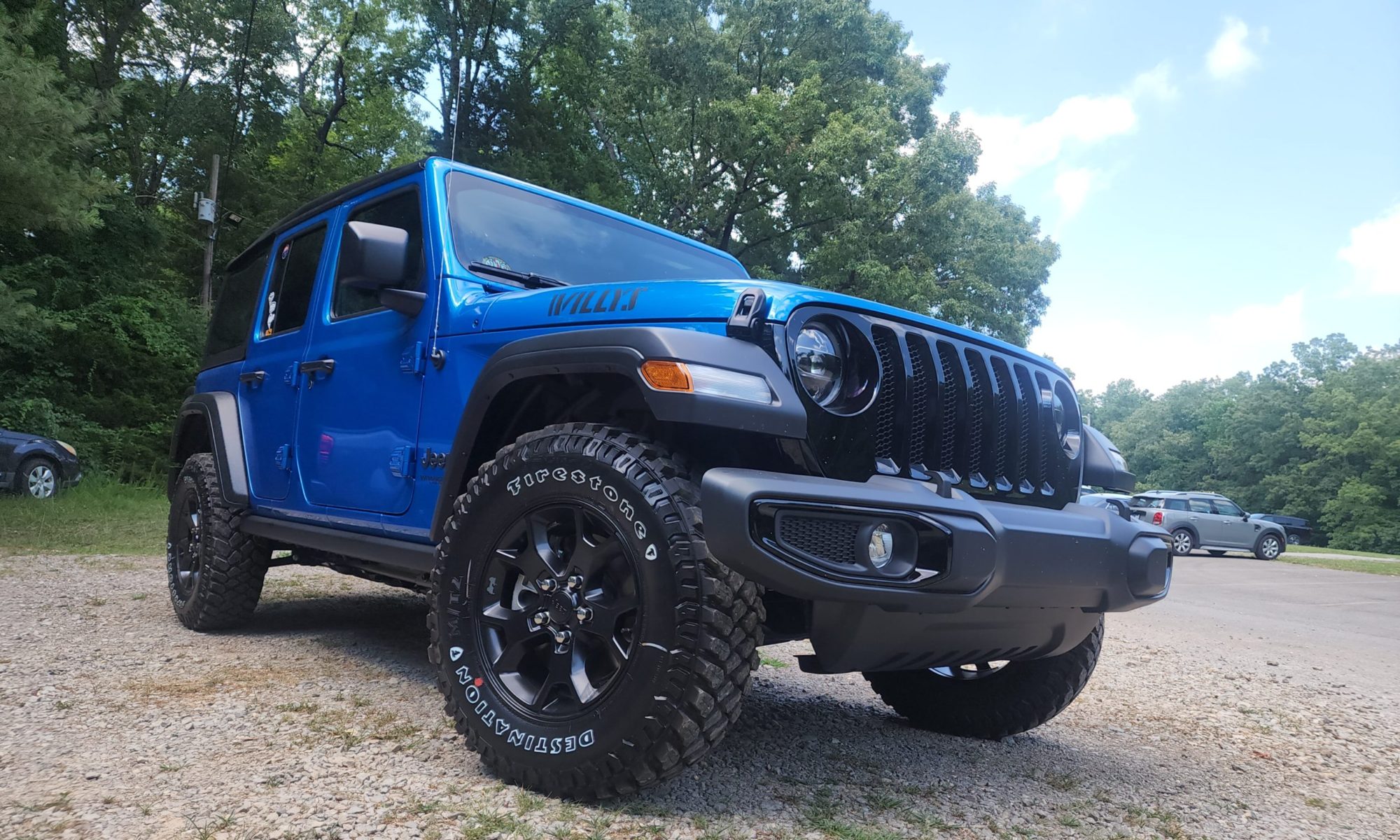
My Jeep is the epitome of adventure, and I have been many places in it. So far I have driven on snow, rocks, roads, mountains, deserts and the great plains. Today my Jeep would accomplish something it had never experienced before: it would drive onto a boat and ferry across the bay. I pulled into line at the Fauntleroy terminal where I would board the ship. I enjoyed some more “No Woman” cheese from Seattle’s Beecher’s cheese (courtesy of a relative I stayed with in Seattle) as I waited in line.
Boarding a ferry is kind of like parking at a big event. They line you up in order and direct you into a specific line where you will park as close as possible to the car in front of you. The instant everyone parks they exit and run up to the top deck where they can shelter from the cooler weather and enjoy concessions. I stayed on the lower deck for a while, enjoying the solitude and feeling the sea breeze. I imagined that Meridith enjoyed the same breeze as she stood on the ferry with Derrick. I think sometimes we spend so much time enjoying these alternate realities we forget that these characters aren’t real…they feel real.
I decided to head up to the concession to get a cup of hot tea and explore the rest of the ferry boat. I could stand at the antiqued controls of the boat just like I was the captain. As I sipped my coffee I took in the view of the water rushing away behind me. On the back wall a plaque was placed in memory of the former captain of this ship. Captain David Summerfield Moon was the former first officer, he died in June of 1977 when he went down with his ship in Alaska. The plaque offered no details of the story, but I imagined it to be one of bittersweet courage. A man surely born a sailor and died a sailor.

The ferry boat controls. June 25, 2011. Seattle

After deboarding the ferry boat I followed the coast of Washington, circling around Olympic National Park until I reached the town of Forks. Seattle held the familiarity of the Grey’s Anatomy set without announcing it’s significance. It made the illusion of being a part of the fairy tale more real. Forks, however, announced it’s new found fame every opportunity it had. Businesses left and right claimed to be the place to get Twilight merchandise, and a Twilight fan store on the main road played the theme music on loud speakers into the street.
While I had also become a victim of the Twilight series, so enraptured by the story that I read all four books within two weeks of  each other, this Forks was not the one I had in my head. The commercialism had destroyed my fantasy world when it came to Forks. All I could think about is how annoyed the residents of Forks must be with all of the Twilight fans coming to visit. While I was excited to visit Forks because I could see the real life place that one of my fairy tales took place in, I was a little embarrassed to admit I was a fan to anyone.

Forks, WA laundry mat. June 25, 2011

I knew I had to do laundry, so I found the only laundry mat in Forks and sat up shop while my attire swirled in the triple load washers. I went through pictures and looked up some more information on my campsite for the night: Bogachiel State Park . While the scent of gain filled the room as my clothes went through the dryer I chatted with a local girl who was there doing laundry as well.
I went to the local grocery store hoping to get some local cherries. Surely they would be cheaper here in Washington than back home in the midwest. I was disappointed to see that they were $10.99 per lb, so I bought some grapes instead, along with some wines. I was about to have a gourmet meal cooked over a campfire.

My campsite at Bogachiel State Park in Forks,WA. June 25, 2011

Bogachiel State Park was a lot like the forest I imagined Bella and Edward wandering through the rain forest. Everything was so green, moss clinging to the tree trunks, very little of the ground wasn’t covered in ferns or moss. It was, just as the main character of Twilight first described it, an alien world. Too green to be real.

Salmon Berries in Bogachiel State Park Forks, WA June 25, 2011

In the green shrubs I found these salmon-colored berries that looked a lot like raspberries. I decided to try them even though I didn’t know what they were. They weren’t too flavorful, a bit more bland than the raspberries I usually enjoyed. I later found out they were unoriginally called “salmon berries” and were perfectly fine to eat. Let me tell you that I only tried a couple berries and was being a bit adventurous…and I do not recommend anyone try any wild fruits or plants unless they can clearly identify it. As so many television shows and commercials state, “Do not try this at home”.

Prosecco in the Seahawks glass. June 25, 2011 at Bogachiel State Park in Forks WA

For my dinner I cooked some leftover shortribs over the open fire, and enjoyed some Prosecco sparkling wine in my new Seahawks glass I had purchased the day before in Seattle. I chatted with my camp neighbors, two bicyclists that had been on the road for over a week already, and one of them dried their damp sweatshirt over my fire. There isn’t much room for firewood on a bike. It was pleasant to have some nice neighbors and I shared my ribs with them since I had way more than I could eat myself.

Bogachiel State Park in Forks, WA- short ribs on the camp fire. June 25, 2011

I then settled down for the night in my tent, in the dark underneath the shelter of the tall redwood trees covered in green moss. The reality of the worlds I escaped to from time to time in book and television were certainly different than the fantasy version, but they still held a mystique. In a lot of ways, Seattle and Forks both were better in real life than in the mind. The fantasy worlds had met reality today and as the dark closed in it was time for me to create my own fantasy world.  Tomorrow brings more reality- although to be honest, I’m beginning to think the reality of this summer is even greater than any fantasy world I could escape to.
-Nicole

Bogachiel State Park. June 25, 2011. Forks, WA

Day 46: Seattle

Day 46: Seattle’s Pike Place Market

After spending so much time in the wild part of the west it was time to heat back to civilization. Seattle was a city that held many things important to me.I had originally planned my route here to visit the University of Washington but later learned their programs weren’t quite what I was looking for in a grad school (While they boast high acclaims in the geology realm, speleology is not exactly something they can claim to fame). So while my professional reasons were missing for this particular visit I had planned this trip well in advance and I didn’t want to change it now.
Besides, I still had things I felt were important to experience in the Seattle area. I was able to examine the flood basalts on my way here. It was the home city to one of my favorite television dramas, Grey’s Anatomy. I wanted to experience the port city life and what it was like to be in the Pacific Northwest. Perhaps more importantly, it was home to the football team I cheer for, the Seattle Seahawks.The first thing I needed to experience while here was Seattle’s famous Pike Place Market.

Fish in Seattle’s Pike Place Market. June 24, 2011

Pike Place Market is probably the epitome of port city life. You walk through the market next to giant ice-filled bins of fresh fish and other seafood, and listen to the salesmen throw their pitches out to the crowd eager to listen. This market isn’t an ordinary market- it has inspired business marketing practices everywhere. If you go to any local bookstore in the business section you are guaranteed to find at least one with advice stemming from the Pike Place Market. These guys know how to sell, and they keep the attention of the entire crowd.

Fresh flowers at Pike Place Market. Seattle. June 24, 2011

Stands in the market vary greatly in their offerings, from jewelry to paintings to clothing and more you can find someone trying to sell something. Fruit stands are common and have fresh fruit from around the states, not just local fruit. The era of mass transportation has certainly changed the scene from what it would have been a decade ago. Fresh flower stands are also abundant in the market place, and as the day progresses the prices of the fresh bouquets drop. If I lived in Seattle I would imagine fresh flowers would be a common occurrence in my home.

“Piroshky, Piroshky” Russian cuisine in Pike Place Market, Seattle. June 24, 2011

The permanent shops that line the opposite side of the street are equally as seductive to the traveler or local. I chose to eat lunch at the famous Russian baker, “Piroshky Piroshky”. The line was long, but the food was well worth the wait. I ordered a lovely meat and cheese pastry, and followed it up with a sweet pastry they call “Oscar’s Star”, a chocolate and hazelnut filled treat in the shape of a star.

Beef & Cheese pastry from Piroshky, Piroshky in Seattle’s Pike Place Market. June 24, 2011
Oscar’s Star pastry from Piroshky, Piroshky of Seattle’s Pike Place Market. June 24, 2011

Street performers are common here as well, mostly musicians that play almost anything. There was even a man that was rolling a piano around on wheels. As I watched one man playing guitar in an eye-catching outfit I noticed another shop I had to visit: Beecher’s Cheese. My relative that I was staying with in Seattle had told me about a unique cheese that Beecher’s offered and I was intrigued. Cheese is a food group on it’s own to me.

Beecher’s Cheese in Seattle’s Pike Place Market. June 24, 2011

At Beecher’s you can watch them make cheese right in front of you, the big troughs of dairy being stirred behind glass panes as you stand in line to try some samples before purchasing. The cheese range in type, but the one I was recommended and found to be the most unique was called “No Woman” cheese, a cheddar type with Jamaican spices.

Seattle’s Beecher’s Cheese. June 24, 2011

On my way home I stopped by “Qwest” field, which was in the process of being renamed “Century Link” field. In fact I was watching them remove the Qwest letters from the field the very day I visited. I picked up a new Seahawks jersey, a pair of socks, and a new beer glass to enjoy my favorite beverages out of during game days this coming season- all from the pro shop across from the field.

Seahawks Socks. June 24, 2011

My visit to Seattle this time was short, but I enjoyed it thoroughly. I would love to come back one day (perhaps for a Seahawks game?), not only to visit the area but also to see my relative who I stayed with. She was very accommodating and introduced me to some new foods while I stayed in her home ( I tried my first Vietnamese dish, she is an excellent cook!). Tomorrow I would enjoy one last important mark of passage for any Seattle tourist as I leave the city: A ferry boat ride across the bay.
I’ll see everyone on the Pacific coast tomorrow.
-Nicole

Seattle Seahawks field- By the time I reached it the “QWEST” had been removed. June 24, 2011


Fresh produce in Pike Place Market. Seattle. June 24, 2011

Day 45: Exploring Forest Service Roads Washington State

Today I took it easy and enjoyed some “Free Exploration” time to get a little more time in with the rural areas of Washington before I headed into Seattle. I started heading in the general direction of Seattle on the highways and took a detour anytime I saw something interesting. I decided to explore the forest service roads of the area and I found some great places to camp in the future.

"29" and me, exploring Washington's Forest Service Roads. June 23, 2011

I ran into an abandoned cabin and decided to wander around it. I took my Jeep up and down the roughly-maintained roads and enjoyed the warm weather. It wasn’t anything too exciting but it certainly wasn’t boring. Oddly, it felt like I was back at home cruising the gravel roads and exploring abandoned farm houses. The roads had a larger distribution of elevations and the weather was a bit cooler than Missouri would be this time of year, but the activity was comforting.

The Abandoned Cabin in Washington. June 23, 2011

Tomorrow I would be exploring Pike Place Market in downtown Seattle. I took a deep breath as I returned to the highway and followed the concrete trail into the city. It’s amazing how quickly your surroundings can change from country to city. I was ready for some city-style relaxation and shopping. I would be staying with a relative of mine for a few days and exploring Pike Place Market. I can’t wait!
-Nicole

Abandoned Cabin in Washington State. June 23, 2011

Day 44: An Intro to Washington State

Did you know that Washington has high desert plains? It has plateaus and mountains, rivers and lakes, snowy peaks and great big canyons? I always thought of Washington as the green state- eternally covered from top to bottom in green plants. There is a lot more to Washington than I thought.
I had planned on visiting Gardner cave so I left Sandpoint, Idaho and headed towards Metaline Falls, WA in the afternoon. It turns out that Gardner Cave, one of the few limestone caves of the state, is closed on Tuesday and Wednesday. Since it was a Wednesday I was unable to see the cave. I decided to pull out the hand atlas, unwilling to give the GPS another go at control quite yet, and found something labeled as the Lenore Lake Caves and I started heading in that direction.

The Grand Coulee of Washington. June 22, 2011

On the way south I ran into the Grand Coulee. This giant steep-walled canyon was carved by massive amounts of melting glacial waters as the Ice Age came to the end. It was once a waterfall even grander in scale than that of Niagara Falls. It was a 3.5 mile long, 350 foot tall water fall that rushed along carving the landscape into what it is today. The water that remains here today helps the desert wildlife thrive, and it is in this large canyon where the Lenore Lake Caves were carved out of the solid flood basalts.

Looking at "29", my Jeep, from a Lenore Lake Cave

Technically these “caves” aren’t large enough to be considered a true cave. They never transition past a twilight zone, but they do hold some historical significance. About 5000 years ago the natives used these “caves” as shelters. The native people resided here during the spring and summer to collect plants and herbs that were used in religious ceremonies.

Don't wear flip flops when hiking up piles of loose basalt breakdown! June 22, 2011. Lenore Lake Caves

I hiked up the cliffs (in flip flops…I’m a bit of a rebel like that….) and visited the inside of the shelters. They would have been fairly comfortable, keeping everyone dry while still allowing for a great view of the canyon in front of them. Looking down to the parking area my Jeep looked dwarfed. The trail up to the shelters was dotted with several different flowering plants.

A Lenore Lake Caves flower. June 22, 2011

So far my visit to Washington had not met a single preconceived notion. I had been in the typical mountain terrain, I had taken in the views of waterfalls both ancient and current, and watched as this terrain turned from a high desert plain, sparsely vegetated, to a fertile land of farm land enriched by the Columbia river. When I arrived in Wenatchee, WA I finally saw the first thing that truely told me I was in Washington State: Cherry orchards.
As I learned back in the winter of 2009-2010, states are only bounded politically, not geologically or by climate. Washington State has a little bit of everything as I have learned today. Soon I would be in Seattle, experiencing the mighty Pacific Ocean. When I visited Northern Arizona in January 2010 I saw that Arizona was more than desert- it had snowy, vegetated mountain terrain. Today I visited Washington and discovered it wasn’t all cool and green- but it also had desert terrain. Arizona and Washington have more in common than I thought!
-Nicole

The Grand Coulee. Washington State. June 22, 2011


One of the Lenore Lake Caves. June 22, 2011

Day 43.5: The Road Less Traveled

GPS.
Although I am from this era I have fought against the technology generation’s idea of navigation. It wasn’t until this past December that I even owned a GPS. I had borrowed family members GPS from time to time, but I always printed out maps and picked up state and local maps along the way. This summer was a little different. I had a North American atlas- from 2008- but I actually relied on my new GPS pretty heavily. In general the GPS keeps you on interstates and other highways well traveled and dotted with tourist traps and gas stations. Today I must have accidentally changed the settings.
I was making my way from Glacier N.P in Montana to Sandpoint, Idaho. I glanced at the atlas but turned on my GPS and followed it’s directions. I thought I would be staying on highway 2 all the way to highway 95 where I would be on the straight track to Sandpoint. Instead the GPS told me to turn left onto Mc Ginnis Meadows Rd., taking to long way to town.
Soon I found myself driving along a country mountain road that certainly wasn’t wide enough for another vehicle to pass me (if I had run into another soul on the 30 mile stretch of road at all…but I didn’t….I really was in the middle of no where). I don’t know exactly what happened to make the GPS direct me this way. I drove through the water of lakes that had crested their banks onto the dirt and gravel road, I tumbled over washouts above several hundred feet deep ravines filled with rushing rivers. I climbed up to tops of mountains and back down to the bottoms of the river-filled ravines.

Bumping along Vermillion River Rd in Montana/Idaho. June 21, 2011

There was a point where I was afraid I should have turned back. Surely driving alone on these roads where there was no cell phone service wasn’t the smartest move to make. Then again, I was on this trip for adventure…would I ever know what laid at the end of this road if I didn’t follow it? I continued on, and after a certain point it made no sense to turn back. It was time to embrace this near off-roading experience. It was actually quite scenic and the road was fun. I like to blame this event on my Jeep and my GPS plotting against me….

Why do they always have warning signs at the end of my paths of travel and not at the beginning? LOL! Juune 21, 2011

I was happy when I emerged from the wilderness at Noxon Reservoir as the sun began to turn the water gold. The rest of the drive to Sandpoint was along the water, beautiful and serene as it twisted around the mountaineous terraine. I was happy to arrive in town and I found a local restaurant in hopes to enjoy a big meal including a baked potatoe. I was in Idaho, afterall. Turns out the restaurant was out of baked potatoes…

Noxon Reservoir June 21, 2011

I guess that not everything is ideal, but that doesn’t mean it isn’t good. Sometimes life’s curveballs can be just as good as what we thought we had predicted for our lives. We try to make our plans for lives, and we alter those plans depending upon the information we receive. Sometimes, even with all of the information we find, life takes turns all on it’s own. It may not be ideal, but the strength and growth we find in ourselves when we meet unexpected obstacles makes life exciting. Sometimes better. We just have to wait and see. We may not want to plan to take the more perilous route, but the experience when we are put in a place to take it is one we will remember for a lifetime. That experience will help us suceed in the future, and it means we are stronger than those who have always received exactly what they wanted.
Tomorrow I venture to the far northeast of Washington state. I would say I’ll see you there, but I can’t be certain….I’ll just say I’ll see you tomorrow, no matter what tomorrow means.
-Nicole

A cave or mine along Vermillion River Rd June 21, 2011

Day 43: Glaciers, Deer and Bears, Oh My! Glacier N.P.

During my visit to Crystal Lake Caverns on Day 34 I spoke shortly on the effects of sacrificing small parts of nature to promote preservation of itself at large. Yellowstone and Glacier National Parks, both, show exactly what this means by changing the way nature interacts with human activity. My friend from Missoula and I went on two long hikes during our visit to Glacier National Park, and during both we noticed abnormal wildlife patterns, starting with our first drive through the park.
We arrived at the park only to find out that, like the rest of the continent, this winter had an abnormally high amount of precipitation and the snow pack was still blocking the pass. We would only be able to experience the Western portion of the park. We drove as far as we could and camped at the end, in the Avalanche Creek campground. The campsites are simple, a firepit and picnic bench with the wooded campsite, and no showers or hot water available. It was right next to the first trail we would hike that night, so we decided to go check out some of the lakes and rivers before we took hit the trail.

Glacier N.P. Blackbear June 20, 2011

On the drive back towards the western entrance we came across some traffic, which usually indicates some sort of wildlife has captured the attention of tourists. After sitting for a short time waiting for the cars to take their turn at taking pictures, we saw the black bear begin to wander around the cars. He took his time, looking into the cars to see who would, unintelligibly, offer him food.
The lakes here are glacial, and the biggest one that we were able to see was Lake McDonald. As may be obvious, a glacial lake is formed by a glacier, in the case of Lake McDonald, one that was over 2000 feet thick. As the thick river of ice slides down during melts it bulldozes dirt and rock in front of it, forming a wall called a terminal moraine. When the glacier receding as the climate warmed, the moraine was left behind, damming a lake that stretches to depths of 472 feet.

Lake McDonald in Glacier N.P. June 20, 2011

When we returned to our campsite we decided it was time to hike the Avalanche Creek Trail so that we could make it back before dark. We had been joking about the bear mace marketed to the city slickers, selling for a whopping $55 per can at the stores within the park. The black bears aren’t anything to worry about, but grizzlies can get pretty aggressive if they are startled by a humans. As long as you follow some common sense rules about wildlife they don’t normally bother you, but as has been indicated in the past few days these animals aren’t quite like normal wild animals. They are used to humans.

The Snowshoe Hare along Avalanche Creek trail in Glacier N.P. June 20, 2011

As we made our way up the 2 mile, 500 foot elevation gain trail (4 miles round trip), wildflowers in bloom everywhere indicating that spring had indeed sprung, we ran across a snowshoe hare. The rabbit hopped around nonchalant as we admired it. It wasn’t until I got within a few feet to take some pictures that he began to hop away. We made out way to the end of the trail that terminated at Avalanche Lake, which was incredibly muddy and wet. Along the north side of the trail Avalanche Creek followed along, carving out the bright red bedrock into curvy, smooth canyons. We laughed at the bear bells we could hear ringing throughout the woods. Fear does a number on people….

Avalanche Creek in Glacier N.P. June 20, 2011

On the way back down the trail to our campsite my friend stopped me mid-step. A deer, barely 10 feet away, walked across the trail and right next to us. Like the hare, she walked slowly along as if we were passing in a hallway. I had never been so close to a deer before, and it didn’t even have it’s tail up in alarm. With each animal we came across that had zero fear of humans we began to understand the excessive warnings throughout the park. These animals weren’t exactly wild: They were a hybrid of wild and domestic. The most dangerous type of wild animals, the kind that are so used to humans they think nothing of walking within arm’s reach.

The deer on Avalanche Creek Trail, unafraid of us hikers. June 20, 2011

The next day we hiked another trail, a 7 mile hike on the McDonald Lake Trail. It is a mostly flat trail that follows along the western side of the lake, heading in a general NE direction. A large portion of the hike goes along an area that suffered from a wildfire not too many years ago. The skeletons of trees stand tall, and wildflowers were blooming everywhere. We also noticed bear scat fairly often right on the trail, many of them obviously too large to be a black bear. Maybe those bear bells weren’t so goofy after all.


Bear scat with a print along the McDonald Lake Trail in Glacier N.P.

Glacier National Park was beautiful. The mountains were topped with snow, the lakes were clear and cold,  and the scenery was green and in bloom. Ironically, although I had come to Glacier National Park in hopes to see a glacier there was too much snow on the trails to get to a glacier.
I often wonder if people who live in big cities think that the wilderness really is like this, if they think wildlife come right up to you like they do in Yellowstone and Glacier. If we sacrifice some of nature to promote funding for preservation of itself at large, are we giving people the wrong idea? How many people feel comfortable preserving a place where the animals are dangerously used to humans, and attacks aren’t as uncommon as they are in the true wild.
Perhaps the West could enlighten me, as it was time to start heading towards the coast. This about as far north as I would be going for the remainder of my trip. Time to start getting warmer.
-Nicole

Someone rowing on Lake McDonald...I'm not sure what this sport is called, but it's the new thing apparently. June 20, 2011


Slick rocks in Glacier N.P., N. McDonald Creek. June 20, 2011Wildflowers in Glacier N.P. June 20, 2011


The lichens in Glacier N.P. reminded me of the moss of the deep south. June 20, 2011


The colors of the sunset in a puddle on Avalanche Creek Trail, Glacier N.P.The Avalanche Creek campsite at Glacier N.P. June 20, 2011


The Avalanche Creek campsite in Glacier N.P. June 20, 2011


Wildflowers in Glacier N.P. June 20, 2011


Rock outcrop in N. McDonald Creek. Check out the preferred jointing!

Day 42: A Drive through Montana

Today I left Yellowstone, and although it is considered by many to be the most scenic national park in the country, it didn’t mean I left all of the scenery and wilderness behind. Driving throught the state of Montana is a series of scenic views, one right after the other. The land stretched for miles with few interruptions allowing you to see for miles and miles (and also meaning there are many miles between gas stations, fill up!).
Along the highway heading north from the park that barely stretches into the southwestern corner of the state, Montana natives greeted me on the highway. Some big horn sheep blocked the highway along a mountain pass. They were thin and shaggy from the long winter and watched as I inched my way past them and snapped some pictures with my cell phone.

Big Horn Sheep taking control of the highway in Montana. June 19, 2011

The glacial lakes of the state are just as breathtaking, the water so clear you can see straight to the bottom even when the water is several feet deep. Montana has two sides of a coin: The fiery breaths of a supervolano and the icy glaciers of the far north. Tomorrow I was heading with my friend, who lives in Missoula, to the opposite side of the coin. Glacier National Park has some spectacular hiking trails to hit, and we were ready.
-Nicole

Flathead Lake of Montana. The water is so clear.... about 3 feet deep at this spot where I took the picture.
Big Horn sheep of Montana June 19, 2011


A scenic Montana highway view. June 19, 2011

Day 41: The Emotions of Yellowstone

Your heart beat begins to quicken, causing an involuntary gasp for air. The emotion is one on high. You feel at peace with the world, like you could imagine being no where else, while at the same time being nervous about what it can bring. It is a treat for the eyes, yet it somehow entices you to close them as if it is too much to take in. You take another deep breath. The scent is relaxing, a freshness you can taste. Although it seems impossible, you feel warm and cold at the same time. Something so grand plays out in front of you that you want to immerse yourself deeply in everything it offers.
It is hard to imagine leaving this spot in time, but you know what comes next can be greater than the last. Letting your heart beat calm, and taking a last, deep breath, you push yourself forward so you can see what comes next. That step forwards sends you through the waves of emotion all over again.
This is the experience of travel. Of taking in something so much bigger than yourself.m It is amazing how a landscape can evoke feelings so akin to love. When you first round that corner as you drive up to a new place you can feel overwhelmed. The speedometer slows down as you try to take it in. Maybe you even pull over. All the while you are having these warm feelings of joy- but you also have fear. Steep, dangerous cliffs….aggressive animals that aren’t afraid of people…swift currents ready to take you away… hot steam boiling out of the ground unexpectedly. The very fact that you are standing inside of a super-volcano can be a rush itself- At any moment everything could become nothing.

These are the most rewarding moments in life. When you feel these emotions you open yourself up to what they offer. You expose you vulnerability. Something so beautiful somehow overcomes the fear, making the dangers a palatable cost. No one climbs a mountain, risking their life as they push themselves up steep ravines and cliffs, to see a land fill. We take risks to get to those ultimate feelings, and as uncomfortable as they are, we live to push our limits for a chance at achieving them.  Heart racing, uneven breathing, warmth and cold washing over you in waves.
Yellowstone is one of the ultimate places to visit- it has so many different faces  to evoke those feelings. From the geysers to the waterfalls, from the fields of bison to the tall, snow capped mountains, Yellowstone is a series of emotions waiting to happen.

The Mammoth Hot Springs Terraces.Yellowstone National Park. June 18, 2011.

Today we continued our journey through the park, making our way to the different waterfalls, and eventually ending up at Mammoth Hot Spring where calcite terraces tower into the air like sculpted snow, steam rising. We saw Inspiration Point, a place aptly named for what it surely does for many visitors. We drove over mountain passes with snow piled up along the side of the highway taller than our vehicles, and watched as we transitioned down and that snow created magnificent waterfalls cascading down the stone into deep cutting rivers.

One of the many rivers in Yellowstone, carving down through the richly colored rocks and sediment. June 18, 2011

We soaked it in. Took the deep breaths. Felt our hearts flutter.

If I could stay here for an eternity I would. I didn’t want to imagine being without this. Like so many days during this trip, it was a battle to leave. Whether it was on the account of my friends leaving me, or because I couldn’t get enough of the scenery I can’t tell you.
I can say this: I’m going to take that one last, deep breath. Slow my heart beat, and take that next step. I think we all know that around the corner it will start all over again. It is hard to imagine getting better than this- All that I’ve seen this far has been amazing. I think we all know, from past experience, it only gets better than this. The world awaits to make my heart skip a beat….. join me tomorrow as I continue my way.

…and don’t forget to breathe.
<3 Nicole

A Yellowstone Survey marker. I think I have a whole collections of photos of survey markers...lol
Yellowstone's petrified tree. There used to be a second, but early souvenir collectors took all of it, bit by bit. Now only this one remains. June 18, 2011


Yellowstone's Mammoth Hot Springs June 18, 2011


One of the (slightly comical) warnings about the wildlife. "Don't get gored by the buffalo". (Please click on picture to see undistorted & in full size)

Day 40: Yellowstone- Geysers, Bison and the Return of Nicole the Destroyer

Those of you that have known me for years know how accident prone I can be. There was the Dec. 2009 El Paso, Texas incident (click here), there was the January 2010 Cattle Blunder of New Mexico (click here), and of course who could forget the Costa Rica Weekend Plastic Disappearance of August 2010 (not yet published, to come soon I promise!!!). There are probably many others that you may remember I have not listed.
It’s no surprise: Somehow I am the luckiest accident-prone person on the planet.
I say I’m the luckiest because even though these things could be potentially life altering events, things that normally ruin your trip to the point of no return, I manage to find a way out of it safe, sound, and sometimes even better than before. Today, my friends, family and other followers, ended up being one of those days. Not bad considering I am 40 days into a trip with no major accidents as of yet.

A hot spring in the Old Faithful hydrothermal field of Yellostone National Park June 17, 2011

This morning we awoke, took a warming shower at the campground facility, and then headed towards Old Faithful where we were to meet up with our two other friends who stayed in the lodge that night. On the way we were able to see many of the things we didn’t see the night before as we wound our way along the roads in the dark: herds of buffalo, hot springs that bubbled up, and great vistas of mountains, prairie, rivers, lakes, and pines.
We arrived at Old Faithful right as it was erupting, spraying it’s heated water and steam up into the air nearly 40 feet high. After catching the eruption from the curb, we found a parking spot and found our way through the crowd to meet up with our two new party members. I saw them walking along the sidewalk away from us, and decided to run up behind them to scare them….only I made one vital mistake.

Old Faithful in Yellowstone National Park. June 17, 2011

The lifeline of my DSLR camera, that nylon strap with the yellow Nikon emblem up and down the sides, the very thing I keep around my neck at all times….was not where it was suppose to be. I had failed to swing it over my head…and the camera was just sitting atop it’s case as I skipped my way towards them. There was a tumbling of the expensive camera equipment across the concrete, and a slight moment of disbelief in what had just happened before I bolted forward to grasp the pieces before someone had a chance to run over them.
My lens had snapped off in the tumble, and at first I thought it might be ok, then lens lacking any cracks or scratches…but alas the lens wouldn’t lock into the camera body. The plastic fins that hold it in place had snapped off. Luckily my friend, who I had been trying to surprised, was observant and picked up the two, small plastic pieces to that I may have had the hope of gluing it back on. We found someone with superglue and glued the pieces on…but even after it sitting for a couple hours, the glue didn’t hold. I could still take pictures…but I had to hold my lens on with pressure to trick the camera into thinking the lens actually was attached. I want you to think about that as you enjoy the photos of this day….these pictures took a lot of work….

A boiling hot spring, a cold river behind it, and another hot spring depositing minerals beyond that. Yellowstone National Park Old Faithful area. June 17, 2011

After I calmed down over lunch, angry at myself for such a ridiculously careless move, we watched Old Faithful erupt once again, this time up close. We decided to fill our day with warm, steaming geyser goodness and took a long walking route that looped through the thermal field.

More of the amazing Yellowstone Geysers, this one about a 2 mile walk from old Faithful. June 17, 2011
A colorful hot spring of Yellowstone in the Old Faithful area- note that the yellow/brown colors indicated bacteria growth.

The springs and geysers bubbled up in marvelous colors, bright blue and green in the purest of them, and yellows/browns in those that had cooled down a bit too much, allowing bacteria to grow. There were so many it was hard to believe, and everywhere you looked along the walk you could see steam rising from one place or another. The buffalo were here too, resting in the middle of the thermal field with their young calves. I really would enjoy owning a herd of bison….

The bison sleeping in the hydrothermal field. June 17, 2011 Yellowstone National Park

After we made our rounds, passing a bear warning sign on the way out that said Yellowstone is not responsible for our safety, and a slightly disturbing trail-closed due to bear activity sign on the way back, we came to yet another animal obstacle: The fuzzy cows I like to call my friends, the Bison.

The frist bear warning we saw on our trail at Yellowstone's Old Faithful area. June 17, 2011
The bear warning sign on our trail in the Old Faithful area of Yellowstone at the END of our trail. June 17, 2011

They trapped us travelers on the wooden walkway, and even managed to walk up, one on each side of the trail, as if they were the guards of Old Faithful. We could hear wolves/coyotes howling in the distance as the evening was cooling the air down. Eventually the bison decided we could pass and moved on to other green pastures.

The guardians of the pathway-Bison. Yellowstone National Park June 17, 2011

On the drive back to the campsite we encountered more bison on the move, using the road as their pathway. Here at Yellowstone the fuzzy cattle know who is boss: them. They have the right of way no matter where you go, and they seem to know it very well. They are so used to people that they don’t budge from their path when a human is in it: it’s expected you will move. I think what I enjoyed most is watching the buffalo’s eyes. You can honestly see them thinking, watching you as if they know who you are and can speak to you with a gaze.

The bison making their evening trek to their night fields in Yellowstone on June 17, 2011

Yellowstone is obviously the place to be if you want to experience wildlife, and hydrothermal activity. There is a lot to take pictures of, so either pack a large memory card (or a lot of film, if that is your style) because you will need it. And remember…those nylon cords, whether they go around your wrist or your neck….are there for a reason!
Tonight we were moved to another campsite….this one with enough room to set up a tent. Hopefully this means we will get a good nights’ rest… I’ll see you tomorrow when we spend more time exploring the wonders of Yellowstone. I’ll be sure to reserve some energy to hold on my lens while taking pictures of all these places for you.
-Nicole

Bison and their calves in Yellowstone, right behind Old Faithful. June 17, 2011


Bison bones from a recent meal for the wolves. June 17, 2011 in Yellowstone National Park


How many people can identify these tracks, located in the warm hot springs of Yellowstone?


There is more than one way to eat a buffalo in Yellowstone National Park of June 17, 2011


Plants incorporated into hot spings deposits? You analyze and let me know what you think. June 17, 2011 at Yellowstone

Day 39: Devil’s Tower and Little Bighorn Battlefield- The trek towards Yellowstone

Today we had a long drive ahead of us to Yellowstone National Park, but that wouldn’t stop us from sightseeing along the way. There were two main things to see on the trek Westward: Devil’s Tower and the site of Custer’s Last Stand, Little Bighorn Battlefield. I jumped into my Jeep, and my two friends into their truck, and we began our journey into the wild west.

Devil’s Tower is one of the geologic sites of importance that we are required to learn the location of as geology students. Today I would actually get to see this place in person, and among reading the theories of the development of Devil’s Tower, also the native stories (and there are many) that accompany it.

Devil's Tower National Monument in Wyoming. June 16, 2011

There are numerous versions of the story, and I read at least 4 different versions within a couple hours. All of them have this in common: some natives (whether they be children, villagers, sisters, etc) were trying to get away from a bear (that may or may not have been a young girl shortly before attack on the village) and the gods raised them up, the bear scratching the rock as it rose into the sky. They became a constellation in the sky.

The geologic theories are also vary, and come in three main flavors.While all theories include that it is an igneous intrusion, how it came to be as it is today has several different possibilities. Some geologists believe it to be a laccolith, an igneous intrusion that was beneath the surface of sedimentary rocks which were later eroded to expose what we see today. Others believe it was a plug of long-gone volcano that used to be in the area, and others still believe it to be other forms of igneous intrusions, the original surroundings long gone due to erosion. I guess you can take your pick as to which you believe…maybe you’ll even go with the bear story.


The Devil’s Tower was the first National Monument in 1906, and thus made Wyoming the state to host both the first National Monument and Park (Yellowstone). It is surrounded in history, an important landmark for the Plains indians. In more recent history (and to my amusement) George Hopkins decided to parachutes from an airplane in 1941 and land atop the Devil’s Tower just to show it could be done. Nevermind the fact that he was trapped there for 6 days until climbers could make their way up to rescue him.

Who can pass up drinking water from a fountain with claims like these? Devil's Tower, June 16, 2011

After climbing up the boulder field to get the closest view of Devil’s Tower you can get without a permit, and drinking the water that was ostentatiously claiming to be pure and of excellent drinking quality, we headed a little northwards so we could swing by Little Bighorn Battlefield before making our arrival, fashionably late, in Yellowstone.

The site of Custer's Last Stand. Little Bighorn Battlefield National Memorial, June 16, 2011

Little Bighorn Battlefield National Memorial is located in Montana, and it is the site of the famous Custer’s Last Stand, where the U.S. troops were defeated by the natives. It is full of historical information about the battle, and the fields are flagged with white markers indicating where soldiers met their fate. It was a pretty interesting place, and if we didn’t have somewhere to be and the weather wasn’t misting upon us we may have stayed longer to learn a bit more.

Little Bighorn Battlefield Memorial. The marker colored in black is Custer's memorial (Although he isn't actually buried here anymore, his body was moved in 1877 to another graveyard)

The last long haul to get to Yellowstone was a long, scenic drive. Montana is full of open space, where you can literally see as far as the eye can see. The mountains eventually begin to jut out of the ground as you near the western half of the state, breaking the golden sunset with snow-capped mountains. The view was beautiful, and with how honey-golden the sun was shining, I imagine it wasn’t difficult for the pioneers to be dreaming of gold in the western frontier.

A Western Montana Sunset. June 16, 2011

When we arrrived at the campsite deep within Yellowstone, the Canyon Campground, we were more than fashionably late. It was near midnight, and the near 2 feet of snow and lack of open space to set up a tent weren’t exactly encouraging. It was the middle of June and there was still an significant amount of snowpack on the ground- who knew!?

Our Canyon Campground site we "slept in" (our vehicles) on June 16, 2011 Yellowstone National Park

Well, we decided to sleep in our vehicles and see what the next day brought.

-Nicole